Photos


Content referencing Clock Tower Acres
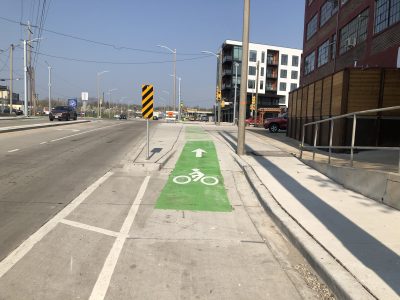
City Seeks Grants to Build Bike Lanes on 2nd, Center, Sherman and Lisbon
Part of mayor's proposal to build 50 miles of protected bike lanes by 2026.
Dec 19th, 2023 by Jeramey Jannene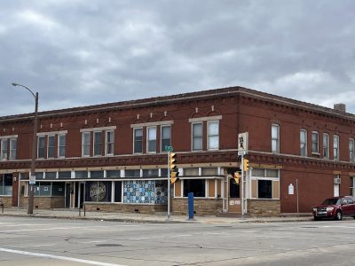
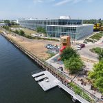
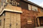
New Bar and Event Space For South Side
Waterfall Lounge and Event would offer food, drinks and entertainment on 1st and Mitchell.
Nov 9th, 2022 by Sophie Bolich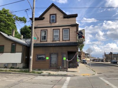
Ollie’s Bar Is For Sale
A historic, century-old corner bar on near South Side could be yours.
Jul 21st, 2021 by Angeline Terry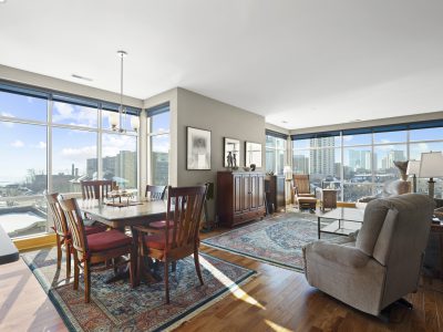
Sterling Lower East Side Condo
Features walls of windows, wood floors, a private balcony and expansive city views.
Feb 23rd, 2021 by Urban Milwaukee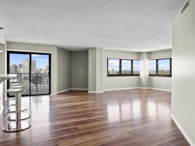
Desirable East Side Condo
Features wood floors, a private balcony, and amazing city views.
Feb 22nd, 2021 by Urban Milwaukee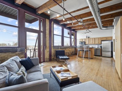
Stylish Condo at Parts House Lofts
This studio features wood floors, beamed ceilings, stainless appliances and a private deck.
Feb 8th, 2021 by Urban Milwaukee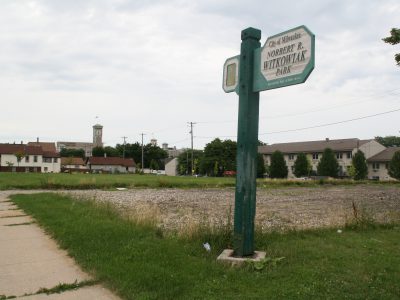
City Refreshing South Side Park
North portion of park was once site of restaurant with dolphin tank.
Jul 23rd, 2020 by Jeramey Jannene
Finding City’s Most Integrated Neighborhoods
Study shows 25 neighborhoods across Milwaukee are majority-minority like city as a whole.
Jun 21st, 2020 by Jeramey Jannene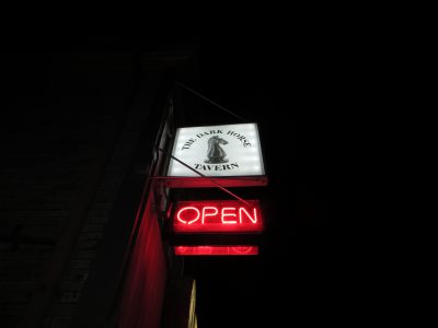
Dark Horse Is So New Yet So Old
South Side bar opened in December with new style in tavern dating to 1880s.
Jan 9th, 2020 by Michael Horne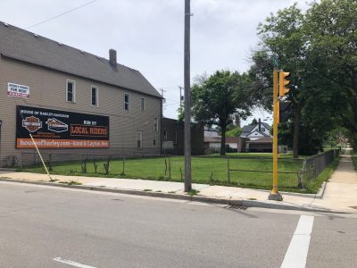
City Selling Walker’s Point Development Site
Vacant lot on 1st and Lapham available for $59,000.
Jun 21st, 2019 by Jeramey Jannene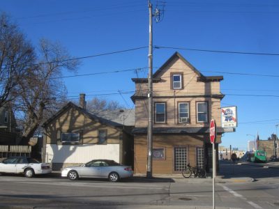
The Cheapest Tavern in Town?
Ollie's is classic South Side workers' bar with no craft beers, but 111 years history.
Mar 2nd, 2018 by Michael Horne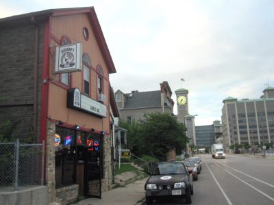
Junior’s Hook Has 125-Year Heritage
Old South Side tavern since 1892, with countless owners, is suddenly chic.
Aug 22nd, 2017 by Michael Horne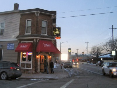
The Bottle Is An Architectural Find
The KK avenue bar's elaborately designed, 1890s-era back room is utterly unique in town.
Mar 8th, 2016 by Michael Horne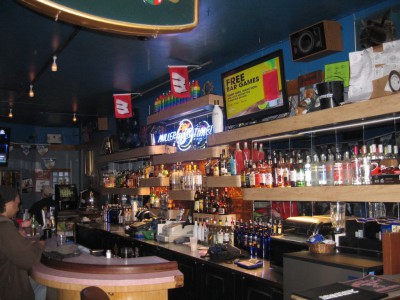
Woody’s Is a Ramshackle Gay Bar
Once had tunnel to sneak in booze during Prohibition. It's been crumbling ever since.
Feb 19th, 2016 by Michael Horne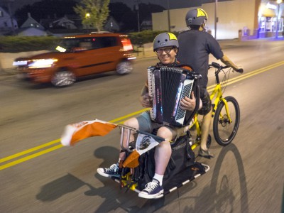
Long Live the Polish Moon Ride!
A great turnout, a beautiful foggy night, and fun polka and Mexican music -- the ride was a big success and will surely grow in coming years.
Aug 29th, 2014 by Dave Schlabowske
Mapping Milwaukee for Teens
New project hopes to map 325 activities and resources in the city for bored teens.
Aug 20th, 2013 by Maggie Quick
Kinnickinnic River Trail
Kinnickinnic River Spillway Originally uploaded by Retinal Fetish Julie Lawrence at OnMilwaukee.com drew my attention to this excellent community development taking place along the Kinnickinnic River on the south side of urban Milwaukee, the Kinnickinnic River Trail. The trail is in the early stages of development and will have a southern terminus at the river and 6th Street (near its intersection with Cleveland St) and at Water St and 1st Street on the northern end. The trail, while still in its infancy, will hopefully include a restoration of the river to a more natural state with the removal of the concrete channeling. Like many other developments occurring in Milwaukee (the Riverwalk, Menomonee Valley restoration, and the Beerline neighborhood come to mind), the KK River Trail is just one of many ways in which Milwaukee is learning to embrace its natural assets. The developments are all the more special because they’re actual functional ways to move around the city without a car, which is due in large part to the dense development surrounding the rivers. Groundwork Milwaukee has provided a PDF with all you could ever want to know about what was discussed in planning for the trail. I’ll try to learn more over the next few days as to what the actual status of the trail is (it’s a little bit hard to figure out with the information online). I took the map out of the PDF and put it online as a JPG image in case you wanted to see the proposed route.
Jan 6th, 2008 by Jeramey JanneneNeighborhood Buildings
-
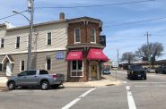
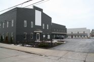
101-111 E. Mitchell St.
-
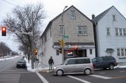
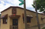
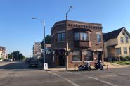
107 W. Mitchell St.
Two-story building owned by brothers Russell Rossetto and John Rossetto.
-
1579 S. 2nd St.
-
1613 S. 1st St.
-
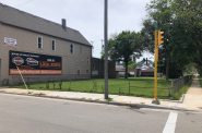
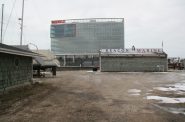
1646 S. 4th St.
Site formerly occupied by Public Natatorium. Now part of Witkowiak Park.
-
1656 S. 4th St.
Part of Witkowiak Park.
-
1753 S. Kinnickinnic Ave.
-
1801 S. 3rd St.
-
1930 S. 4th St.
-
1933 S. 1st St.
-
1966 S. 4th St.

-
2000 S. 4th St.
-
201 W. Mitchell St.
-
2078 S. 4th St.
-
Public Natatorium
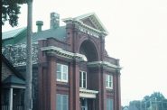
Occupied site at 1646 St. 4th St. For five years included a restaurant that had dolphins swimming in pool.