
New Designs For Key Downtown Sites Revealed
Open-house meeting on 2040 Downtown Plan being held Wednesday night.
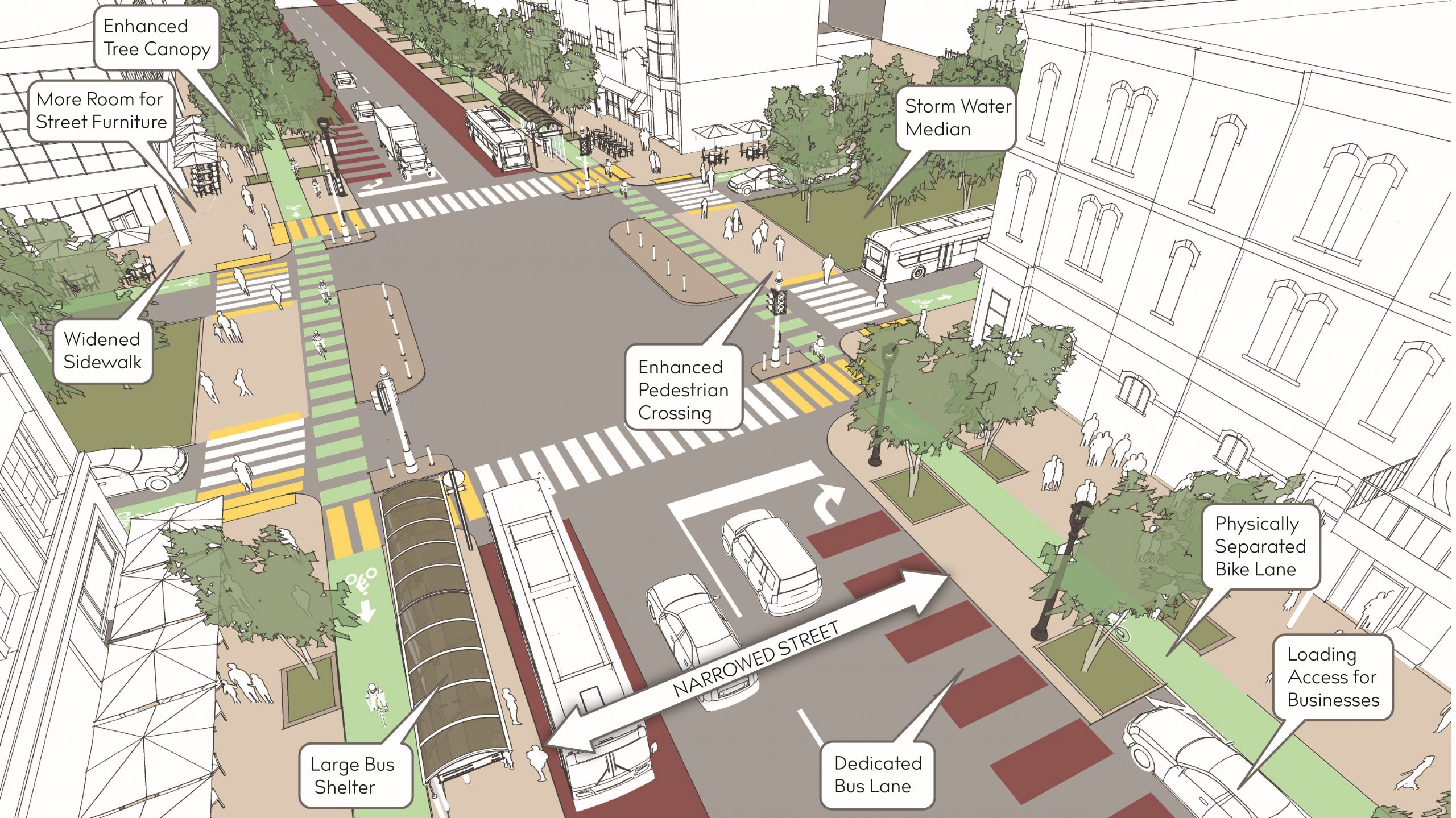
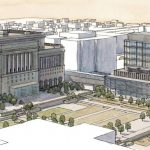
Reconfigured N. Water St. at E. Juneau Ave. Rendering provided by Department of City Development.
The Department of City Development (DCD) and its partners have big plans for at least three key locations Downtown as part of the “Connec+ing MKE 2040” downtown plan update.
The visions, released before an open house meeting, include adding bus-only lanes and protected bicycle lanes to Water Street, upgrading Cathedral Square Park with a pavilion building, permanent stage and water feature and upgrading W. Kilbourn Ave. by adding trees, removing a travel lane and upgrading the protected bike lanes.
DCD also has seven “big ideas” that are intended to summarize the planning effort so far: doubling Downtown’s residential population, making streets more friendly for walking, biking and transit, investing in parks and public spaces, creating and connecting vibrant places, repairing the urban fabric with infill development, connecting the city to water and connecting Downtown to surrounding neighborhoods.The concepts are intended to generate conversation as DCD, Milwaukee Downtown, Business Improvement District #21, and the project consulting team host an open house Wednesday afternoon from 3:30 to 6:30 p.m. at 3rd Street Market Hall, 275 W. Wisconsin Ave. Individuals can also provide feedback online.
It’s the third of four planned meetings intended to create a shared vision for the future of Downtown. The ideas in the last two downtown plans, including building a streetcar system and demolishing the Park East Freeway, have been largely realized.
The partners took feedback from a May meeting on the topics of housing, business, retail, arts and culture, public space, transportation, development and sustainability to create 46 recommendations. Each of the recommendations will be presented at Wednesday’s meeting.
The project consulting team was announced in 2021. P3 Development Group is managing equity and engagement and The Kubala Washatko Architects, HNTB, American Design, Inc., and raSmith are providing design services.
A group affiliated with 1000 Friends of Wisconsin has called for the city to include the removal of a portion of Interstate 794 in the updated plan. The 2010 Downtown Plan included a since-completed catalytic project to add lighting and other activation under the elevated freeway to better connect the Historic Third Ward and East Town.
A DCD report says that, since the plan was last updated in 2010, there has been $3.5 billion in development and there are now 4,800 more residential units in Downtown. The plan was originally created in 1999 and includes recommendations on things now taken for granted, like redeveloping the Pabst Brewery and adding more two-way streets.
The city is contributing $50,000 to the latest planning effort and Milwaukee Downtown is providing $100,000.
The downtown study area encompasses seven separately branded neighborhoods: East Town, Westown, The Brewery District, Deer District, Haymarket, Hillside and the southernmost portion of the Lower East Side.The area is roughly bounded by W. Walnut St. and E. Lyon St. on the north, the Menomonee River and E. Clybourn St. on the south, N. Lincoln Memorial Dr. on the east and Interstate 43 on the west.
DCD has undertaken a number of planning projects for other areas of the city in recent years, including the Water and Land Use Plan that guides the development of the Harbor District, a S. 13th St. area plan for the Crisol Corridor and an updated plan for the area around W. Fond du Lac Ave. and W. North Ave. A planning effort is currently underway for Bay View.
Conceptual Design Concepts


Eyes on Milwaukee
-
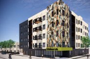
Church, Cupid Partner On Affordable Housing
 Dec 4th, 2023 by Jeramey Jannene
-
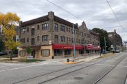
Downtown Building Sells For Nearly Twice Its Assessed Value
 Nov 12th, 2023 by Jeramey Jannene
-
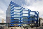
Immigration Office Moving To 310W Building
 Oct 25th, 2023 by Jeramey Jannene


It used to be that Milwaukee was building more places to go and fewer ways to get there. (At least 20 downtown streets cut off since about 1970).
2022 UPDATE: Plans are being made to build more places to go or live and fewer lanes to get there.
I like the concept but I don’t see any proposed configurations along the Hop route.
The words “key sites” are reassuring, because this concept’s traffic capacity isn’t adequate for streets in general,
and might even result in bottlenecks in the locations planned.
I really wanted to drive up to Milwaukee to be at this afternoon’s meeting but, alas, I could not. That said, I like where the plan is headed.
I roll my eyes every time I see someone say that the goals of the 2010 plan were largely accomplished. It’s simply not true. Just look at the eight “catalytic projects” outlined in the plan and you’ll see that the closest any of them came to completion was the streetcar. “Station Square?” Nada. “Broadway Connection?” Just a little. “Peer Marquette Square?” Nope. “Kilbourn Extension to MacArthur Square?” Nothing.
https://city.milwaukee.gov/ImageLibrary/Groups/cityDCD/planning/plans/downtown1/images/5-DowntownPlanCh5_10-12-101.pdf
This isn’t to say that great progress hasn’t been made, simply that the projects set out in the plan have largely not been realized. That’s why I’m gratified that the planning team has taken my advice (and maybe that of others) and based the plan, not on catalytic projects, but on a number of broader goals that could be applied throughout downtown. (I did suggest this on the engagemke.com site.) 😉
I can’t disagree with any of the seven “big ideas” currently suggested in the plan. However, I like that my thinking (and undoubtedly that of others) is reflected in the first goal: double downtown’s residential population. I strongly believe that, without this goal, everything else becomes window dressing—wider sidewalks for downtown’s already sparse pedestrian-scape, nice thoroughfares for bicycles, busses and cars to travel *through* downtown, and public spaces for special events.
Downtown Milwaukee must become the city’s greatest neighborhood if it is going to thrive. Everything else is secondary. Along side this, the city’s attitude around mass transit must change. Downtown residents and visitors who arrive by mass transit, not cars, are what will give downtown the boost it needs. Mass transit riders are, by their nature, also pedestrians. Car riders (and I am one, on occasion) are not pedestrians if they can help it. They park close to their destination and leave when their business is done.
Also, labels notably missing on the renderings-with-labels are those for the “infill” development. For example, on the Water and Juneau rendering, the lower-right corner suggests a building with umbrellas outside where there is currently a parking lot, and, on the Kilbourn and Plankinton rendering, there are obviously 6+ story developments on what is currently another parking lot and where Benihana currently exists.
Infill development is another great idea in the plan.
Confused about the plan for Juneau and Water intersection.
Juneau is designated as an east-west corridor for emergency vehicles as the there are no power wires for the Hop running on Jackson from Ogden to south of State Street. The Hop runs on batteries in this section of its route. This allows emergency vehicles to pass through the Juneau and Jackson and the State and Jackson intersections without height restrictions.
So if the new design for the intersection of Juneau and Water restricts the movement of emergency vehicles entering Juneau to go East then all of the emergency flow will be forced to State. And then what happens if there is construction or a blockage on State Street ?
This design seems to be addressing the problems with violence in the ‘Entertainment District’ and does not consider the ramifications to the emergency vehicle flow patterns that were established when the Hop was built. Nor does it consider the desires of the residential community to use Juneau as an east-west corridor.
Aren’t there better ways to solve the violence problem with the bars around Juneau and Water ?