
See How State Thinks Traffic Would Change With I-794 Removal
Traffic model shows the biggest impacts outside of Downtown.
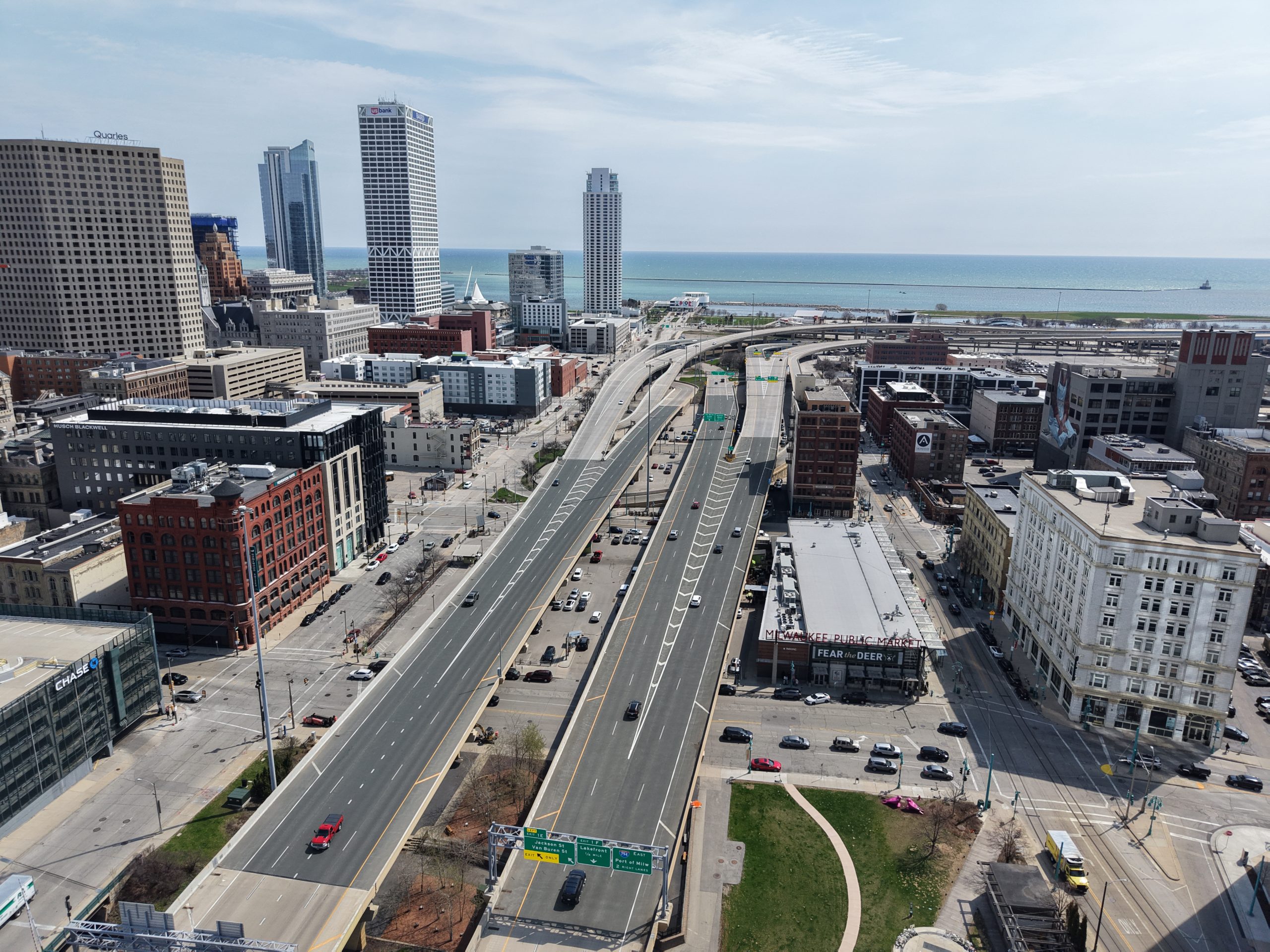
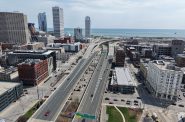
Interstate 794 between Downtown and the Historic Third Ward. Photo by Jeramey Jannene.
For the first time, estimated traffic data shows the potential impact of various rebuild options for Interstate 794 through downtown Milwaukee. A study process to replace the aging freeway segment has been underway since 2022.
The models estimate 2050 travel times if the freeway is removed and replaced with a boulevard, rebuilt as is or redesigned.
Project display boards detail where WisDOT and its consulting team believe the 74,000 vehicles that use the corridor daily would be diverted under each option, estimated travel time impacts for select trips and updated designs for the four study options.
The data were first released Tuesday at a public meeting hosted by the Wisconsin Department of Transportation (WisDOT) at the Milwaukee Marriott Downtown. A second meeting is scheduled for Wednesday evening at St. Thomas More High School.
The diversion models show traffic counts changing in both predictable and unpredictable ways. The Hoan Bridge, which would remain under any scenario, would see a 45% decrease in traffic if it terminated into a boulevard. Interstate 94 west of the Marquette Interchange would see a 3% reduction, while several ramps to and from the interchange to I-794 would see decreases between 5% and 40% and some even greater reductions. The Fond du Lac/McKinley ramp to Interstate 43, created with the removal of the Park East Freeway, would see a 32% increase.
Time impacts
Streets near I-794 would see a 282% increase in traffic, but Van Buren, Jackson and Broadway would see traffic reductions of 40% or more. Bay and Becher streets in Bay View would see an 84% traffic increase, and S. Kinnickinnic Avenue would see a 31% increase.
The net impact of the model on a trip from Cathedral Square Park to Interstate 94 at N. 27th Street is one to two minutes if motorists opted to use Interstate 43 to leave or enter Downtown. Continuing on the footprint of Interstate 794, replaced by a Clybourn Street boulevard, would add between two to five minutes.
An end-to-end trip from the Hoan Bridge to the Marquette Interchange on the boulevard would extend travel times by four to 6.5 minutes.
“We saw what we expected to see with traffic counts and the concerns about the bridge, but we’ve also seen that [WisDOT] is saying ‘with our numbers the freeway removal does work, it can happen,'” said Montavius Jones, a member of the Rethink 794 coalition advocating for a boulevard replacement. He said the diversion models show that the downtown street grid could handle the traffic without gridlock.
The travel time data indicate that the downtown street grid could absorb the traffic increases of a boulevard plan, but the nearby freeway system may be stressed.
I-43 congestion
A trip from W. Howard Avenue north to W. Locust Street would see travel times grow from 8.5 minutes to 23.5 minutes at 8:30 a.m. The reverse trip would also grow from 7.5 minutes to 19.5 minutes. Evening rush-hour trips would see much smaller impacts..
Neither of the I-43 trips relies on I-794, but the 8% traffic increase on the corridor to approximately 180,000 vehicles daily is expected to cause new congestion points to emerge at Holt Avenue, the Marquette Interchange and in the stretch between Fond du Lac Avenue and Locust Street.
According to WisDOT’s estimates, total vehicle hours traveled in the regional freeway system would increase by 58% if the freeway were replaced with a boulevard.
“I think DOT modeling is based on a traffic pattern that assumes people will continue driving to the office at 9 a.m. every day and leaving at 5 p.m., and I don’t see that happening in the future… I have concerns about their modeling methods,” said Jones.
The modeled trip data, according to WisDOT representatives at Tuesday’s meeting and others familiar with the project, does not account for individuals choosing different routes, modes, or options if trip times expand dramatically in specific corridors, such as I-43.
”As part of this study, WisDOT is testing the model’s sensitivity to future traffic conditions and operational changes to better understand how travelers might adjust their routes,” said a WisDOT spokesperson after this article was first published.
Bridge impacts
Under WisDOT’s model, bridge openings would cause congestion in the street grid after 6:30 p.m. if the freeway were removed.
According to the model, motorists would encounter one to two bridge openings per hour during the evening rush hour period. The U.S. Coast Guard, at the city’s request, already blocks bridge openings for 90 minutes during a portion of that period, but only for non-commercial vessels. The model, as graphed, does not take into account the restricted period and lays out the openings evenly.
Bridge openings would also cause delays under WisDOT’s freeway improvement plan, because the number of access ramps would be removed and motorists would need to divert to other routes to access the freeway.
Bridge modeling is based on 2022 opening counts. The number of openings fluctuates with Lake Michigan levels and the location of tour boat companies.
What’s next?
WisDOT did not release estimates of potential land-use impacts from replacing the freeway with a boulevard. The potential development and its impact on Downtown has been a point raised in favor of the freeway removal option by Rethink 794 advocates. Data is expected to be shared at a future meeting.
The next public meeting is expected in spring 2026, with a preferred alternative to be presented at a public hearing later that year.
A final design is expected to be completed in 2030.
WisDOT says the freeway segments east of the Milwaukee River were built in the 1970s and now need replacement. The portion to the west, which would be partially removed as part of the boulevard option, was rebuilt as part of the Marquette Interchange project.
Project display boards are available on the WisDOT website.
Selected Project Display Boards
")
")

 during a.m. peak period")
 during p.m. peak period")

April 2025 Design Alternatives


UPDATE: Details on boat restrictions have been updated.
If you think stories like this are important, become a member of Urban Milwaukee and help support real, independent journalism. Plus you get some cool added benefits.
More about the Interstate 794 Rebuild
- MMAC Supports Mayor’s Recommendation for I-794 Lake Interchange Project - Metropolitan Milwaukee Association of Commerce - Jul 8th, 2026
- Mayor Opposes Replacing I-794 Connection With Downtown Boulevard - Jeramey Jannene and Sophie Bolich - Jul 8th, 2026
- See Costs, New Details For 794 Replacement Options - Jeramey Jannene - May 1st, 2026
- State To Reveal New I-794 Cost Estimates - Jeramey Jannene - Apr 7th, 2026
- 794 Teardown Advocates To Host Walking Tour - Jeramey Jannene - Mar 30th, 2026
- Real Estate Group Casts Doubt on I-794 Removal Plan - Jeramey Jannene - Nov 11th, 2025
- See How State Thinks Traffic Would Change With I-794 Removal - Jeramey Jannene - Nov 5th, 2025
- Public Meetings Upcoming On Possible I-794 Removal, Replacement - Jeramey Jannene - Oct 17th, 2025
- WisDOT Unveils Four Options To Rebuild I-794 - Jeramey Jannene - May 30th, 2025
- Open House Scheduled On Revised Plans To Replace I-794 - Jeramey Jannene - May 9th, 2025
Read more about Interstate 794 Rebuild here
Transportation
-
Milwaukee Plans 60 Traffic Safety Projects for 2026
 Apr 8th, 2026 by Jeramey Jannene
-
State To Reveal New I-794 Cost Estimates
 Apr 7th, 2026 by Jeramey Jannene
-
Bus Riders Can Finally Pay With Credit Card
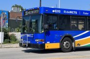 Apr 6th, 2026 by Graham Kilmer


I went to the meeting on Tuesday. The WISDOT engineers seemed surprised to meet members of the public that favored removal.
Ha! If you’re a fan of “City Nerd” Ray Delahanty, like I am, you may have already seen his great a YouTube episode on traffic engineering:
https://youtu.be/NgJ998KHBpc?si=rQAWHKesstN2B0Nd
He used to be one in Portland and, while much of this is about street-level urban traffic planning, it’s clear that traffic engineering is always in service to automobiles. It starts with the assumption that auto traffic is the highest and best use of thoroughfares and intersections to the detriment of all else. (Hey, traffic engineering is how we got here in the first place!) outmoded formulas and algorithms.
I get that part of planning is about looking well into the future, but ALL the projections are 25 years into the future. You’d think they could have run some interim numbers, too. Of course, these projections are all inertia-based. Nothing changes (including current rates of change) except that the freeway comes down.
Traffic engineering sure sounds like the easy life! No imagination required.
They’re saying I-43 rush hour traffic would get 2×3 times worse? Seems very unlikely. Why wouldn’t South Milwaukee/Oak Creek commuters just stick with the Hoan?
Yeah, their numbers don’t add up or there’s a miscommunication. How does an 8% traffic increase translate to such a large increase in travel time?
Mostly wishful thinking not planning. I assume DOT will reimburse drivers for the extra mileage required for the trips rom the south shore burbs. I utilized Superior Street to and from the Hoan as 794 was usually backed up during rush hours.
The 94 North-South corridor adjacent through this section could (and should) also see upgrades / improvements to handle shifts in traffic patterns, seems like an awfully huge miss to not recognize ANY of that.
National & 6th St, Lapham, Becher (and that ridiculous existing design), and no connection with Lincoln (and honestly the Chase bridge / whole design it has with everything else) could and should see proper rework with updated traffic patterns etc.
WDOT is not interested in changes in the method of transportation. Their assumptions are that there will be NO improvement in public transportation. Nor does WDOT take into account the rising levels of smog caused by increases in personal autos. Milwaukee is already experiencing high levels of smog because of the city’s unique geography. The engineers are stuck in the 1950s and still ignorant of issues other than autos.
Finally, WDOT does not take into account the cost savings and increased revenue–as a result of development on Clybourn–that removing I794 would create. The economics overwhelmingly favor removal.