
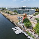
Milwaukee Streetcar Meeting This Thursday
Don’t forget that this Thursday is the open house for the Milwaukee Connector Downtown Streetcar plan. The open house runs from 3 p.m. to 7 p.m. at the Zeidler Municipal Building on the corner of Kilbourn Ave and Broadway. There will be short presentations at 3:30 and 6, come and leave a comment on the proposed system.
Comments could and should focus around how or why you would use the streetcar, what routes are best of the proposed routes, what service frequency you would like, hours of operation, how it should interact with existing transit systems (i.e. the 10, 15, 30 MCTS routes), vehicle types, and what future extensions should be.

It’s important you make a comment on the record in support of the streetcar. If you can’t make the meeting, you can leave a comment online.
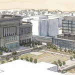
As a refresher, here’s our latest article on the issue (with route #1 winning overwhelming in the poll. You can also view two PowerPoints on the proposed streetcar line. One from the office of Mayor Barrett and another from the Milwaukee Connector study group.
More about the Milwaukee Streetcar
For more project details, including the project timeline, financing, route and possible extensions, see our extensive past coverage.
- FTA Tells Milwaukee to Crack Down on Fare Evasion — Even Where Fares Don’t Exist - Graham Kilmer - Dec 12th, 2025
- Alderman, State Allies Seek Federal Help to Kill the Streetcar - Jeramey Jannene - Oct 28th, 2025
- Streetcar Service Suspended Following Truck Crash - Jeramey Jannene - Oct 21st, 2025
- One Alderman’s Quest To Defund The Streetcar - Jeramey Jannene - Oct 18th, 2025
- Another Streetcar Collision - Jeramey Jannene - Jun 27th, 2025
- Streetcar Hit By Apparent Red Light Runner - Jeramey Jannene - Jun 16th, 2025
- Streetcar Will Run On Consolidated Route During Summerfest - Jeramey Jannene - Jun 11th, 2025
- City Hall: Milwaukee Must Replace Failing Streetcar Switches - Jeramey Jannene - Feb 24th, 2025
- Streetcar Confronts Limited Funding, Operations Challenges - Evan Casey - Jan 22nd, 2025
- Council Kills Streetcar’s ‘Festivals Line’ - Jeramey Jannene - Jul 31st, 2024
Read more about Milwaukee Streetcar here


The route should be the one that has the highest potential for ridership and service to the citizens of Milwaukee. Success on the first effort almost assures that the system will expand and create one of the important increments in an effort to turn Milwaukee back into a first class city.
The first route should travel as much of the commercial and high density population areas of the city.
It should be a “rails in the ground” system to assure investors along the route that it won’t be changed in the near future.
It should be electric powered, so we are using power produced in our area rather than using higher polluting imported fossil fuels.
Any significant amount of parking that is displaced should be replenished with surface or ramp structures.
The route must include the campus of the University of Wisconsin – Milwaukee.
It should start at the Intermodal Station on St Paul proceeding to Water St, north to Brady, Brady to Prospect, Prospect to North Ave, North Ave to Lake Drive, Lake to Downer, Downer to Hartford, West on Hartford to Oakland, Oakland to south to North Ave, North Ave to Farwell, and Farwell south to Brady returning to the Intermodal.
The next significant connection should be to Mitchell. The airport is the next most important portal to the city. Getting air passengers into the heart of the business and commerce district is vital.
@Jeff a couple of things. If the routes want to hit the highest density areas, as I believe it should, then well it really ought to go by JVT and Yankee Hill (very high pop density), not on Water St. Second I really don’t think it is necessary to run down Brady (and there is little development opportunity there anyhow), so a simple route that goes up Prospect and hits Brady would cover that Brady just as well.
Van Buren makes a better (and much straighter) N/S route than H2O, which . Brady historically was a streetcar route; an Ogden / Farwell continuation might do the trick if Brady was to be a mere stop, then run the dang thing up to UWM via Downer. Make sure there’s a stop at the parking garage! I endorse Joe Klein’s approach — let’s study the old routes. There is wisdom in them; many quality buildings remain along those routes. They would become immediately more desirable.
As a living Historian of “Brownsville;” busineses and homes were demolished to make room for I-43. “Brownsville;” included, Walnut Street, the business district which included a Mayor, Mr. Josey, the Regal Theatre, two frozen custard busineses, Williamson’s and Larry’s, Clara’s Restaurant, Band Box Cleaners/Record Shop a drug store with a soda/malt counter, fish and chicken market 3 churches: Tabernacle Baptist, Galilee Baptist and St. Matthew CME, a YWCA, Attorney Ted Coggs office, four taverans all the businesses in “Bronsville” were wiped out/demolished for the construction of I-43. “Brownsville’s” area included: State Street on the South, North Avenue on the North, Twelth Street on the West and around the Milwaukee River over to Booth Street on the East, then back up to North Avenue. When I bordered the street car on 10th & Vliet, it went down Winnebago Street to Juneau Avenue, went on Juneau Ave. up to Knapp Street and I got off @ Lincoln High School where my brothers “Sonny,” Jesse, Warner Miller and I attended high school. The “HUGEST” error, in my opinion, was when the Interurban Line was demolished to make room for I-94. That was our “Rail.” Why couldn’t it have co-existed with I-94? Chicago’s rail, at various points, co-exist with their highways HMMHMMHMM. I guess what I’m questioning is does a complete way of life have to be erradicated in the name of “PROGRESS?”
http://www.milwaukeenewsbuzz.com/?p=61719
Looks like the route is somewhat set. If they get the money for the extensions I think it looks really good (although I wish they could get it further North to UWM.)