Lincoln Memorial Dr. Was Under Water
A 20-year landfill project created the road and the city’s waterfront playground.
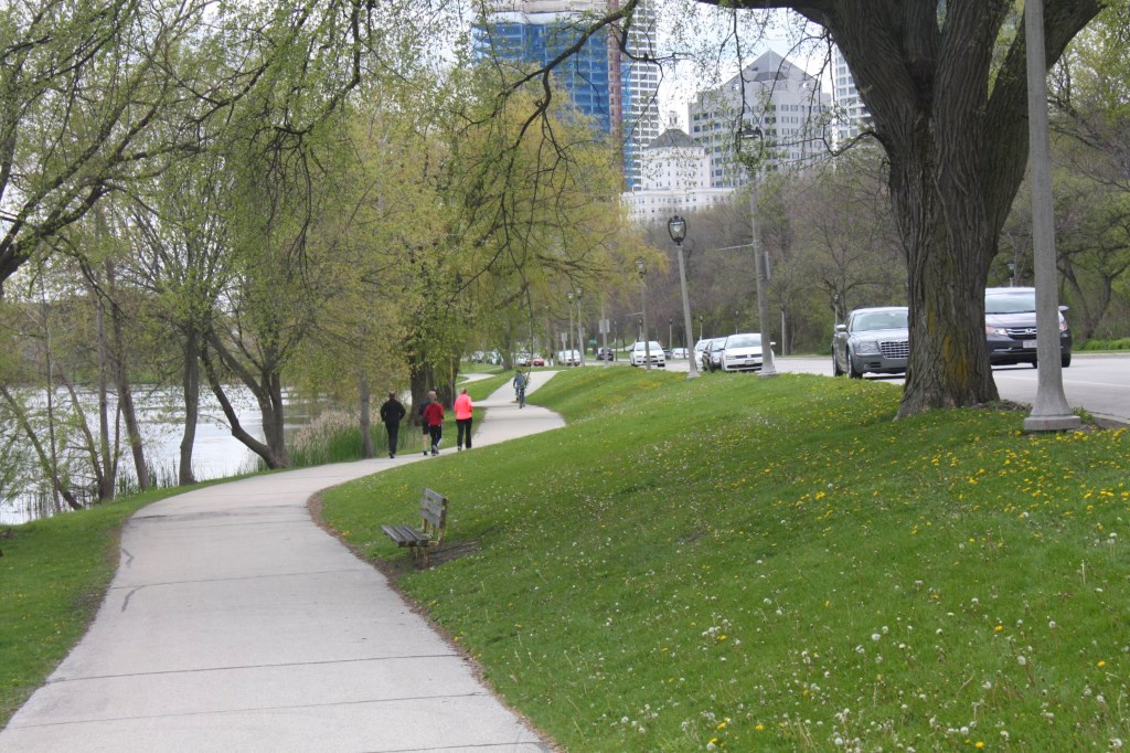
North Lincoln Memorial Drive is the city’s playground — but it wasn’t always that way. A century ago there was no biking, in-line skating, kite flying, walking, jogging or other activities we see today along the drive. As a matter of fact, there was no Lincoln Memorial Drive at all. The road and everything to the east of it was water.
At the beginning of the 20th century, many city residents wishing to view Lake Michigan were limited to seeing it from either Juneau or Lake Parks. Mansions above the bluffs along N. Prospect Avenue blocked most of the vistas. Sunbathers and swimmers who wanted to go to the small beaches below the bluffs went via one of the parks. Reaching the water from Juneau Park required crossing four sets of railroad tracks.
Forward-looking local officials were unhappy with the situation and they agreed with Alderman Cornelius Corcoran when he said, “The entire lakefront should belong to the people and be for their enjoyment.”
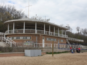
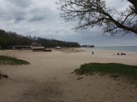
There were two plans to do this. One was to buy the Prospect Avenue mansions as they became available and eventually turn the entire east side of the street into parkland. Another plan, the one pursued, was to create parkland below the buffs with landfill. State legislation had given the city the right to a 300-foot-wide strip of lake bed along the shoreline between Juneau and Lake Parks in the 1890s. In 1907, the massive landfill project that took more than 20 years to complete was started. The work created McKinley and Bradford Beaches as well as a lagoon and a small park around it. Lincoln Memorial Drive connected them all and ran from E. Mason Street to E. Kenwood Boulevard, a distance of slightly over three miles. It opened in 1929 and was named for Abraham Lincoln, whose statue stands in front of the War Memorial today.
A section of the drive south of Bradford Beach and north of the Government Pier ran very close to the water. Because there was no breakwater there, lake storms would wash sand, rocks, gravel, and other debris onto the road. In recent times, more fill moved the waterline away from the street and large rocks at the shore and other landscaping have eliminated that problem.
Changes to the breakwater and still more landfill made the McKinley Marina a safe harbor for private boats as well as charter boats for hire for fishing, sightseeing, and sailing. It is the home of the Milwaukee Yacht Club, which offers storage, docking, and launching services. It is also the home the of the Milwaukee Community Sailing Center which, among other activities, teaches young people how to sail.
More landfilling was also done in the 1970s and 1980s and gave us Veterans Park, which includes the Vietnam Veterans Memorial and is an ideal place to watch the many firework displays offered during the summer. Lake breezes make kite flying a popular pastime. The lagoon draws kayakers, paddle boaters and, in spite of appeals to the contrary, people feeding the water fowl.
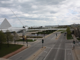
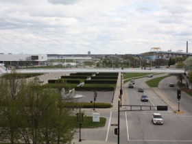
In the 1950s, the War Memorial and Milwaukee Art Museum building was constructed at the south end of the drive. After the Chicago and Northwestern Railway Station at the foot of E. Wisconsin Avenue was razed and the tracks removed, the road was extended southward and now provides access to the Calatrava addition of the Art Museum, Discovery World, the Lakeshore State Park, and the Summerfest Grounds, all sitting on landfill.
With the anticipated Lakefront Gateway project due to be completed near E. Clybourn Street, Lincoln Memorial Dr. will become all the more important as the city’s playground.
Along Lincoln Memorial Drive
Carl Baehr, a Milwaukee native, is the author of Milwaukee Streets: The Stories Behind their Names, and articles on local history topics. He has done extensive historic research for his upcoming book, Dreams and Disasters: A History of the Irish in Milwaukee. Baehr, a professional genealogist and historical researcher, gives talks on these subjects and on researching Catholic sacramental records.
City Streets
-
Revised Milwaukee Streets Book Dishes the Dirt
 Nov 3rd, 2025 by Michael Horne
-
The Curious History of Cathedral Square
 Sep 7th, 2021 by Carl Baehr
-
Gordon Place is Rich with Milwaukee History
 May 25th, 2021 by Carl Baehr









Great planning and urban development sucess story! A similar lakefront landfill project should be done to the area located from the Milwaukee River connecting south to South Shore Park. That portion of Milwaukee’s precious lakefront is not being used anywhere near its highest possible use. Chicago, Vancouver, Oakland, and even Jersey City understand the full potential and value of their waterfronts. If only we had a mayor with vision…
We are indeed fortunate to have inherited this well-preserved lakefront. I believe Charles Whitnall was a driving force in that planning, as well as for other aspects of the parks system. Christian Wahl was a leader early on in forming the city’s first parks commission, recruiting Olmsted to design three of the first six newly created parks, etc. Wahl was also a bit of a designer.
Carl, perhaps you could do future articles on these civic visionaries (if you have not already).
The early Socialist leaders also played a big role in ensuring that Milwaukee had exceptional public amenities such as a great park system, and efficient sewers and such (and thus were called “Sewer Socialists”). They understood the role of the public realm in creating and maintaining quality of life.
We desperately need real civic vision these days. Current elected officials are allowing parks legacies to decline with neglect, scheming to sell them off or otherwise privatize public amenities, and instead subsidizing private projects posing as “public infrastructure.”
Bill Marsh, we can appreciate the idea of duplicating what was done north of the river by doing the same south. However, the port provides a surprisingly significant boost to the local economy. The port, the Jones Island treatment plant, the coast guard station, etc all have their uses and purposes. Could we fit more uses in some places? Yeah, probably. But you can’t replicate what you have on the north side along this stretch because of the other uses already in place. Not to mention the cost to do a project like that when you already have the amenity in place.
My contention is that the economic value of the port as-is is significantly lower than its potential value as a residential, commercial, and tech district. Especially if the lake frontage and harbor front was fully taken advantage of with private and public development.
The Port of Milwaukee is ranked as the 91 for US ports by tonnage (we are below Escanaba!), and it is used primarily to ship low-value commodities. The number of port jobs in Milwaukee is miniscule relative what could be there. How could piles of salt, oil/gas tanks, and a bunch of old freighters docked over the winter be the best use of so much valuable water frontage? Obviously MMSD has to stay and same with the Coast Guard, but they can be worked around. I say leave a few piers for ship dockage on the north end of the lake front near MMSD, and redevelop the rest.
Apparently as happens in metro Milwaukee, special interests and the lack of vision by our governmental leaders will result in kiling progress.
PS-Rebuilding the I-794 freeway and Hoan Bridge is another case in point. Where else in this day and age do cities build (or rebuild) freeways on their waterfronts?
2 comments: I believe the landfill used to form Veterans Park was spoil from the construction of the Interstate through Milwaukee, where massive amounts of fill were the result of creating the deep valleys for grade separation. I’m not sure where a similar source of fill would come from today.
Second, the author references a plan to open up the lakefront by purchasing & razing the mansions along Prospect. There was a similar plan, partly implemented, to buy & raze mansions on the lake side of Lafayette & Terrace Avenues.
Houses were to be removed north & south of the Villa Terrace, showcasing the house & grounds in splendid isolation.
Several of these demos occurred during the 1960s and 70s when I was growing up on the East Side. The general decline of the area during the 50s made such a program possible, since the county could afford to buy these houses in the cheap.
As the East Side was rediscovered in the 60s & 70s the county was priced out of the market & the plan ground to a halt.
I believe the Veteran’s Park landfill came from material removed from MMSD’s Deep Tunnel project, not from freeway construction (which were largely complete a decade earlier).
A history of Lake Park on the county parks website notes that Frederick Law Olmsted originally planned what eventually became Lincoln Memorial Drive, at least the northern section. That was around 1892. It does not say when the drive was first created.
“The Olmsted plan for Lake Park envisioned a main road along the lakeshore below the bluff, another road that followed city streets along the top of the bluffs at the park’s western edge, and a connecting road from the base of the bluffs up through a ravine. Along the crest of the bluff he proposed meandering carriage roads crossing the ravines on the bridges.”
http://county.milwaukee.gov/HistoryoftheParks16572.htm