
Water and Brady Is A Mess
With growing density and auto, bike and pedestrian traffic. Is there a solution?
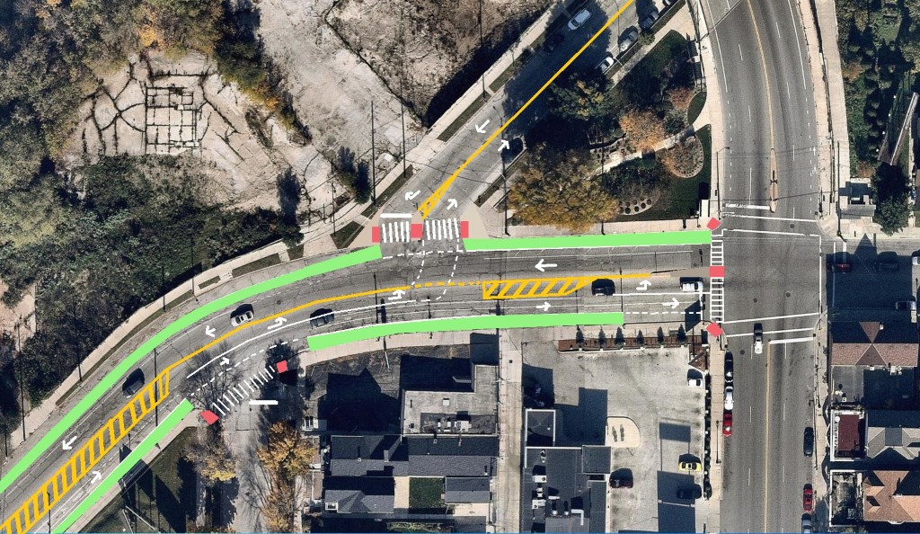
Intersection of N. Water and E. Brady streets. Design by John O’Neill
Water and Brady streets is one of the most prominent and problematic intersections on the East Side, if not in the entire City of Milwaukee. This intersection has seen a tremendous amount of development with hundreds of apartments rising in either direction. Previously used primarily by neighboring industrial facilities, the intersection is now in the center of one of the city’s higher density mixed use neighborhoods. With the resulting growth of pedestrian and bike traffic in this area, the need to rehabilitate and reconfigure this junction in a way conducive to improved public safety becomes ever more critical. With many hundreds more apartments set to rise and associated drivers, bikers and walkers sure to come to this location it is urgent that the city formulate and implement a plan to reduce congestion and improve safety for all of the intersection’s users.
What Works
Water St. already has bike lanes and is an existing transit corridor. The neighborhood is medium density, walkable and the terrain here provides for a dramatic entrance from the traditional East Side into the North End and Park East Corridor. The flow of traffic is generally fine other than during weekday rush hours and temporarily as a result of jersey barriers associated with the ongoing multifamily construction along Water. Brady Street Park exists in the triangle bounded by Water, Brady and Holton streets – this is a great little community space and beloved by neighbors. In a neighborhood that needs quality green space, it should be made easier to access for those in the neighborhood. This is obviously a nexus of cultural and social institutions in the neighborhood and improving accessibility and safety only stands to the benefit all who use it.
What Doesn’t
The intersection is constantly backed up by drivers heading north on Water and attempting to make a left across Brady to continue doing so. The topography of the intersection also creates difficult sight lines, making it difficult to see turning drivers. Drivers on N. Water merging onto E. Brady going east are also frequently at a loss with the bustle of turning cars and traffic heading south or north from Brady and Van Buren. Pedestrian crossings are limited and the haste with which one needs to make a left turn from Water St. onto Water St. (north of Brady St.) puts pedestrians and bikes at a risk of collision as they attempt to walk west on Brady St. from Brady Street Park towards Water St. and down the hill. The fact that Water basically merges onto Brady creates the impression of an onramp for drivers – which makes it intimidating for bicyclists and walkers to cross the street. Residential development has grown considerably in the area and drastically increased the population, but the city has yet to respond with adjustments to accommodate those changes.
What can we do to improve it?
My proposal calls for eliminating the parking lane on Water St. starting at the Danceworks building and up the hill onto Brady St. until Van Buren and eliminating the parking lane on the north side of Brady between Van Buren and Water. I would push the existing bike lane to the sides of both Water and Brady streets and delineate them with green paint to improve visibility. I would install high visibility crosswalks on the north side of Brady where it crosses Water, on the east or southeast side of curving Water where it crosses Jackson and on the east side of Van Buren where it crosses Brady. High Visibility Crosswalks are basically bar- or ladder-like crosswalk markings that have been found to increase awareness of drivers and provide them with additional time to stop.
I would also implement designated left turn lanes at Water and Brady and at Brady and Van Buren. Under this retrofit, Brady would have one lane of active and unencumbered traffic going in either direction. I would channelize the center of the corridor so as to provide space for drivers and additional overflow space for left turning cars if necessary during rush hour. I would also add a small concrete bump out at Water and Brady so as to draw cars to a slowing stop and to create a more traditional T intersection and less of an onramp aesthetic. I would rehabilitate the existing pedestrian island to create a refuge for pedestrians in crossing from Brady Street Park to Water Street.The city Department of Public Works has been hesitant to add an additional traffic light to this intersection given there is already a traffic light at Van Buren. With that in mind, I have worked to provide a different resolution to the problem. Water and Brady will continue to be controlled by a stop sign, and pedestrian crossings will be enhanced at three different junctures. Overall we see a plan that prioritizes the flow of traffic from Water to Brady, pays additional attention to bikers and pedestrians, and further controls the intersection in an attempt to reduce accidents – namely left turn accidents.
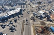
N. Water and E. Brady Streets


Intersection
-
The Bermuda Triangle of Milwaukee’s Northwest Side
 Feb 19th, 2026 by John O’Neill
-
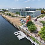
The Port of Milwaukee Interchange Is an Overbuilt Mess
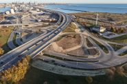 Nov 16th, 2025 by John O’Neill
-
6 Changes Needed on Commerce & North
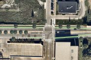 Aug 25th, 2017 by John O’Neill


John, Any ideas for the pedestrian safely crossing Water at Jackson?
Sounds good. I expect the city will want to rebuild Water Street in that whole corridor from maybe Knapp Street to Van Buren, but with all the construction projects current and future, they want to wait until that all finishes up.
I drive through this intersection every day, but I can’t recognize anything on the photo. What is the orientation?
So, your “solution” is to add traffic lanes?
Have you not learned anything from the last 70 years of road design?
Also, how does the east-bound GRE bus stop play into this? Or when an east-bound car is turning right but waiting for peds?
@Tim – re-read the article. The only thing that was added are two more clearly defined bike lanes. Parking lanes were eliminated and the number of active traffic lanes (1) did not increase in either direction. The lone addition is a designated turning lane.
I wouldn’t put a stop sign there, just slows down traffic and it’s just getting busier there. I agree with the lane widening to have dedicated through lanes, I think that’d help a lot.
Part of the traffic problem on Brady and Water is that anyone living or working on or near Prospect south of Brady use Brady and then Water as an exit to the freeway. The only alternative is to go all the way to North Avenue. Not sure what would cut back on that traffic.
This engineering is a hang-up for the Wangard project. There is some interest in extending E. Brady St. to the west — at least visually, as one means of diminishing the problem there. Wangard’s property might have to be shaved a bit on its east end which would open up some space. Also, we have the bridge approach, which really complicates things. And I would hate to lose one of the city’s oldest elms in the triangle park.
‘Tis a mess. But the original plan in the early 20s was to have Holton be a viaduct as far south as E. Pleasant St.
That would have solved some of our problems, but really messed up the lovely stretch of Van Buren there.
Put the bus stop a quarter to halfway up the block from hybrid?
I redesigned this a year ago… let me know what you all think.
http://i.imgur.com/jQbpzdj.jpg
It’s pretty gnarly on Oakland and North Ave too, especially if you’re headed north on Oakland and want to make a left, it’s very dangerous. I think a turn light would make a significant difference.
Make right turn on red illegal on southbound Holton. That will help clear the logjam of vehicles waiting to continue northbound on Water or southbound on Water.
The stoplight at Humboldt/Kane/Water has helped because people didn’t know how to navigate the 4-way stop sign. When construction is complete the street will be easier to navigate because the giant pickup trucks won’t be parked there and the oblivious construction workers won’t stroll out into the street in front of traffic.
Thank you for a timely article. I live off this intersection. Aggressive east side drivers aside, I have dodged traffic crossing with the WALK light as backed up drivers from the Jackson/Water/Brady split race the changing lights of the Brady/Van Buren-Holton Bridge traffic light as if it doesn’t exist. Add to the fray all the ignored “pedestrian crossing” signs. I call this strip “Death Race 2000” (points for bikes and pedestrians who manage to get in the way).
Being someone who lives a block from that area, I would ask the city to install a double roundabout. One on the corner of Brady and Van Buren and the second on the three way at Water and Brady.
John – great article, thanks for bringing attention to what is by far the worst intersection in Milwaukee. I like Mike’s idea for a double roundabout. What about putting in a stop light there?
It seems like it needs some sort of drastic change or there are going to be serious accidents there. My first visit to Milwaukee I almost got hit coming east on Brady and turning north on Water, I couldn’t believe the layout of the intersection (or how bad Milwaukee drivers are – no offense to everyone reading this).
What about protected bike lanes on water all the way to city Hall?
Also, I’m hosting a Milwaukee Walks MTG to try and make crossing the street safer for everyone at Central Library, Thurs 2
/2 1-3 in rm 2b. Come share ideas for making walking better and getting people driving to yield to people crossing the street!
The inconveniences of this intersection are nothing compared to North & Oakland. It’s not unusual for there to be one, unending line of cars from Oakland west to Humboldt, east to Lake Drive. The result of overbuilding of apartments along the corridor without creating new traffic controls. For one thing parking should be eliminated along North east of the bridge to create two lanes of traffic.
Overbuilding of condos/apartments bringing more traffic is an essential awareness to bring to this discussion. There was a recent comment about the need to rethink how many apartments and condos can be built in the downtown area without creating an oversupply; thus reducing the rates that can be charged; thus reducing the planned economic benefits to developers and managers of these properties. Economic benefits become the dominant drivers to development rather than livability. Then who wants to live there. A build out that forgets that humans need to be a part of the picture is not progress but decline. Creating a livable city is a necessary ingredient for MKE’s future. See further details on Facebook at Friends of Milwaukee’s Downtown Forest.
@Barbara Just to be clear, there has been no condo development in Milwaukee in well years. And yes lots of vacant land is now becoming apartments. Glad to see it.
Density is what drives cities. Density generates taxbase, is new customers and new friends! Oh yeah, and density is green. It is key to walkability, to transit ridership and, yes, great cities.
PS I’d love to see an effort to bring more street trees to Milwaukee.
This corridor would be a great place for the city to institute protected bike lanes. I’m indifferent as to whether parking remains and the bike lanes are parking-protected or whether parking is removed – either way, the bike lanes need to be protected (not just buffered or painted), or they will just be used as loading zones and passing lanes. I’d actually like to see protected bike lanes extend south on Water St. to Cherry St. or Knapp St., with one general travel lane in each direction removed, the parking lane shifted to take over the former travel lane, and bike lanes in the current parking lane.
Eric S, I like the idea of protected bike lanes. I’m sure some people would lose their minds over it though.