
Design Your Own Streetcar Route
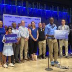
UrbanMilwaukee would like to issue you a challenge. With the announcement that Mayor Tom Barrett with the help of Congressman David Obey and Senator Herb Kohl managed to get 60% of the $91.5 million for his streetcar vision, it’s time to think about what the final route may be.
There is a simple reality any Milwaukee streetcar proposal must deal with though, there is only enough money for an initial 3 miles.So here’s the game.
1. Create a Google Account or use an existing one.
2. Create a route (not longer than 3 miles) using Google Maps. Don’t know how to do this? There is an introductory video.
3. Paste a link to your route in the comments of this post.
4. Wait until Wednesday afternoon, at that point we’ll put together a poll so we can vote for the best one.
Can’t wait to see what you come up with, whether it’s a line to Bay View or UWM, or perhaps a completely different loop around downtown.
More about the Milwaukee Streetcar
For more project details, including the project timeline, financing, route and possible extensions, see our extensive past coverage.
- FTA Tells Milwaukee to Crack Down on Fare Evasion — Even Where Fares Don’t Exist - Graham Kilmer - Dec 12th, 2025
- Alderman, State Allies Seek Federal Help to Kill the Streetcar - Jeramey Jannene - Oct 28th, 2025
- Streetcar Service Suspended Following Truck Crash - Jeramey Jannene - Oct 21st, 2025
- One Alderman’s Quest To Defund The Streetcar - Jeramey Jannene - Oct 18th, 2025
- Another Streetcar Collision - Jeramey Jannene - Jun 27th, 2025
- Streetcar Hit By Apparent Red Light Runner - Jeramey Jannene - Jun 16th, 2025
- Streetcar Will Run On Consolidated Route During Summerfest - Jeramey Jannene - Jun 11th, 2025
- City Hall: Milwaukee Must Replace Failing Streetcar Switches - Jeramey Jannene - Feb 24th, 2025
- Streetcar Confronts Limited Funding, Operations Challenges - Evan Casey - Jan 22nd, 2025
- Council Kills Streetcar’s ‘Festivals Line’ - Jeramey Jannene - Jul 31st, 2024
Read more about Milwaukee Streetcar here
Political Contributions Tracker
Displaying political contributions between people mentioned in this story. Learn more.
- June 29, 2017 - Tom Barrett received $1,000 from Herb Kohl
- March 3, 2016 - Tom Barrett received $5,000 from Herb Kohl


Because I am up late and was curious to see what I could come up with, here are three entries. While a loop makes certain sense, with only 3 miles of tracks to lay, I can’t really see them being used in a loop downtown, I can’t imagine myself using it except in very extreme situations. Here are three tries that tie in either anchors on both ends or at least stick close to popular landmarks for the public.
The Downtown-Brady Line:
http://maps.google.com/maps/ms?ie=UTF8&hl=en&msa=0&msid=112279874402845266728.000465d6db73dad3928d6&ll=43.04468,-87.904487&spn=0.01932,0.045404&z=15
Line to UWM:
http://maps.google.com/maps/ms?ie=UTF8&hl=en&msa=0&msid=112279874402845266728.000465d70038daf8de756&ll=43.04653,-87.893672&spn=0.019319,0.045404&z=15
Ogden-ThirdWard-MAM Line:
http://maps.google.com/maps/ms?ie=UTF8&hl=en&msa=0&ll=43.040822,-87.901912&spn=0.019321,0.045404&z=15&msid=112279874402845266728.000465d71f745ab1c843e
For anyone participating in any line/loop creation, it would be cool to see what you think are prime areas for development with the line. While the Mayor’s loop may seem goofy now, it does serve a lot of edge areas like the Park East that could be pushed to develop faster with the line in place (and to develop bigger).
With the KRM and High Spped Rail as real possibilities, I think it is vital to hit the intermodal station. In addition, somewhere along the route you need a maintenance facility and storage shed for the streetcars, so keep that in mind as well.
@MilwaukeeD Agreed hit the Intermodal Station seems like a must happen to me too.
http://maps.google.com/maps/ms?ie=UTF8&msa=0&msid=116701689569287864474.000465de5289ef7dae178&ll=43.040508,-87.909551&spn=0.022677,0.038667&z=15
the problem is, milwaukee is already so walkable/bikable it’s hard to determine where the streetcar should go within a 3 mile loop. for example, it would be awesome if it could get out to the stadium or down to walker’s point somehow.
I have a question. Is the line limited to three double-track miles or just three miles total length? Because if you single-track the line with occasional passing tracks you would probably be able to run the line four or five miles with the available funds.
http://maps.google.com/maps/ms?ie=UTF8&hl=en&msa=0&ll=43.052269,-87.896419&spn=0.005574,0.014462&z=17&msid=107949597789535800481.000465df49d4f179dd919
http://maps.google.com/maps/ms?hl=en&ie=UTF8&msa=0&ll=43.036744,-87.902298&spn=0.021895,0.055618&z=15&msid=100505100194550221516.000465de72ed982952ba5
At just under three miles of total track this route isn’t a loop but would be southern, northern, and eastern routes requiring three trains operating in a hub and spoke with the most logical hub being the existing Intermodal Station. The goal of this design is two fold, catering to both work and play.
Work: Maximizing the proximity to the downtown office high-rises and Fortune 500 headquarters (Northwestern Mutual, Johnson Controls, US Bank, Manpower, M&I Bank, etc.) will provide the daily commuters tired of paying $100-190/month for downtown parking to make the KRM line financially viable
Play: Providing access to the downtown attractions (MAM, lakefront, H-D museum, Third ward, Bradley Center, Milwaukee St., Third St., Water St., and 5th/6th/National Ave) that currently attract driving day trippers, weekenders, and going outers that will find taking the Amtrak and transferring to the downtown light rail more accommodating then driving and finding parking.
It is regrettable that I ran out track before having a viable link to the Potawatomi Casino or Miller Park but collaboration/cooperation with Potawatomi’s existing shuttle network and possibly a dedicated Brewers game day Milwaukee County bus down Canal St. (which would require cooperation of officials who, at times, seem more concerned with grandstanding then solutioning) will also drive up the ridership of downtown light rail, Amtrak, and the KRM line.
Let’s face it, those Illinois based Cubs/Soxs fans and Third Ward condo owners are going to come to Milwaukee anyway and since they are used to taking light rail in/around Chicago they are a much easier sell for ridership then 99.99% of the residents of SE Wisconsin that have never lived in a larger city where light rail was a necessity and still say “I just don’t understand the need…”
North Side – Marquette – Cathedral Square
http://maps.google.com/maps/ms?ie=UTF&msa=0&msid=
107014636369832204954.000465e16fd0c19ef367c
This line would encourage development on the near North Side, including the now-desolate blocks near Johnsons Park and North and Fond du Lac. It would connect the near North Side with Marquette University and Downtown.
North Side – Brewery – Downtown
http://maps.google.com/maps/ms?ie=UTF&msa=0&msid=
107014636369832204954.000465e1a835920cd1534
This line would connect the North/Fond du Lac area and Johnsons Park with the Brewery and Park East corridor with the heart of Downtown Milwaukee. It would encourage economic development in the Park East, the near North Side, and enhance the Brewery as a destination.
This is a brilliant idea. I strongly thing the streetcar should run as much as possible on its own right of way – NOT on city streets, otherwise it’s barely faster than a bus. 3 miles is a total joke. I still think it’s better than nothing, but man, if it’s not quickly followed by expansion, the naysayers will have a field day with it.
So i cheated… here’s my 4 mile run: http://maps.google.com/maps/ms?ie=UTF8&hl=en&msa=0&z=13&msid=117625184132008241289.000465e466163f9b3b7b5
The description of my route (as copied from my map):
As much as I think the current proposal touches on all the important areas of downtown, one thing that would encourage more development along the route, and overall use of the streetcar system, is if it’s destinations are all entertainment venues: the Bradley Center, Summerfest grounds and Potowatomi Casino. By bringing in more riders right away, it would be my hope that the line along Canal St. could be completed all the way to Miller Park and the northern line extended northwest along Fond du Lac Avenue.
One of the benefits of the southern extension in the Third Ward would be the ultimate development of the massive parking lots bordering the Italian Community Center. This line could then be extended west on Chicago, south onto Milwaukee, leading over the Milwaukee River and onto Pittsburgh Avenue, where it can then head south on 1st St. and beyond
Here it is: http://maps.google.com/maps/ms?ie=UTF8&hl=en&msa=0&msid=100408497727146637268.000465e817dec38104554&ll=43.038068,-87.919979&spn=0.026913,0.077248&z=14
Marty’s 0920 map intrigues: it includes elements of the dinky (ran on 6th and 5th to Oklahoma, terminating on that earthwork that still stands on the east side of 6th), the Milwaukee Northern (actually went north on 5th and 6th to Atkinson and thence north as far as Lindwurm Park) and the 13-Clybourn (west terminus near Marquette Stadium, convenient to today’s Miller Park), east terminus the North Western Depot, close to the art center. (There also was, at one time, a faster service from downtown that stopped near the Soldiers Home, also convenient to Miller Park, but the straight line distance is just outside the three mile limit.)
4.3 mile cheat Intermodal-UWM
http://maps.google.com/maps/ms?ie=UTF8&hl=en&msa=0&ll=43.048443,-87.895635&spn=0.005575,0.014462&t=h&z=17&msid=107949597789535800481.000465e8f7b848b941faa
Check it out
http://maps.google.com/maps/ms?hl=en&gl=us&ie=UTF8&oe=UTF8&msa=0&msid=100788912438506819023.000465e588f4e37fc77a7&z=14
The route I posted was intended to meet the challenge of serving multiple customers. It seems to be a basic assumption that any idea must meet the Intermodal Station. If we are talking about true transit integration, this seems to be a must. That area also provides location for maintenance and storage facilities under the highway or some similar spot.
Who should this line serve? It seems it should handle both tourist/occasional visitors, but also serve as a meaningful connection between residents and jobs. It should highlight and connect our most revived neighborhoods and serve the densest areas, both in terms of jobs and neighborhoods. The census tracts this runs through are the densest in Wisconsin. The east town office area if the densest area of jobs in the state as well. Just check the census as well as the Downtown BID’s market study on where the jobs are.
Some might argue why serve these areas? The fact is that this initial streetcar line must be successful from day 1 if future extensions will be taken seriously. Look at the bus rider ship on the No. 30 from Wisconsin to Ogden, typically standing room only.
Also to be looked at is what is a walkable 3 block distance from the line. So many additional attractions and population centers. This route has the ability to serve existing riders, and also draw new people, who do have the choice to drive, out of their cars.
In the next phase, the line should extend north to at least Kenilworth than possibly to UWM. (That seems like another $39 million if you do the math.) Maybe more important is for the next extension to go south from the Water and Chicago tip down to the 5th Ward and even onto the UWM Water Institute, given all the economic development potential and lack of anti-development sentiment that area seems to have. Similar benefits to going north into the Park East and the area north of McKinley, as allot development potential seems to exist there. Maybe then on to “Bronzeville”
In any event, no line is perfect, but this alternative attempts to hopefully seek balance between connecting downtown attractions (as the original Milwaukee Connector Study set out to do), but also begins to develop the important connection between residents and jobs, allowing them to leave their car behind. Imagine, not having to build yet another parking ramp downtown!
Let’s see… the choo choo train will NOT go to UWM, Miller Park, Mayfair, Bayshore, Marquette, Harley Davidson, Manpower, or Potawatomi? Where is this going to go? For the love of god, don’t one of you ineffectual socialist dolts see that this thing is going to be a huge failure? What is about you liberals that causes you to believe this is going to work? Name ONE city where there is a similar type of rail system is profitable and successful? Well, let me help…there isn’t one!
@ Corrina: Hmmm, that’s a tough one. How about ChicagoNewYorkWashingtonDCSanFranciscoPortlandEveryBigCityInTheFreakingWorld? Speaking of government subsidies, how about you show your good citizenship by killing all future road projects because, hey, they are just socialistic subsidies that would be failures in the privatized universe of your mind!