
A Walk That’s All Woods And Water
From Caesar’s Park to Urban Ecology Center you pass 70 different tree species and dozens of wildflowers, shrubs, and grasses.
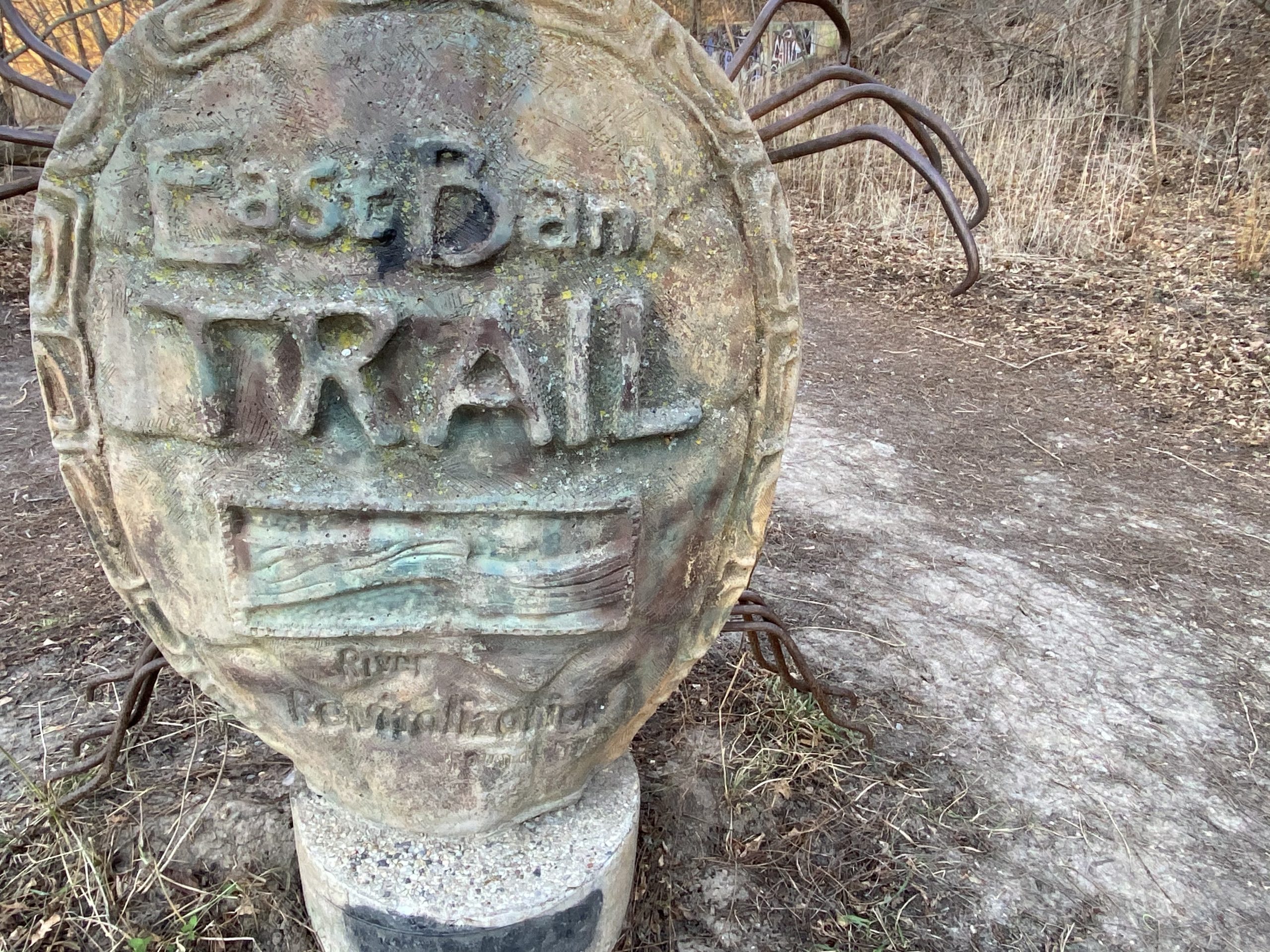
Start of the trail in Caesar’s Park. Photo by Cari Taylor-Carlson.
Distance: Two miles
Parking: On the street
Start: Caesar’s Park, 1939 N. Warren Ave.
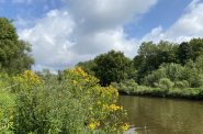
At one end of this walk there’s Caesar’s Park; at the other end, Riverside Park, the Urban Ecology Center, and Locust Street; and in between, a wide gravel path through the Milwaukee Rotary Centennial Arboretum.
You will start this walk at Caesar’s Park, just 3.7 acres, and the place where the former North Avenue Dam changed the flow of this section of the Milwaukee River. The dam, built in 1835, was constructed to provide power for mills, tanneries, and factories downriver. An unexpected benefit, an impoundment upriver, turned the river into a popular playground. The water in the impoundment, a lake-like area that backed up behind the dam, was warmer than Lake Michigan and soon became a destination for swimming and boating. Multiple boat clubs sprang up on the shoreline and band concerts became a regular evening event for locals. From the late 1800s to World War I, you could take a steamboat north from North Avenue to visit a beer garden, or, you could rent a small boat with oars and row up the river. If you were a member of Milwaukee’s affluent class, you could tour the river in your private watercraft.
Over the decades since then the river became extremely contaminated and in the 1990s Mayor John Norquist pushed to remove the dam and return the river to its natural boundaries, which was done in 1997. After its removal, dozens of fish species returned to the colder water along with wildlife that had formerly lived along the banks before the impoundment flooded their habitat.At the other end of the walk, Riverside Park, designed by Frederick Law Olmstead in the 1890s, was once a ravine that ran from Oakland Avenue to the river. The ravine was used as a carriageway that led from Oakland along the base of the ravine, under the railroad tracks, (now the Oak Leaf Trail) and through a tunnel. From there, it climbed to the top of the ravine and exited at Locust Street. In the 1970s, the ravine was filled in and now supports the Riverside University High School athletic fields.
The Urban Ecology Center, at Riverside Park, sits on land that was once the site of the National Brake and Electric Company. At one time, the company employed 1,400 employees in a complex that included a foundry, an office building, and several smaller buildings. Established in 1901, it ceased operating 30 years later, and in its place we have the Urban Ecology Center, dedicated to educating the community about the environment and teaching children basic ecological principles.
The Walk
The walk starts at the steps leading to the river at Caesar’s Park, once known as Milwaukee River Dam Park, and later named for a local resident, Caesar Paikowski. At the river turn left and soon you will see the sign for the Milwaukee Rotary Centennial Arboretum. The arboretum, 40 acres that combines Riverside Park with the Milwaukee River Greenway, stretches along the river from North Avenue to Locust Street.
It’s a living museum with 70 indigenous tree species along with dozens of native wildflowers, shrubs, and grasses. The restoration of these 40 acres is an ongoing project supported by the Milwaukee Rotary Club, the Urban Ecology Center, the River Revitalization Foundation and many other organizations. As you walk, take a moment to indulge your imagination and picture this arboretum in 100 years when the newly planted trees have reached their full maturity and native wildflowers carpet the floor of the forest. On occasion, deer have been spotted along the river.As you follow the gravel trail, you will encounter fishermen, bikers, many recently planted trees marked with white protective casings, a couple of benches, and a different kind of children’s playground, trees and rocks instead of jungle gyms and teeter totters.
If you follow the paved trails that lead to the Urban Ecology Center, you can explore the building and its displays. Or, you could linger on multiple trails that crisscross Riverside Park adjacent to the trail, continue on the gravel trail to Locust, or, turn around and return to Caesar’s Park and a meal on Brady Street. Wherever you end this walk, you will need to retrace your steps back to start at Caesar’s Park.
This walk along the river has, albeit briefly, removed you from the clutter and clamor of the city and taken you to a place where the Milwaukee River flows quietly and inexorably to its final destination, Lake Michigan.
Along the Walk


If you think stories like this are important, become a member of Urban Milwaukee and help support real, independent journalism. Plus you get some cool added benefits.
Milwaukee Walks
-
A Lovely Walk Along the Milwaukee River
 Aug 17th, 2024 by Cari Taylor-Carlson
-
Kilbourntown Tour Offers Tons of History
 Oct 8th, 2023 by Cari Taylor-Carlson
-
Riverwest Is a Melting Pot
 Aug 25th, 2023 by Cari Taylor-Carlson