Layton Boulevard Has Overlooked History
Once the city’s western boundary with homes for wealthy, the area later added Frank Lloyd Wright homes.
Distance: Three Miles
Start: At the corner of S. Layton Blvd. and W. National Ave.
Parking: On the street
Frederick Layton had the honor of having two city streets named after him. As Carl Baehr wrote in Urban Milwaukee in 2018, “Layton had an avenue named for him because he was a meatpacker and a boulevard to honor his contributions to the city.” It’s confusing. The boulevard, the site of this walk, was designated as Layton Boulevard in 1909, while Layton Avenue was added as the city pushed further south. To further complicate things, Layton Blvd. starts as S. 27th St. until it becomes Layton Blvd. at the Mitchell Park Domes and then continues south to W. Lincoln Ave., where it reverts to 27th St.
The area was originally home to Potawatomi and Menomonie Indigenous people who lived there until white farmers came to farm their land in the 1820s. In 1838, these Native Americans were rounded up and herded west to the Mississippi, a sad operation known as the “Trail of Death.”
As you ramble down Layton, it’s hard to picture this four-lane boulevard where cars accelerate from stoplight to stoplight as a once-bucolic Indian trail that ran from Chicago to Green Bay. The boulevard, once known as S. Washington Ave., was the western boundary of Milwaukee until it was integrated into the city in 1903.
The east side of Layton developed ahead of the west side, and that’s where you will see the most elegant homes. The west side remained agricultural, mainly occupied by celery farms until the 1900s. Many of the early homes on the street’s east side were summer homes for the wealthy, which created a suburban enclave south and west of Downtown. As the boulevard became more popular, some residents hoped it would become the new Gold Coast, perhaps because it was as close to an exclusive neighborhood as anywhere on the South Side.
Eventually it became a diverse, middle-class neighborhood populated first by German and Polish immigrants and followed by Latinos who began to arrive in the 1920s though not in big numbers until decades later.
Several churches and diverse architectural styles make this historic district from W. National Ave. to W. Lincoln Ave. a neighborhood worthy of a historic walk.
The Walk
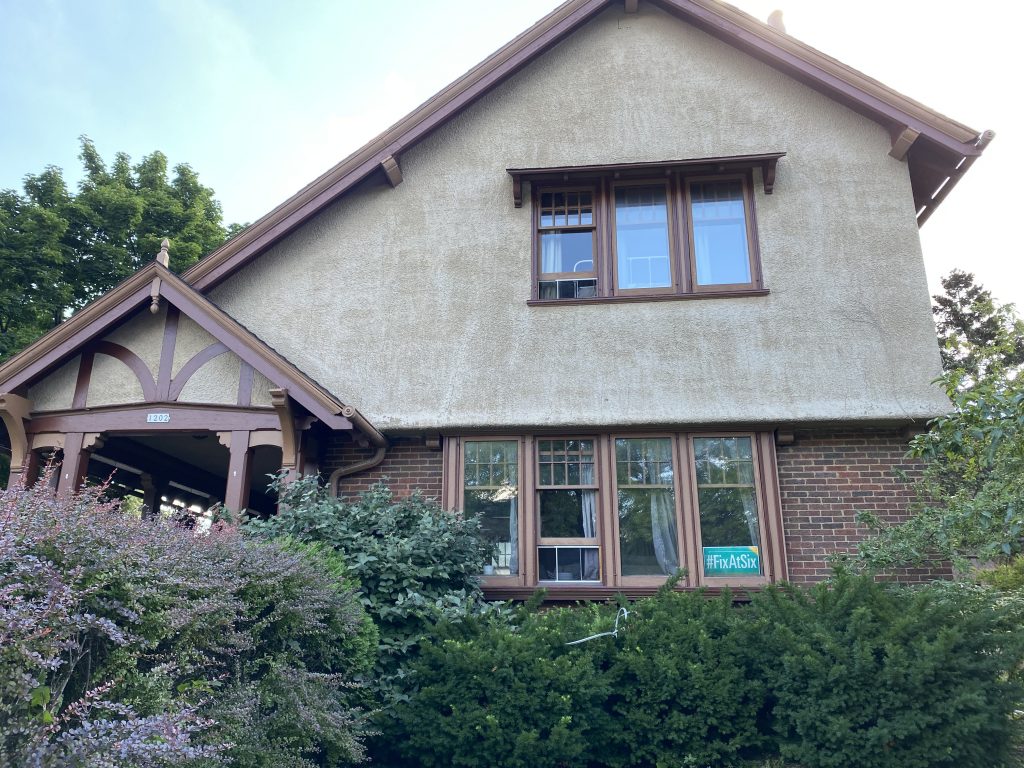
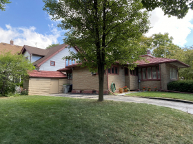
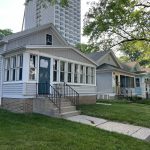
Start this walk at the corner of National and Layton. At 1202, look for the Alexander Eschweiler-designed home. Eschweiler, a prominent Milwaukee architect, designed several notable mansions on Milwaukee’s East Side in the early 1900s. This is one of his more modest designs, done in the then-popular arts-and-crafts style.
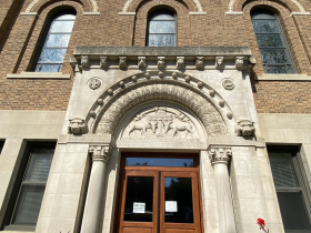
At 1236, take a look at Ascension Lutheran Church known for its spectacular stained-glass windows. Next you will come to St. Lawrence Catholic Church where, if you look carefully, you will see a statue high on the roof on the back side of the church. Across the street, the historic St. Joseph Convent building will soon be converted to affordable senior housing. Adjacent to the Convent, the Sacred Heart Rehabilitation Hospital opened in 1893 as a sanitarium for people who suffered from arthritis. It has since been relocated to N. Port Washington Rd. in Mequon.
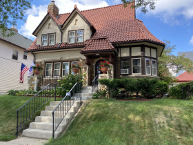
Across the street at 1615 look for the home designed to look like a German cottage with its lovely, rustic, red tile roof.
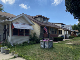
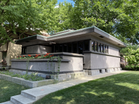
As you continue walking south, you will notice that the homes get smaller. In the 1900 block, starting with 1954, you will see six almost identical bungalows. They were built by the Association of Commerce as part of a program to meet the post-war housing shortage. When you come to W Burnham St., detour one block west, to see six American System-Built Homes designed by Frank Lloyd Wright, which were built in 1916. One of Wright’s goals was to build affordable housing for middle-class families. These homes were constructed with pre-cut lumber according to standardized designs. The dimensions are modest with clean lines and the ageless appeal of Wright’s work. Two of the homes have been restored and are open for tours on Saturdays.
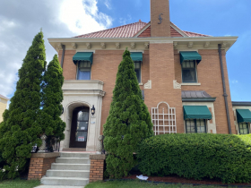
Before you come to Lincoln, the southern boundary of the Historic District, look for the elegant home at 2146. This was the residence built for Sylvester Wabiszewski, president of the Maynard Steel Foundry.
At Lincoln, turn and retrace your steps back to National and the start of this tour through the Layton Boulevard Historic District. Because Layton is a four-lane boulevard and a major north-south thoroughfare, crossing the boulevard can be dangerous. It’s not the peaceful trail that once connected Chicago with Green Bay; instead, it’s more like an inner-city freeway with a fascinating backstory and an important link in Milwaukee’s history.
Along the Walk
If you think stories like this are important, become a member of Urban Milwaukee and help support real, independent journalism. Plus you get some cool added benefits.
Milwaukee Walks
-
Kilbourntown Tour Offers Tons of History
 Oct 8th, 2023 by Cari Taylor-Carlson
-
Riverwest Is a Melting Pot
 Aug 25th, 2023 by Cari Taylor-Carlson
-
Washington Park Was Once Farmland
 Jul 7th, 2023 by Cari Taylor-Carlson





I’ve often wondered how Urban Milwaukee scoops the Milwaukee Journal-Sentinel so often.
Is the wonderful camera used by Cari Taylor-Carlson limited to one-month prescience in its shots of the future?
Great Story I lived at 1114 S Layton when I was a small child. I remember playing on the steps of the Lutheran Church and visiting the firehouse at 26th and Scott (even got to ring the firetruck bell)