Preferred alternative announced for I-94 East-West project, Milwaukee County
Public hearings scheduled for mid-December 2022
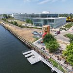
The Wisconsin Department of Transportation (WisDOT) and the Federal Highway Administration today announced a preferred alternative for reconstruction of the I-94 East-West corridor between 70th Street and 16th Street in Milwaukee County. The preferred alternative improves safety, replaces aging infrastructure and reduces congestion on the nearly 60-year-old highway.
“Safety is our agency’s highest priority and doing nothing about this section of I-94 is not an option,” WisDOT Secretary Craig Thompson said. “Listening to people who live in the community is a vital part of creating safe roads. We placed a high priority on public involvement during the I-94 East-West reevaluation which resulted in significant changes to the previous proposal, and we remain committed to working with stakeholders to minimize any impacts to the community.”To ensure that decisions about reconstructing the corridor are based on the best, most recent data and public input, WisDOT recently completed a Supplemental Draft Environmental Impact Statement.
As a result of the input gathered during this process, the preferred alternative includes constructing a modern eight-lane freeway and replacing the Stadium Interchange with a Diverging Diamond Interchange. Other improvements include:
- Modernizing the Hawley Road, 35th Street and 25th/27th Street interchanges to provide better and safer access for Milwaukee neighborhoods.
- Enhancing connections for nearby Milwaukee neighborhoods to other areas of the city, county and state.
- Improving bicycle and pedestrian accommodations across I-94 and connecting the Hank Aaron State Trail with the Oak Leaf Trail.
- Increasing safety and efficiency on adjacent east-west roadways by reducing future traffic volumes on local roadways. Local roads can better function for all modes of transportation.
WisDOT is anticipated to invest $25 million in transit solutions as a traffic mitigation strategy during construction. Short-term effects of the increased transit funding will aid Milwaukee County’s efforts to employ new transit such as the 27th Street Bus Rapid Transit.
As a result of the public involvement through the environmental document process, some impacts were reduced including smaller infrastructure footprints and less real estate acquisition.
Two public hearings are planned so the public can review and provide input on the preferred alternative.
- Monday, December 12, 2022, from 3 to 7 p.m.
- Wisconsin State Fair Park, Tommy Thompson Youth Center, Gate #5
640 S. 84th Street, Milwaukee - Transit access via MCTS Route 33.
- Wisconsin State Fair Park, Tommy Thompson Youth Center, Gate #5
- Wednesday, December 14, 2022, from 4 to 7 p.m.
- Marquette University High School (enter from Michigan Street parking lot)
3401 W. Wisconsin Avenue, Milwaukee - Transit access via MCTS Routes: 35, 30 and Gold Line.
- Marquette University High School (enter from Michigan Street parking lot)
More information on the I-94 East-West corridor project can be found at wisconsindot.gov/94eastwest.
Depending on final approvals and funding, construction on this section of I-94 is currently expected to begin in 2025.
NOTE: This press release was submitted to Urban Milwaukee and was not written by an Urban Milwaukee writer. While it is believed to be reliable, Urban Milwaukee does not guarantee its accuracy or completeness.
More about the I-94 East-West Expansion
- Transportation: I-94 Project Will Fund Bus System Improvements - Graham Kilmer - May 16th, 2026
- Transportation: 27th Street Bridge Closes Next Week - Graham Kilmer - Jan 26th, 2026
- Transportation: 27th Street Bridge Will Close For A Year - Graham Kilmer - Nov 29th, 2025
- Coalition Raises Concerns on I-94 Construction - Sierra Club - Nov 12th, 2025
- Construction Starting On $1.7 Billion Interstate 94 Widening - Jeramey Jannene - Oct 15th, 2025
- Governor Evers approves first segment of I-94 East-West construction to begin in Milwaukee County - Wisconsin Department of Transportation - Oct 15th, 2025
- Transportation: Fix At Six Coalition Sues State, Federal Government Over I-94 Expansion - Graham Kilmer - Aug 20th, 2024
- WisDOT to host I-94 East-West Freeway Project public meetings - Wisconsin Department of Transportation - Jun 12th, 2024
- Open Houses Announced For I-94 Widening - Jeramey Jannene - Jun 6th, 2024
- ‘Fix at Six’ Group Wants I-94 Expansion Delayed For Civil Rights Report - Jeramey Jannene - Mar 20th, 2024
Read more about I-94 East-West Expansion here
Mentioned in This Press Release
Recent Press Releases by Wisconsin Department of Transportation