June Was One of Wettest Months in Wisconsin History
Wisconsin is drought-free after the entire state struggled with drought conditions in 2023.

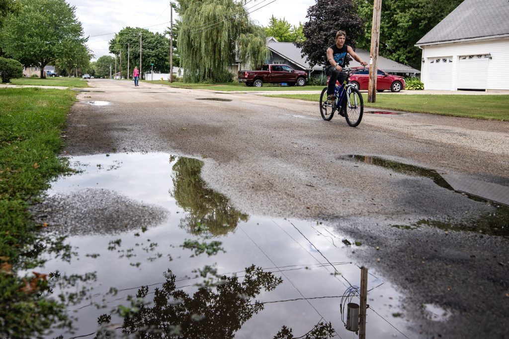
A bicyclist rides past standing water on a road during a break in the rain Monday, Aug. 14, 2023, in Brodhead, Wis. Angela Major/WPR
Last month was one of the wettest on record for June in a dramatic reversal from the drought conditions that covered Wisconsin at the same time last year.
The month marked the sixth-wettest June in state history based on records dating back to 1895. That’s according to Steve Vavrus, director of the Wisconsin State Climatology Office.
“Last June was the fifth-driest statewide, so this marks the biggest one-year precipitation flip-flop from one June to the next,” Vavrus said.In June, the state averaged 6.97 inches in rainfall, which was 2.27 inches above normal for the month.
“Most parts of the state had more wet days than dry days in June, which is especially unusual in the summer,” Vavrus said.
The La Crosse area set a monthly record with 24 days of rain last month compared to the previous record of 22 days seen in 1935 and 2013. Frequent rain prompted flooding along the Mississippi River and brought water levels to its second-highest for the month at 11.01 feet.
While all regions saw more rain than normal, climate data shows northwestern and southcentral Wisconsin experienced the most rain.In southcentral Wisconsin, Madison saw a total of 8.82 inches for the month of June. Meteorologist Nate Falkinham with the Milwaukee/Sullivan office for the National Weather Service said rainfall was more than 3.5 inches above the norm.
“It looks like it was fairly close to the record. That maximum was in 2008 of just about 11 inches and we ended up with almost 9 (inches) in Madison last month,” Falkinham said.Weather data shows it was the sixth-wettest June on record for the Madison area. In northwestern Wisconsin, the Ashland area saw 8.53 inches of rain in June. Meteorologist Lee Britt with the National Weather Service in Duluth said it was one of the wettest Junes in the last two decades.
“That was the second-rainiest month they’ve ever experienced,” Britt said. “The rainiest year for June was 2018 where they had 8.97 inches of rain.”
Britt said small portions of Ashland and Iron counties still had drought conditions last month, but the latest map from the U.S. Drought Monitor shows no trace of drought statewide. That’s a stark contrast to the same time last year when the entire state saw anywhere from abnormally dry to extreme drought conditions, prompting a disaster declaration for 18 counties as crops struggled in areas that were most severely affected.
While weather patterns have favored wet conditions, Vavrus said the shift from El Niño to La Niña hasn’t really played a role. The climate patterns in the Pacific Ocean can create a chain reaction in weather worldwide. During El Niño events, ocean temperatures are warmer than normal. Waters are cooler than average during La Niña.
Vavrus said that transition in climate patterns has been slower than expected.“I don’t think that the odd wetness pattern that we’ve seen in Wisconsin this spring and summer is due to the transition toward La Niña yet,” Vavrus said.
Overall, precipitation has increased about 5 inches in Wisconsin since 1950, according to the most recent report from the Wisconsin Initiative on Climate Change Impacts. However, rainfall in the summer has varied. Even so, the southern and central portions of the state have seen significantly wetter conditions during the summer months.Vavrus noted that May and June combined were the state’s wettest for the two months since 1968 with a total of 12.5 inches of rain. He said the frequent rains have helped the state avoid extreme heat so far this summer. Many areas have gotten close or seen just one or two days of temperatures topping 90 degrees Fahrenheit.
That’s likely to change this weekend.
“So buckle up for a little bit of heat and humidity too, but then it should get a lot more comfortable right after that,” Vavrus said.
The Madison and Milwaukee area are set to see temperatures around 90 degrees this coming Sunday and Monday as thousands of visitors descend on Milwaukee for the Republican National Convention, which runs July 15-18.
June was one of the wettest in state history was originally published by Wisconsin Public Radio.
If you think stories like this are important, become a member of Urban Milwaukee and help support real, independent journalism. Plus you get some cool added benefits.


