Milwaukee Opens Its Active Streets
Custer, Fratney and Washington reconfigured for pedestrians and cyclists over motor vehicles.
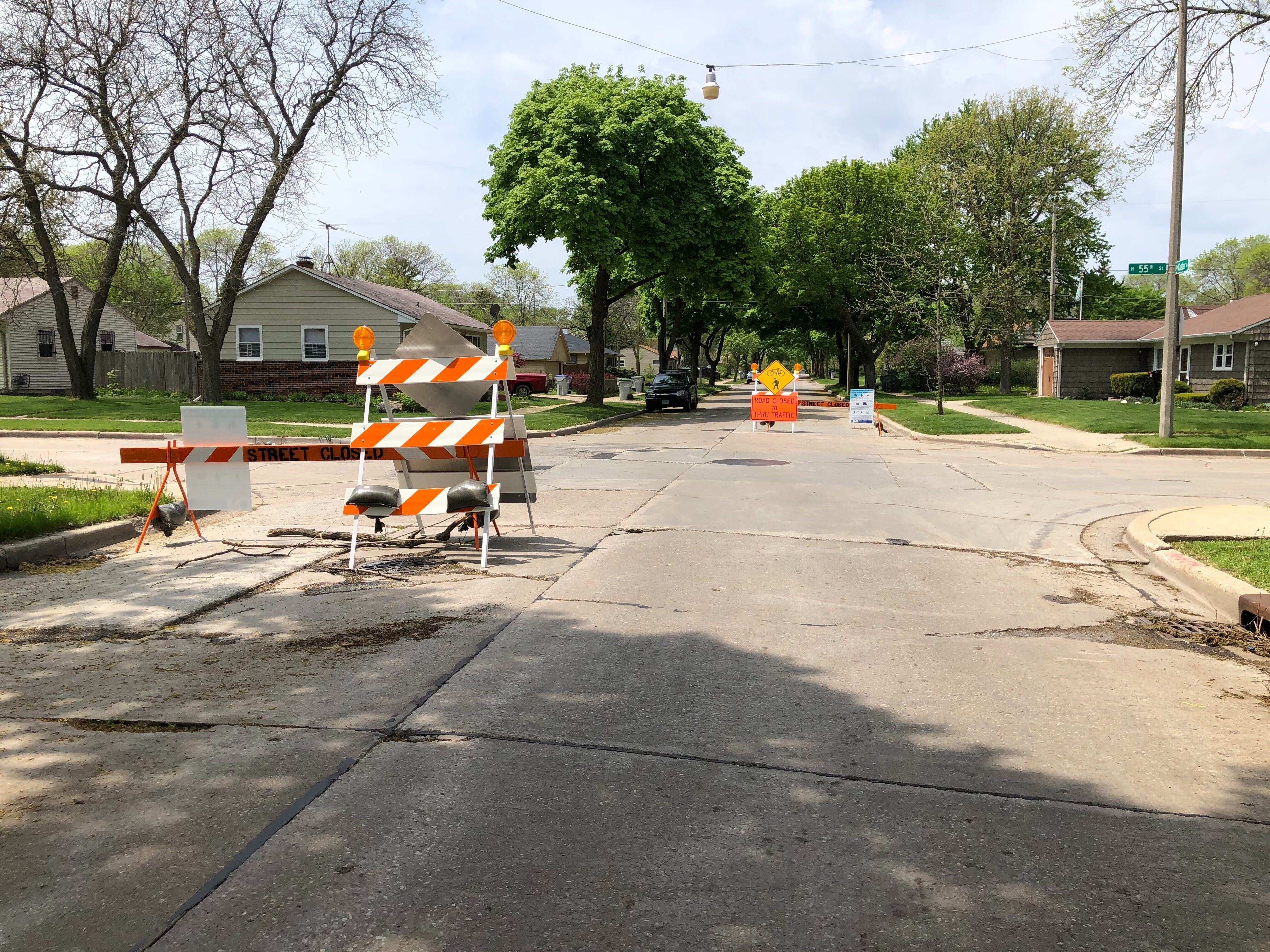
W. Custer Ave. at N. 55th St., reconfigured to be an “Active Street.” Photo by Jeramey Jannene.
The Department of Public Works began implementing its half of the Active Streets program on Friday, partially closing streets across the city.
The city-county partnership is reprogramming city streets and county parkways as open space for socially-distant activity, including biking, running and walking.
People aren’t blocked from getting to their homes, nor are delivery drivers. Signs and barriers have been placed at key intersections diverting all but local traffic away to arterial streets.
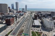
In Walker’s Point, Washington St. has been reconfigured from S. Water St. to S. 20th St. N. Fratney St. has been reconfigured from W. Meinecke Ave. to W. Keefe Ave. in Riverwest. And W. Custer Ave. has been reconfigured from N. Sherman Blvd. and McGovern Park west to N. 64th St. and Westlawn Gardens.
The city is basing its model on Oakland, CA, which has grown its program from 4.5 to 20 miles over the past month and will eventually increase that to approximately 74 miles. Many of the trails across Milwaukee are seeing increased use according to trail counters and are not wide enough to allow people to maintain at least six feet of spacing.
“The beauty of this is it’s flexible and nimble,” said Michael Amsden, DPW’s multimodal planning manager, in presenting the plan to the Public Works Committee on May 13th. He noted the plan could be adapted based on demand and behavior.
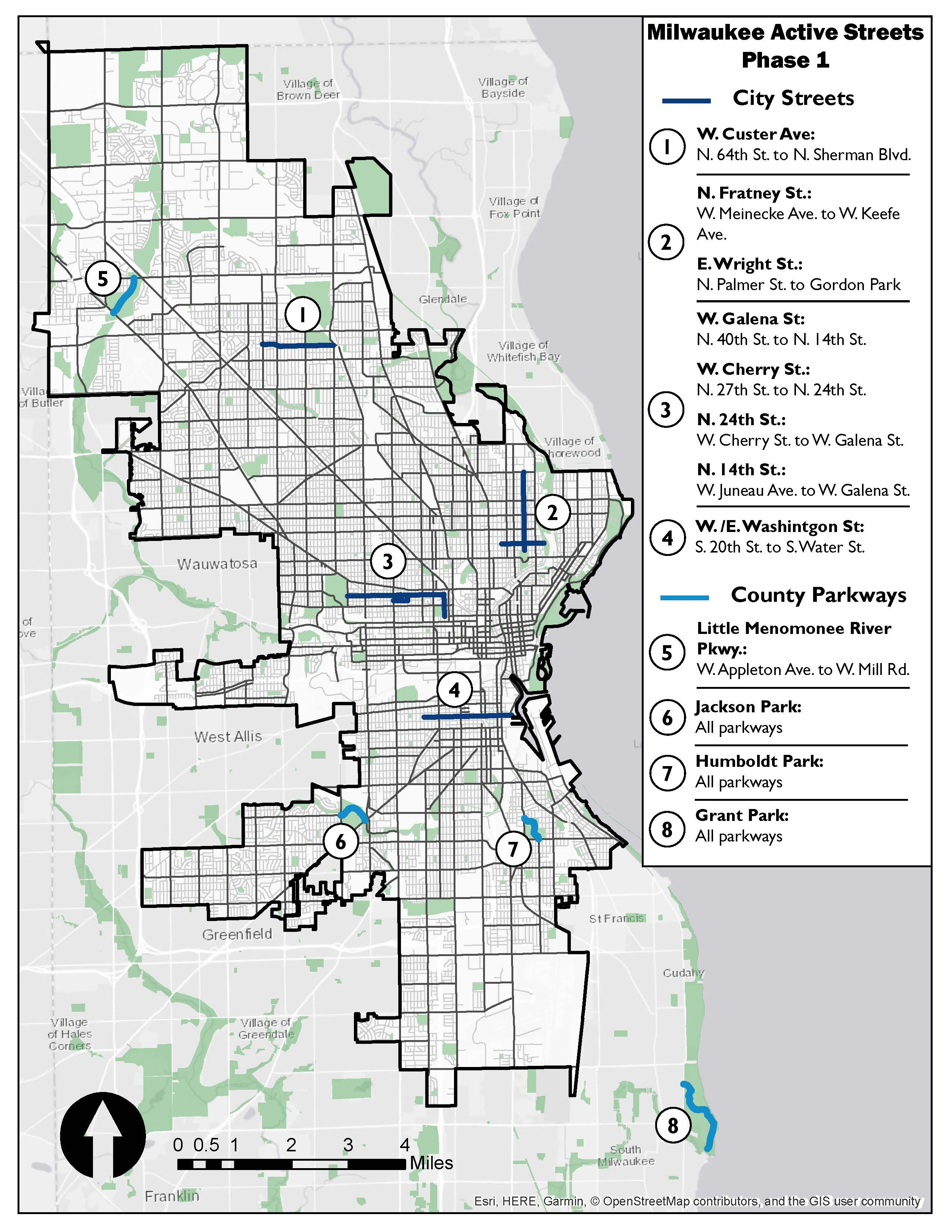
Active Streets Map. Image from the City of Milwaukee.
On the eastern portion of the W. Custer Ave. corridor cars were still driving on the street at high speed, weaving around the barricades to go multiple blocks. But the western portion through Westlawn Gardens, which includes speed bumps, had no such problem. Despite the fast-moving cars, it was still feasible to walk in the street end-to-end without issue. Barricades were only located at the major intersections, allowing drivers to go multiple blocks uninterrupted.
Urban Milwaukee visited each of the city corridors over the past 72 hours and watched drivers be diverted by the barricades after initially turning towards them. But few cyclists or pedestrians were spotted on the streets.
Want a more secured space? The Milwaukee County Parks streets, including Humboldt Park, Jackson Park and the Little Menomonee Parkway, are fully closed to motor vehicles. Estabrook Park will also be added.
The first phase of the program will eventually encompass 10 miles of streets and parkways, with the city planning to reconfigure 7.5 miles of streets. DPW plans to close Wright Street in Riverwest as part of the Fratney corridor and close a long stretch on the city’s near west side centered around W. Galena St.
The city and county are recruiting volunteers to monitor segments of the project on a once-a-week basis.
Photos


If you think stories like this are important, become a member of Urban Milwaukee and help support real, independent journalism. Plus you get some cool added benefits.
Transportation
-
Milwaukee Plans 60 Traffic Safety Projects for 2026
 Apr 8th, 2026 by Jeramey Jannene
-
State To Reveal New I-794 Cost Estimates
 Apr 7th, 2026 by Jeramey Jannene
-
Bus Riders Can Finally Pay With Credit Card
 Apr 6th, 2026 by Graham Kilmer