Active Streets Program Needs Volunteers
Live near one of the closed streets? Help keep track of how it's going.
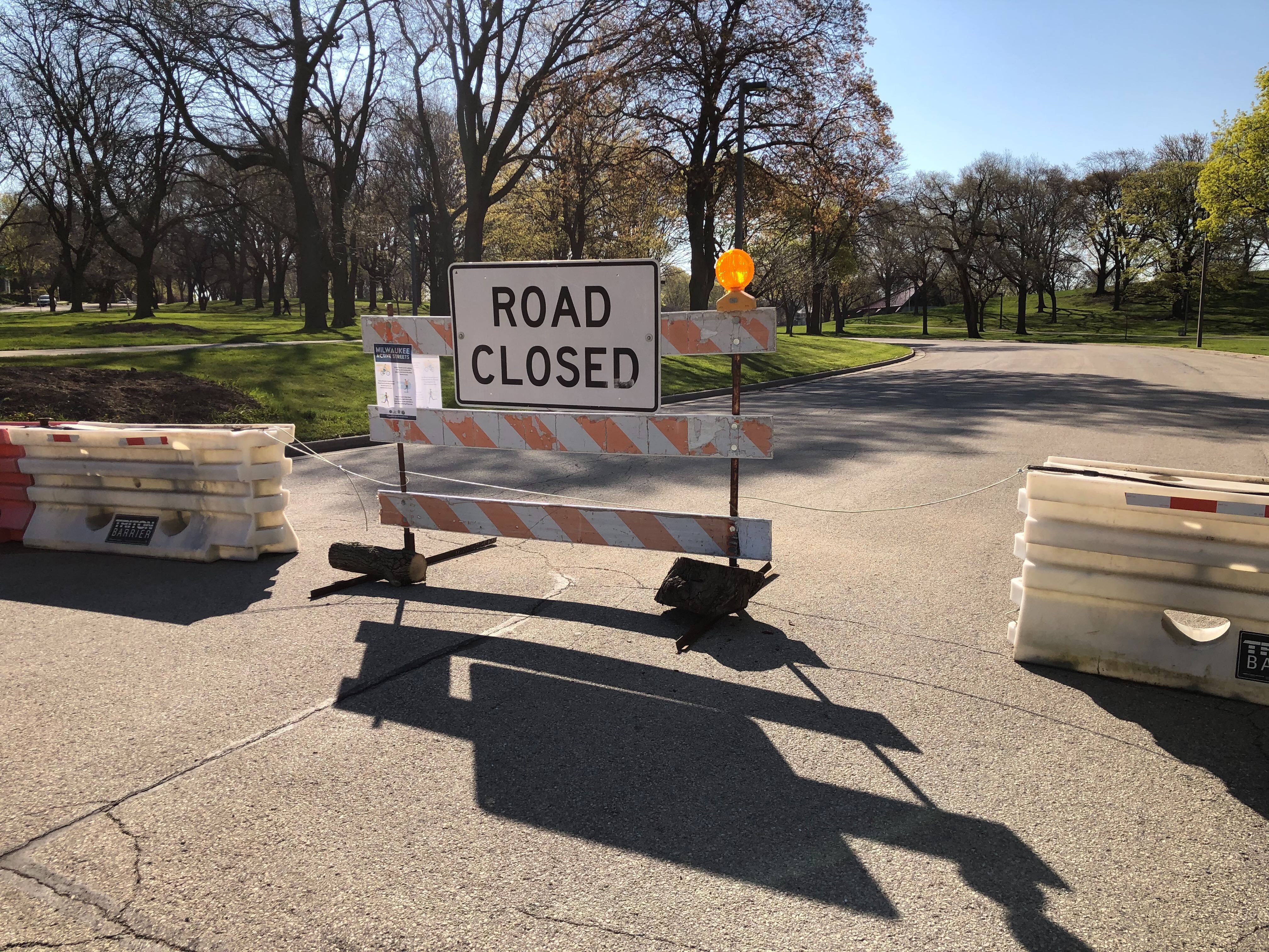
Active Streets closure of roads through Humboldt Park. Photo by Jeramey Jannene.
A program to create more public space for socially-distant physical activity needs volunteers to monitor how things are going.
The “Active Streets” program, announced last week by Milwaukee County Parks and the city’s Department of Public Works, will close 10 miles of streets in its first phase. Three county parkways have already been entirely closed and four city street corridors will be closed to all but local traffic.
The program is intended to create more space for individuals to be outside while maintaining social distancing guidelines to stay six feet from others. Trail counters have already shown a surge in activity this year compared to 2019 and many of the trails are not wide enough to maintain safe distances.
Volunteers are asked to watch a 45-minute training video and then visit their designated street segment once per week and report back online on how things are going.“The object of Active Streets is for continuous movement,” said interim Milwaukee County Parks director Jen Francis in announcing the program on Friday. The partners don’t want to see groups form to play games in the street. “Keep moving, keep to small groups of family members.”
Individuals are allowed to walk, bike, run or wheel (with wheel chairs) in the spaces.
County parkways, starting with roads through Jackson Park and Humboldt Park as well as the Little Menomonee Parkway, have been closed entirely. Some city streets will follow, pending Common Council approval.
Those proposed city closures include:
- W. Washington St. from S. Water St. to S. 20th St. in Walker’s Point
- W. Custer Ave. from N. Sherman Blvd. to N. 64th St. near McGovern Park
- N. Fratney St. from W. Meinecke Ave. to W. Keefe. and Wright St. from the Beerline Trail to N. Palmer St. in Riverwest
- W. Galena St. from N. 14th St. to N. 40th St. and N. 14th St. from W. Juneau Ave. to W. Galena St. connecting King Park, Tiefenthaler Park and Washington Park on the city’s west side
The Wisconsin Bike Fed launched an advocacy campaign for the closures in early April and briefed city and county officials on suggested strategies including creating loop routes and ensuring equitable closure distributions.
A number of changes have been made to the program since it was first introduced, including pushing back barriers at intersections to create handicapped parking spaces. The suggestion came from a comment on an Urban Milwaukee Facebook post announcing the Humboldt Park closure. Barriers are also now connected with cables so they cannot be moved.
Volunteer Sign Up Links
- Custer Avenue
- Galena Street
- Fratney Street
- Humboldt Park
- Jackson Park
- Little Menomonee Parkway
- Washington Street
If you think stories like this are important, become a member of Urban Milwaukee and help support real, independent journalism. Plus you get some cool added benefits.
Transportation
-
Milwaukee Plans 60 Traffic Safety Projects for 2026
 Apr 8th, 2026 by Jeramey Jannene
-
State To Reveal New I-794 Cost Estimates
 Apr 7th, 2026 by Jeramey Jannene
-
Bus Riders Can Finally Pay With Credit Card
 Apr 6th, 2026 by Graham Kilmer