
Council Committee Blesses Active Streets
And wants more. "Why seven miles? Why not do 70 miles?" asks alderman.

Slow streets signage in San Francisco. Photo from San Francisco Municipal Transportation Agency.
The city’s half of the Milwaukee Active Streets program is moving forward.
The program, a partnership between the city and county, is intended to create more space for socially-distant-compliant walking, biking or running.
As part of a first phase, the Department of Public Works is planning to partially close 7.5 miles of streets across the city. Milwaukee County Parks closed 2.5 miles of streets it controls Friday.
“We are proposing to close streets to through traffic,” said Michael Amsden, DPW’s multimodal planning manager, in presenting the plan to the Public Works Committee Wednesday morning. “What this means is that people, if they want to, will be able to use the streets for other ways to get around.”
But people won’t be blocked from getting to their homes, nor will delivery drivers. Signs will be at “key intersections” diverting traffic to arterial streets.
“The beauty of this is it’s flexible and nimble,” said Amsden. He noted the plan could be adapted based on demand and behavior. The city is basing its model on Oakland, CA, which has grown its program from 4.5 to 20 miles over the past month and will eventually increase that to approximately 74 miles.
“Why are we doing seven miles? Why not do 70 miles?” asked Alderman Robert Bauman.
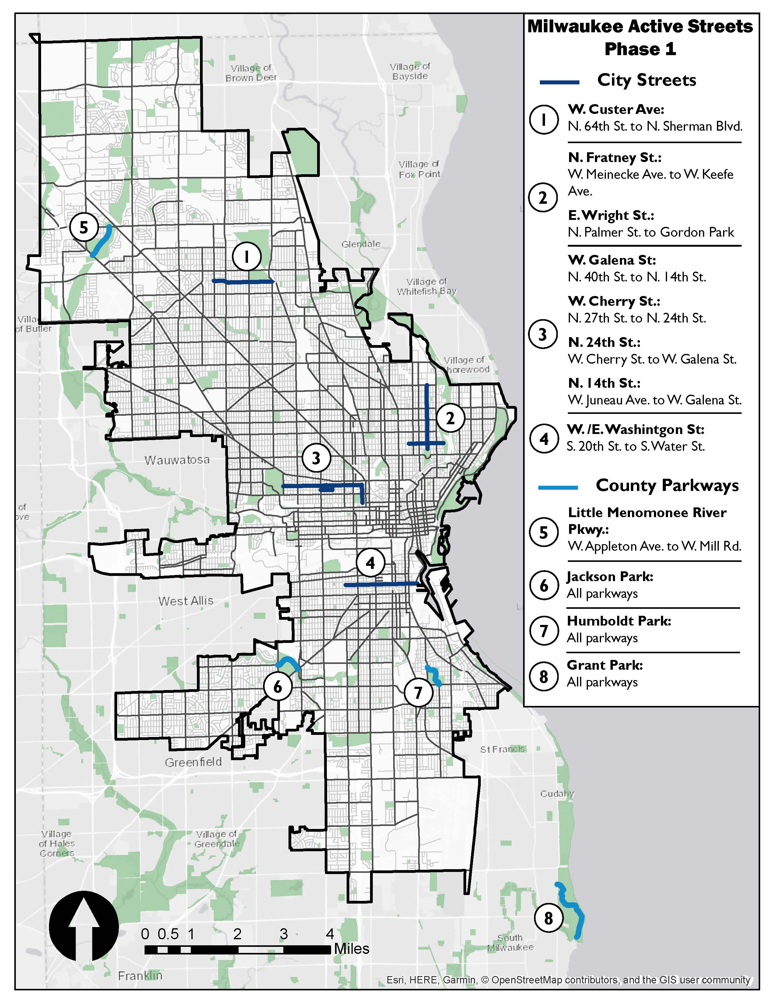
Active Streets Map. Image from the City of Milwaukee.
“There are a couple of things,” said DPW Commissioner Jeff Polenske, chief among them the lack of barricades. “A lot of our barricades are being utilized for the current testing sites. So we’re trying to manage the levels we have.”
“We think this is a good number to just see how it works,” said Amsden.
“I say we do every residential side street in the city,” said Bauman. “How many miles is that, 800?”
Polenske said the city picked streets it had already been considering for other reconfigurations, including N. Fratney St. and W. Wright St. in Riverwest. W. Washington St. in Walker’s Point is also planned for a future bicycle-focused redesign. He said residents would be able to see how such bicycle boulevards might function.
Ald. Mark Borkowski said the city should accompany the program with the enforcement of traffic laws. “The unfortunate thing in my estimation is those doggone reckless drivers are still out there,” he said. “I would caution us when we start doing these things that we have got to have the hammer down on reckless driving.”
Polenske said he believed drivers could be cited for violating the through-traffic restrictions and the Milwaukee Police Department was in support of the intiative. Bauman said DPW should get a firm answer as to whether citations could be issued.
“The only risk I see is it creates a false security,” said Bauman.
Kate Riordan, DPW associate transportation planner, said a 24-by-36-inch sign would be installed alongside each barricade with information in English and Spanish on how to use the streets. “Letters and flyers are being sent to all addresses along each corridor,” she said. “Adjustments can be made because this is really a low effort initiative.”
She said requests are already coming in for streets to be added. Amsden said the majority of feedback has been positive.
Polenske said the city could bring back the program annually if it succeeds. “I think there are some real good opportunities to go through a kind of pilot project with this,” he said.
Milwaukee County Parks executed complete closures of 2.5 miles of roadways including those running through Humboldt Park and Jackson Park and the Little Menomonee Parkway.
The full Common Council will review the proposal on May 27th. DPW plans to start by closing a portion of W. Custer Ave. on the city’s northwest side.
The city and county are recruiting volunteers to monitor segments of the project on a once-a-week basis.
Milwaukee Street Through-Traffic Closures
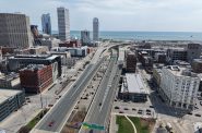
- W. Washington St. from S. Water St. to S. 20th St. in Walker’s Point
- W. Custer Ave. from N. Sherman Blvd. to N. 64th St. near McGovern Park
- N. Fratney St. from W. Meinecke Ave. to W. Keefe. and Wright St. from the Beerline Trail to N. Palmer St. in Riverwest
- W. Galena St. from N. 14th St. to N. 40th St. and N. 14th St. from W. Juneau Ave. to W. Galena St. connecting King Park, Tiefenthaler Park and Washington Park on the city’s west side
Legislation Link - Urban Milwaukee members see direct links to legislation mentioned in this article. Join today
If you think stories like this are important, become a member of Urban Milwaukee and help support real, independent journalism. Plus you get some cool added benefits.
Transportation
-
Milwaukee Plans 60 Traffic Safety Projects for 2026
 Apr 8th, 2026 by Jeramey Jannene
-
State To Reveal New I-794 Cost Estimates
 Apr 7th, 2026 by Jeramey Jannene
-
Bus Riders Can Finally Pay With Credit Card
 Apr 6th, 2026 by Graham Kilmer


I am hoping for the road through Estabrook Park between the two parking lots; the north one is near the beer garden and the south one near Capitol Drive