The Lakefront, About 1866
Prior to the settlers arrival, the lakefront wasn't a gorgeous green space, but an often-grassless bunch of eroded bluffs.
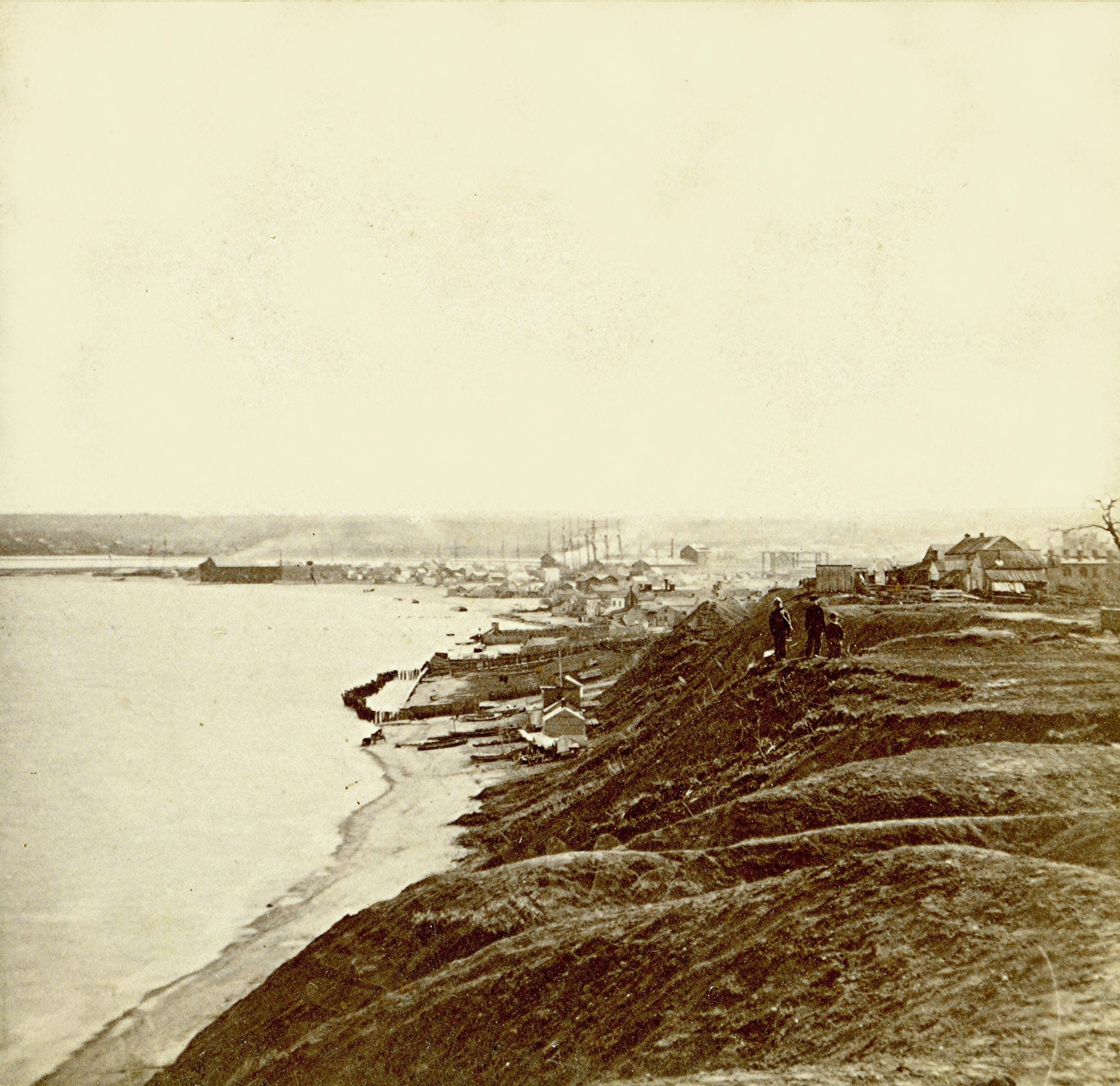
Lakefront, About 1866. Image courtesy of Jeff Beutner.
It is easy to imagine a Milwaukee lakefront in pre-settlement times as a place of unspoiled beauty with pristine beaches and majestic groves of ancient trees with a carpet of wildflowers on the forest floor. But the reality is that the water level of Lake Michigan has always been volatile and the lakeshore was anything but a place of pure beauty. A map from the 1830s indicates that much of the Wisconsin shoreline of Lake Michigan consisted of sandy cliffs.
This is a view of the Milwaukee shore dating from about 1866. The view is from the block between Wisconsin and Mason and looking south. Note the erosion and complete lack of trees. Another view from this period looking north shows bluffs bereft even of grass.
This southward view is of interest as it is after 1857 when a new channel had improved navigation from the lake to the Milwaukee River. Previous to this time boats would have to anchor or dock in the bay and use tenders to transport passengers and cargos to docks along the river. A lighthouse once stood about where the men in the foreground (up on the hill) are standing.
The harbor improvement of 1857 would turn the sandy peninsula at the mouth of the Milwaukee River into the fisherman’s community known as Jones Island. Some of the modest wooden homes visible in the background show the beginning of a settlement in the area. You can also see some ship masts pointing skyward.
After the harbor improvements Milwaukee would thrive, as its port was superior to Chicago. By 1862, Milwaukee was the top shipper of wheat in the world. But this was also an era when many railroads were being constructed and there Chicago had the geographic advantage, which allowed it to gradually supplant Milwaukee, becoming a leader in shipping a wide range of commodities.
Jeff Beutner is a collector of photographs, postcards and stereoviews of old Milwaukee. This column features these images, with historical commentary by Beutner.
Yesterday's Milwaukee
-
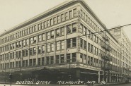
When Boston Store Was Big
 Apr 18th, 2018 by Jeff Beutner
-
Sherman Park Has Been a Melting Pot
 Aug 25th, 2017 by Jill Florence Lackey, PhD
-
The Rise and Fall of Bronzeville
 Aug 5th, 2017 by Jill Florence Lackey, PhD


To politicize this a little, I humbly pose this question to Preserve Our Parks: shall we return these lands to their untouched, native state? Let O’Donnell fall to ruin as the County deliberates, then remove the concrete altogether? I can’t imagine the sandy swamp where the transit center now sits would be much prettier, or any more useful to the public, than the barren escarpments pictured.
My take on this is that Preserve Our Parks is not asking to return the lakefront to its pristine state. Though, not being political, it’s fine to exaggerate their case for a bit of humor. The Public Trust Doctrine has both worked, and not worked for the public trust; I saw a map of the lakefront marked with dozens of ideas to plant someone’s bright idea close to the water, including a Clown Museum (how did we pass that idea to the dustbin?). The point of the trust might be understood when considering this: “close to the water” is highly desirable and the temptation to sell proximity to the highest bidder will always be with us. A trust doctrine gets us through the generations infatuated with dollars as our guiding star. Not to be political, but we might be in the middle of that generation right now. There is a 1940s photo of the beach near Wisconsin Ave. Very appealing in many ways, it serves to prod us to consider and reconsider what can be done is not necessarily what should be done.
The Public Trust Document has saved Milwaukee from having private interests dominate the lakefront in our city. Whenever our family entertains out of state visitors the first thing they comment on is the beautiful public lakefront, free for recreation and enjoyment. As someone who appreciates and uses the lakefront for walking, biking, kite flying, museum visiting, and public art appreciation, I would be disappointed with another big skyscraper replacing O’Donnell Park.
Why not create an open and public art experience with the Milwaukee Art Museum, like Millennium Park in Chicago?
The only issue I take with this article is the first paragraph and the tagline: “Prior to the settlers arrival, the lakefront wasn’t a gorgeous green space, but an often-grassless bunch of eroded bluffs.” You do know that this picture is POST settlement, right? Meaning AFTER settlers (those houses and people pictured)? We don’t have many pics pre-settlement, but I can assure you it before humans came it didn’t look like this. Men create grassless, eroded bluffs. Sometime the lake does or violent storms do temporarily, but that is a short-term situation as nature is very resilient. You can see that if you visit natural shoreline areas like Lion’s Den Gorge in Ozaukee County for example or even Schlitz Audubon. The big thing this pic shows is where the actual lake bluff was (which is close to where the lake bluff sits today). What we think of as the lakefront and the land both east and west of Lincoln Memorial was under water in this picture. Is that fenced in area the yacht club? (I think I’ve seen similar pictures inside of MYC). I agree with Bill that the reason the Public Trust Doctrine exists is to protect assets that are held in trust for the people. This is why we still have public access to much of Lake Michigan in Milwaukee, period, even after years of Depression and industrial growth. In areas where the lake wasn’t filled, the public can still access up to the Ordinary High Water Mark (this stopped a scheme in Shorewood to fence off Atwater Beach a few years back to ameliorate private landowners north and south who didn’t like the public on their property. The OHWM, which works well in most places, does not work in downtown Milwaukee. Were it not for the filling, the water would be lapping likely somewhere west of Lincoln Memorial Drive or where the historic shoreline was. Due to past filling, legally the standard is that those filled areas are also public. This also by the way stops people from filling in the lake (although the process for that has changed significantly since historic times–requiring big and difficult permits). If concessions are made, they will likely have a greater impact and could set a precedent for the State, which many of us think would be bad. Regardless, this is something that needs to be challenged in the courts to be legitimate and to give guidance to title companies given the deed restrictions on this property.
I’m curious, how does today’s water level compare to the water level in 1866?