Open House Scheduled On Revised Plans To Replace I-794
WisDOT expected to show four options, including a boulevard option.
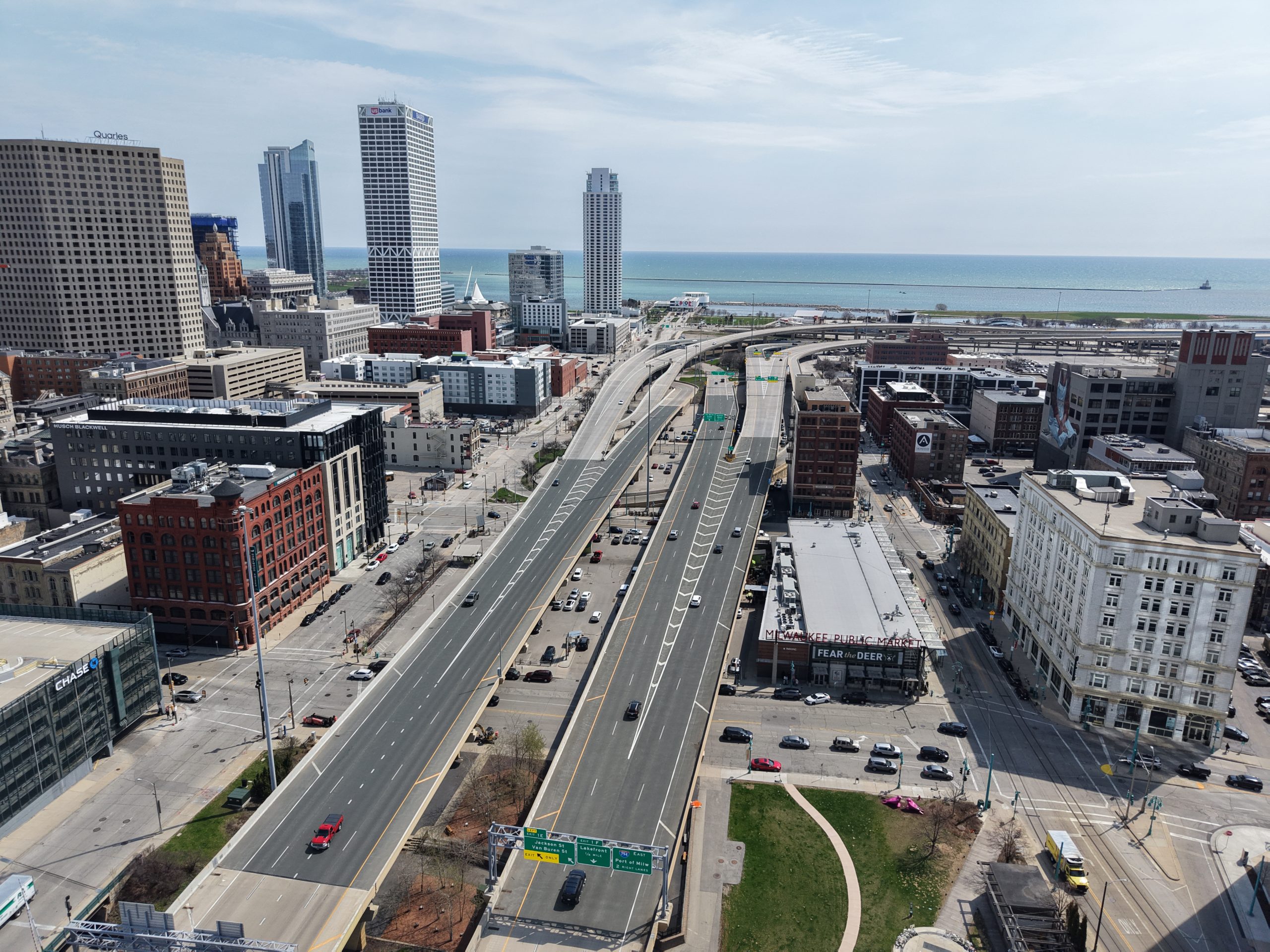
Interstate 794 between Downtown and the Historic Third Ward. Photo by Jeramey Jannene.
It’s time to make your voice heard on the options to remove or replace Interstate 794 through downtown Milwaukee.
The Wisconsin Department of Transportation (WisDOT) will host an open-house-style public meeting on May 29 to show its refined design alternatives, answer questions and solicit feedback.
The meeting will be held at the Milwaukee Marriott Downtown hotel, 625 N. Milwaukee St., from 4 to 7 p.m.
Based on a stakeholder presentation earlier this year, WisDOT is likely to show four options at the meeting: a freeway-to-boulevard replacement, two options to slim the freeway’s footprint and an option to rebuild as-is.
The refined design options follow 2023 public meetings, where WisDOT unveiled nine options to replace the aging elevated freeway. City Engineer Kevin Muhs previously told the Public Works Committee that the project timeline was delayed because the city has been asking substantial questions about traffic impacts of various options and the environmental review is substantially larger.
The project, expected to cost more than $300 million, is formally to rebuild the elevated freeway between N. Water Street and the Hoan Bridge, but in 2022 the Rethink 794 coalition called for the state agency to formally study replacing Interstate 794 between N. 6th Street and the Hoan Bridge with a boulevard. WisDOT initially reviewed multiple boulevard design options. Under all scenarios, the Hoan Bridge would remain.
According to WisDOT, the freeway segments east of the Milwaukee River were constructed in the 1970s and need replacement. The portion was to the west was replaced as part of the Marquette Interchange project.
A project traffic study estimates that 26,600 vehicles make an end-to-end trip across the entire study area each day. More than double that total enters or exits the study area via a ramp and does not make an end-to-end trip, presumably to start or end a trip Downtown. Proponents of a boulevard have said a grid would better diffuse traffic across city streets and that removing the elevated structure would better connect Downtown while creating more land for public or private use. N. Lincoln Memorial Drive, which is likely to see its freeway ramps reconfigured as part of the project, handles more than 31,000 vehicles daily according to a WisDOT traffic count.
Last week, UW-Milwaukee School of Architecture and Urban Planning students presented their visions for how the land could be repurposed.
For more on WisDOT’s draft options, including intersection design options, see our coverage from April.
April 2025 Design Alternatives


Existing members must be signed in to see the interactive map. Sign in.
If you think stories like this are important, become a member of Urban Milwaukee and help support real, independent journalism. Plus you get some cool added benefits.
More about the Interstate 794 Rebuild
- 794 Teardown Advocates To Host Walking Tour - Jeramey Jannene - Mar 30th, 2026
- Real Estate Group Casts Doubt on I-794 Removal Plan - Jeramey Jannene - Nov 11th, 2025
- See How State Thinks Traffic Would Change With I-794 Removal - Jeramey Jannene - Nov 5th, 2025
- Public Meetings Upcoming On Possible I-794 Removal, Replacement - Jeramey Jannene - Oct 17th, 2025
- WisDOT Unveils Four Options To Rebuild I-794 - Jeramey Jannene - May 30th, 2025
- Open House Scheduled On Revised Plans To Replace I-794 - Jeramey Jannene - May 9th, 2025
- UWM Students Design A Future Without I-794 - Jeramey Jannene - May 2nd, 2025
- See New Options To Slim I-794 in Downtown or Make It A Boulevard - Jeramey Jannene - Apr 2nd, 2025
- Freeway-to-Boulevard Option Still On Table for 794 Rebuild - Jeramey Jannene - Jan 30th, 2025
- Converting 794 To Boulevard Could Yield 3,000 Housing Units, $1.1 Billion in Development - Jeramey Jannene - Nov 21st, 2024
Read more about Interstate 794 Rebuild here
Transportation
-
Bus Fare Evasion Declining
 Mar 15th, 2026 by Graham Kilmer
-
Committee Approves Towing Reckless Drivers, With Objections
 Mar 12th, 2026 by Graham Kilmer
-
$14.1 Million Plan Targets Safer Streets In Walker’s Point, Valley, Westown
 Mar 12th, 2026 by Jeramey Jannene