
City Will Redesign King Drive, Pere Marquette Park
And build a protected bike lane on W. Highland Avenue.
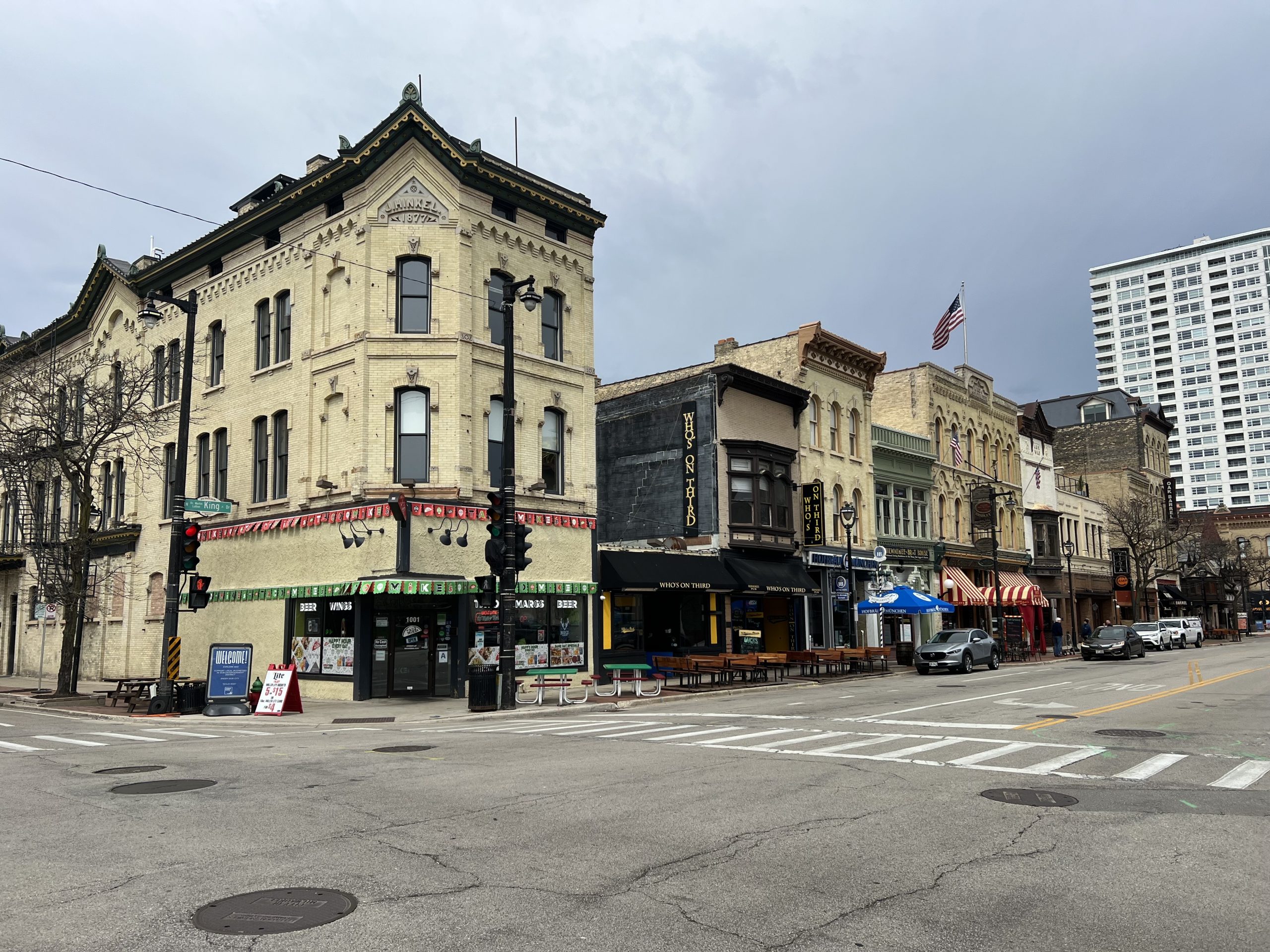
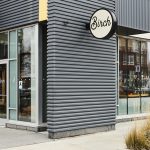
N. Martin Luther King Jr. Drive (former Old World Third Street) at E. State Street. Photo by Jeramey Jannene.
A new financing proposal would allow the city of Milwaukee t0 redesign Martin Luther King Jr. Drive through Downtown, provide Milwaukee County with revenue to overhaul Pere Marquette Park and construct a protected bike lane on W. Highland Avenue to connect neighborhoods just west of Downtown.
The proposal, according to a public notice, would be funded with incremental property tax revenue from a tax incremental financing (TIF) district created to in 2006 to enable the redevelopment of the former Pabst Brewery, now The Brewery District.
The city would use funding from the district to fund a “redesign” of N. Martin Luther King Jr. Dr. between W. McKinley and W. Wisconsin Avenues. The half-mile corridor, previously Old World Third Street, runs through the Westown neighborhood connecting The Avenue with the Deer District and Schlitz Park developments.
Most of the street is currently one lane in each direction, with a central turn lane and painted bike lanes. It was previously two driving lanes in each direction. In recent years the portion north of E. State Street has been partially pedestrianized in the summer to create additional outdoor seating for the cluster of neighboring bars.
Pere Marquette Park, 900 N. Plankinton Ave., is located in the middle of the former Old World Third corridor. The 1.9-acre riverfront park is owned and managed by Milwaukee County Parks, but the city-controlled TIF district would be used to provide the county financial support. A similar arrangement was recently instituted for Red Arrow Park on the east side of Downtown.
The park is primarily a sloped grass lot with a central gazebo used as a stage by bands. A riverwalk segment runs along it, between E. State St. and E. Kilbourn Ave. and the Milwaukee County Historical Society operates from the former Second Ward Savings Bank at the southwest corner of the park.
The new Highland Avenue protected bike lane would run from N. 6th to N. 18th streets, connecting Downtown with the King Park neighborhood across Interstate 43. The protected bike lane would connect with a previously developed segment that runs from N. 18th to N. 41st streets. The current configuration involves plastic delineators and paint placing bikes along the curb while parking spaces are pushed inward.
It is scheduled to be reviewed by the board of the Redevelopment Authority of the City of Milwaukee on April 18. The Common Council will also need to approve the proposal.
“The City is committed to creating safe and enjoyable spaces for drivers, pedestrians, and bicyclists,” said the Department of City Development in a statement announcing the plan. “Officials will continue identifying new development opportunities that benefit residents and improve neighborhoods so everyone feels welcomed and protected.”
The city has used TIF districts to fund several other safety-focused downtown area street projects, including W. Michigan Street, N. Van Buren Street, W. Walnut Street and E. Kilbourn Avenue. TIF funding was also used to pay for projects near Midtown Center and other scattered spots where districts were available.
Specific details on the financing aspects of the proposal are not yet available. Extending the life of a TIF district allows the city to harvest revenue for public infrastructure improvements within a half mile of a district’s boundaries without encountering state-imposed revenue limits. All else being equal, closing a district before its 27-year limit is reached would allow for a marginal reduction in the property tax rate but a loss of revenue capacity.

Existing members must be signed in to see the interactive map. Sign in.
If you think stories like this are important, become a member of Urban Milwaukee and help support real, independent journalism. Plus you get some cool added benefits.


Although I didn’t need a map to appreciate this story, I want to take the opportunity to thank you folks at Urban Milwaukee for the sudden influx of maps! I think I have asked for maps in the past and am glad to see them turning off regularly!
I am glad to see that the City of Milwaukee is seeing the value of building and extending bike lanes as a very cheap but beneficial quality of life infrastructure. I wish that more of the suburban communities would develop bike routes and protected bike lanes that would connect with what is going on in Milwaukee.