Data Shows Milwaukee’s Traffic Calming Effort Is Working
Speeding dropped 69% on one southside street.
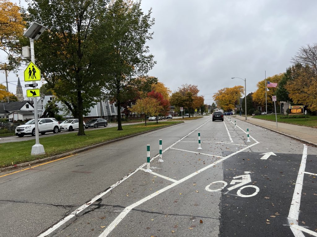
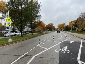
A protected bike lane on W. Lapham Blvd. cut the number of driving lanes in half and reduced speeding by 69%. Photo by Jeramey Jannene.
The dozens of traffic calming projects deployed on Milwaukee’s streets in recent years are having a measurable positive impact on the city’s quest to eliminate traffic deaths.
Initial data collected from two federally-funded projects shows a substantial drop in speeding, which reduces the odds of a fatality in the event of a collision, makes streets more appealing for pedestrians, cyclists and neighbors and is a general indicator of a reduction in reckless driving.
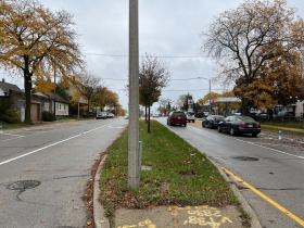
Alongside Humboldt Park in Bay View, E. Oklahoma Avenue received a two-phase road diet that resulted in a 37% reduction in the number of vehicles driving over the speed limit and the median speed dropping from 34 mph to 30 mph. The street was restriped in 2020, going from four lanes to two with a center turn lane. In fall 2022, pinned-on concrete bump outs were added to select locations in the parking lane, blocking opportunities for illegal passing and reducing turning speeds. Automated speed data collected by the Department of Public Works found that only 1% of motorists were observed to drive more than 10 mph over the 30 mph limit, down from 6%.
Even more significant speed reductions have been observed on W. Lapham Boulevard in the Historic Mitchell Street neighborhood. A protected bike lane was added in 2023, which reduced the four-lane street to two lanes and moved the parking lane away from the curb to a location between the bike and driving lanes.
As a result of the changes, a 69% drop was observed in the number of speeding motorists. The median speed dropped from 30 mph to 25 mph, below the street’s posted 30 mph limit. Speed recorders recorded no drivers going more than 10 mph over the speed limit, down from 3%.
“We’re very happy with this result. It’s better than we expected,” said City Engineer Kevin Muhs in an interview.
The city ran its traffic analysis faster than usual on the Lapham project. “That project was particularly controversial with the neighborhood, so we wanted to see whether or not it was achieving what we hoped it would achieve,” said Muhs. The city normally favors waiting one year to allow drivers to adjust to a new traffic pattern.
Is there a point at which the city would say it’s gone too far?
“With any of our projects, any change, we certainly look to and listen to citizen feedback,” said Muhs. “Sometimes that feedback is contrary to our goals. So we’re not necessarily going to listen to feedback that says ‘I want you to make the street more dangerous again.'”
But the engineer said it would continue to listen if people think they’ve gone too far. “There may come a point, I don’t think we’ve hit this yet, in which the residents don’t find it to be a benefit to them. I don’t want to say never. Our focus is primarily on speed because speed is directly correlated to survivability and death and life-changing injuries when it comes to moving vehicles, so we want to get those speeds down. We know that results in safety. That’s the main goal. That’s the main focus,” said Muhs. “The whole thing is oriented [toward], and in the context of, quality of life and making the city and the streets a more attractive place for everyone.”
The city’s multi-modal planning manager said the city is a long way from slowing things down too much. “We’re nowhere near getting to that point yet,” said Michael Amsden.
Amsden said the net feedback on the Lapham project, which runs from S. 6th St. to S. Cesar E. Chavez Dr., is positive. “People notice and appreciate that speeds are down,” he said. “Most people think that slower speeds is a really good thing.”
According to a 2011 study, pedestrians hit at progressively higher speeds have a significantly higher chance of death or significant injury. At 40 mph, pedestrians struck have a 46% chance of death. That falls by more than half at 30 mph, with a 20% chance of death. At 20 mph it is only 8%.
The key takeaway for Amsden and Muhs on the Lapham project was what to do before a construction crew arrives on site. “It’s not necessarily the speed reduction that’s the concern, it’s the delivery. And I think that’s a correctable mistake. It’s not correctable by taking it out, it’s correctable by talking to and educating and explaining [the project] to neighbors,” said Amsden. Muhs cited the change from parking near the curb to parking between the bike and driving lanes as a change that could have used more explaining.
“Generally, with road diets we’re seeing good speed reductions,” said Amsden of the resulting speed data. “The amount varies and that’s fairly common.”
Amsden said congestion remains a “fear and concern” of residents during planning efforts, but he said the city is willing to accept brief peak travel hour congestion for “22 and a half or 23 hours” of flowing but safer streets.
“There just aren’t a lot of instances in Milwaukee where you can really cause congestion throughout the day,” said Muhs. “We know that if it’s not congested in the peak hour, we’re kind of in trouble. And even when it is congested in the peak hour, that still means off-peak people can go way too fast.”
To collect the data, the city relies on an automated sensor laid atop the street for at least 48 hour. When driven over, a pneumatic tube sends a surge of air pressure toward a roadside sensor. Raw data is produced in 15-minute increments. DPW officials will also conduct visual surveys during peak travel periods to look for congestion issues.
“Basically starting in 2020, 2021, we’ve really started to try to do a better job of collecting before and after data,” said Amsden. “We don’t have data on every project we have done, and obviously, if you don’t collect before data, the after data is not nearly as meaningful.”
DPW accepts feedback on its projects via email at move@milwaukee.gov or comments forwarded by an area alderperson. “Any change generates feedback, both positive and negative. There so far have been very few projects where, on net, we haven’t received positive feedback,” said Muhs. “We are still very comfortable in the direction we’re going.”
And go it will. Forty-five projects are scheduled for construction this year.
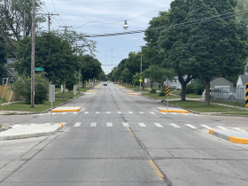
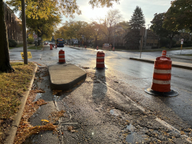
There is one new feature DPW is deploying on which it does not yet have data: speed tables. The concrete overlays, which double as raised crosswalks, are a less intense version of a speed hump. Targeted for locations near schools, the first of 20 was installed last fall. Amsden noted that collecting the data will require a well-defined strategy, as shifting the proximity of the sensor to the table would yield very different results. “We do expect to do some before and after data on some of those projects,” said Muhs.
Photos
If you think stories like this are important, become a member of Urban Milwaukee and help support real, independent journalism. Plus you get some cool added benefits.
Transportation
-
Congestion Pricing Cuts Air Pollution in New York City
 Dec 14th, 2025 by Jeff Wood
-
FTA Tells Milwaukee to Crack Down on Fare Evasion — Even Where Fares Don’t Exist
 Dec 12th, 2025 by Graham Kilmer
-
Will GOGO’s Bus Service Ever Get Going?
 Dec 9th, 2025 by Jeramey Jannene







Anyone who doesn’t like these efforts is part of the problem. It’s unfortunate that as a society we have to go through these exercises and costs just to keep pedestrians and cyclists, people and pets, safe from egregiously dangerous drivers.
So happy to see proper traffic calming measures / road diets and DATA to back up all the results too.
So much better than blindly lowering the speed limit to 20 and nothing else (which just lets cops write up even worse tickets and destroy folks lives even more)… “twenty is plenty” what a joke, lowering limits on roads that support way faster speeds has been proven to not work. That and speed bump installations, which also isn’t nearly as effective and is more dangerous than proper restriping and curb bumpouts and road diets and speed tables etc…
Can’t wait to see this applied to more roads going forward. Finally an answer/solution to reckless driving & speeding. Keep it up.