Riverwest Is a Melting Pot
Its historic mix of cultures and ethnicities continues to this day and, and creates a unique walk.
Distance: Two miles
Start: At the corner of N. Humboldt Blvd. and E. Center St.
Parking: On the street
The Riverwest neighborhood, among the most diverse neighborhoods in Milwaukee, is immediately west of the Milwaukee River. It is bounded by E. Capitol Dr. on the north, N. Holton St. on the west, and the river on the east and south. It’s a neighborhood where many ethnic groups came to work, planted their family roots, and have remained Riverwest residents for generations.
The first settlers arrived in the early 1800s and formed a community close to Capitol Dr. Dams built at Capitol and E. North Ave. provided power for industry and soon there was a paper mill, a flour mill, and jobs for those early settlers. Because these workers needed a place to live, the village of Humboldt, named after German explorer Alexander von Humboldt, provided the needed housing. The Humboldt Plank Road, also named for said explorer, was the route used to bring goods from the city, which was at the time south of North.
Sometime in the 1860s, the Capitol dam was destroyed by floods, and by 1870 the river was primarily used for recreation. This lasted until 1930, when the combination of Prohibition and increasing pollution ended its popularity as a recreational corridor.
As Robert W. Wells wrote in This is Milwaukee, “By the time Milwaukee had become a city, the settlers had already managed to pollute their environment….Acting Mayor Smith signed an ordinance making it illegal for anyone to bring such disease as cholera to Milwaukee…. It turns out, however, that the ordinance was ineffective as most bacteria in those days were unable to read.”
Wealthy Germans began to build their summer residences west of the river, including the Kern family who made their fortune in the flour business. Kern Park, at the northern end of Riverwest and the location of the former estate of the Kern family, once housed tuberculosis patients and their families in the Kern’s 20-room mansion. In 1911, patients paid $5.00 to $10.00 to sleep for a week in the temporary sanitarium known as the Social Workers’ Tuberculosis Sanitarium. It operated until 1915, when it was moved to the Milwaukee County Grounds.
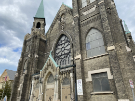
In the 1880s, early Polish settlers followed the Germans and built more modest homes. Tanneries and factories along the river south of the North Ave. dam provided jobs for the Polish and opportunities for recreation, and these included Blatz Park by the river and the popular beach at Gordon Park. In the 1890s, they established their own church, St. Casimir, and in 2003, the St. Casimir Parish merged with St. Mary of Czestochowa to form Our Lady of Divine Providence.
At the same time, Riverwest was becoming more densely populated by the thrifty Poles, with their small cottages and Polish flats, Victorian homes were being built just north of the North Ave. dam on the former plank road, now N. Humboldt Blvd.
Frank Whitnall, father of Charles Whitnall, had a 20-acre estate north of E. Locust Street, where he grew plants in multiple greenhouses. Today this neighborhood, not as populated as the rest of Riverwest, was the birthplace of Charles Whitnall, known as the “Father of Milwaukee Parks.” Gordon Park and Gordon Circle were named after his only son, Gordon Whitnall.
In the 1920s, Italians came to Riverwest, many of them former residents of the Brady St. neighborhood across the river. They were followed by Puerto Ricans, African Americans, and, in the 1970s, another group that migrated to the neighborhood and stayed: artists looking for inexpensive spaces for their work.
The Walk
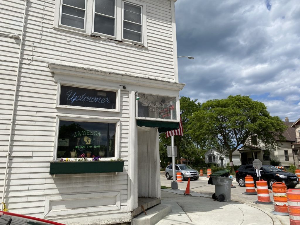
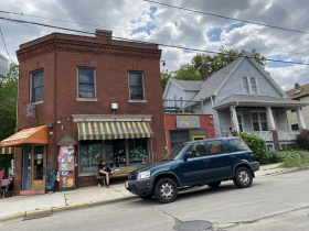
This walk starts at the Uptowner bar at the corner of E. Center St. and N. Humboldt Blvd. The name of Center St. suggests it’s the center of something, but that’s not the case. It was named after Alexander Center, a prominent local citizen. There was once a trolley on Center that began service in 1909 and traveled via Humboldt and Locust to its destination at Lake Park. The trolley lasted until 1937, when it was replaced by buses in the same year that Roy Pinkley, vice president of transportation for the electric company, stated, “Streetcars are the backbone of the transportation system.…They are the most efficient vehicles for handling mass transportation. I don’t see the end of them in Milwaukee.” (quoted in Carl Swanson’s Lost Milwaukee.)
Walk one block west on Center, turn left on N. Weil St. and right on E. Clarke St. Here you will see Our Lady of Divine Providence, formerly St. Casimir. The building, completed in 1893, was built by Polish immigrants and constructed with Cream City brick. It was completed in 1899. Slightly darkened brick is the only sign of age on this elegant and very large church.
Continue west on Clarke to N. Fratney St. until you come to the Riverwest Co-op, a natural foods store where the motto is “Food for People, Not for Profit.” It’s located in a former Schlitz Tied House, once a brewery-owned bar. Tied refers to “tied” to Schlitz Brewery, one of many bars built by Schlitz on corners like this one in Riverwest and throughout the city.
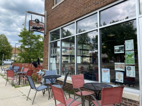
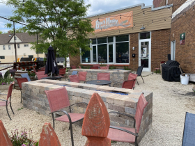
Return to the church at N. Bremen St. and turn left. At Locust, look for Black Husky Brewing on the corner. Here is a brewery where dogs are welcome, but don’t look for pizza and bar food. If you need something to eat with your beer, bring it yourself and enjoy it on the outdoor patio.
Now turn left on Locust and walk to Woodland Pattern Book Center at 720, a nonprofit bookstore where the owners promote poetry, books from indie publishers, and the arts. Every year in January, Woodland Pattern sponsors a two-day Poetry Marathon with more than 300 participants, mainly poets, along with a few musicians.
Return to Bremen and continue walking north. Along the way notice the small cottages, Polish flats, and duplexes in this densely populated part of Riverwest. At 3000 Bremen, you will come to Snail’s Crossing park, named for a quilters’ pattern that represents the blend of ethnic groups in Riverwest. “Crossing” refers to its location at a former railroad crossing. The park is special because neighbors and children pitched in to help build it; like the neighborhood, it was created by a diverse group of helpers.
Turn right on E. Burleigh St. and right again on Humboldt. You will pass Colectivo a popular local cafe, Gordon Park, and the Uptowner where you started. Continue south on Humboldt to E. Meinecke Ave. Turn left on Meinecke and left again on Gordon Place. At 2443 look carefully for the octogen-shaped house, the last remaining eight-sided house in Milwaukee. This type of pre-Civil War design was the rage in the 1800s when people believed they promoted good health thanks to multiple windows that brought fresh air inside from the outside.
Return to Humboldt and the Uptowner where you began this stroll through the center of Riverwest.
There is so much more to see in this neighborhood west of the river. Stay a while and check out the shops, the restaurants, the bars and the breweries in this neighborhood where anything goes, everyone fits in, the people are friendly and the vibe is cool.
Along the Walk
If you think stories like this are important, become a member of Urban Milwaukee and help support real, independent journalism. Plus you get some cool added benefits.
Milwaukee Walks
-
A Lovely Walk Along the Milwaukee River
 Aug 17th, 2024 by Cari Taylor-Carlson
-
Kilbourntown Tour Offers Tons of History
 Oct 8th, 2023 by Cari Taylor-Carlson
-
Layton Boulevard Has Overlooked History
 Jul 23rd, 2023 by Cari Taylor-Carlson











Thank you from a long time resident. No place like RW!