City Improving Kinnickinnic River Trail Access
Federal project will improve on-street access to off-street trail.
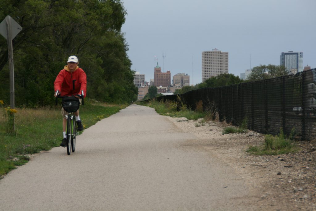
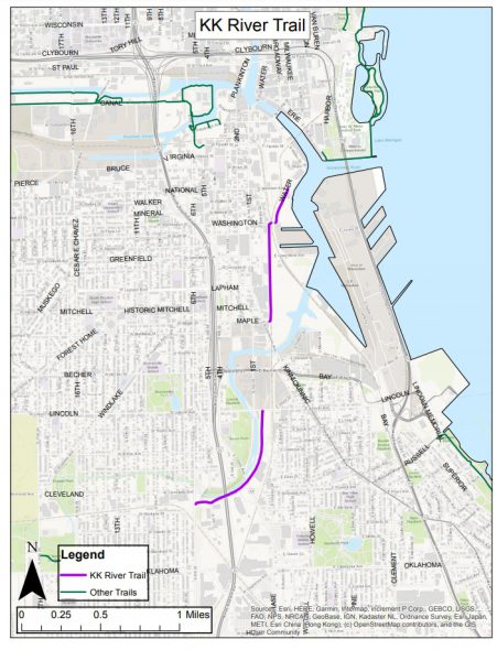
The City of Milwaukee will leverage a federal grant to improve access to the 2.3-mile Kinnickinnic River Trail which connects the Harbor District, Walker’s Point, Bay View and Polonia.
“This project is looking to make better on-street connections to the off-street trail sections so that people of all abilities can comfortably ride the entire segment and not have to mix with high-speed traffic while they’re on the streets,” said Department of Public Works multi-modal planning manager Michael Amsden in a presentation before the Common Council’s Public Works Committee on Wednesday.
The project will provide on-street accommodations along S. 1st Street from E. Lincoln Avenue to E. Maple Street, S. Water Street from E. National Avenue to E. Pittsburgh Avenue and a handful of other locations.
Bicycle facilities will be added to the S. 16th St. bridge over the Kinnickinnic River near W. Harrison Avenue, according to a city report.
The off-road portion of the trail currently ends at S. 6th St., but a newly-created corridor is available following the Kinnickinnic River to the west because of flood abatement projects conducted by the Milwaukee Metropolitan Sewerage District. Modrzejewski Playfield, situated in the middle of that corridor, is getting an overhaul through a separate federal grant. An extension of the trail through the corridor has been planned since at least 2017 and is included in the Route of the Badger trail plan.
The federal government, through a Congestion Mitigation and Air Quality (CMAQ) grant passed through the Wisconsin Department of Transportation, will pay for 80 percent of the project’s costs. The project’s total budget is $1,199,780.
A second $1,180,000 project would be similarly funded and aims to improve pedestrian safety along two heavily-used transit corridors. Improvements could include curb extensions, bus bulbs, Americans with Disabilities-compliant curb ramps, raised crosswalks and high-visibility crosswalk markings. “The project will also evaluate the feasibility of high-occupancy vehicle (HOV) and bus only lanes,” according to the report.
The two corridors are W. Burleigh Street from N. 20th Street to N. Sherman Boulevard and S. Cesar Chavez Drive from W. Pierce Street to W. Mitchell Street.
Amsden said both were identified as corridors on the city’s high-injury pedestrian network in a 2019 study.
“Well that’s good stuff,” said Alderman Robert Bauman.
“It should be,” responded Amsden.
The committee unanimously adopted the commitment for its funding share.
Legislation Link - Urban Milwaukee members see direct links to legislation mentioned in this article. Join today
If you think stories like this are important, become a member of Urban Milwaukee and help support real, independent journalism. Plus you get some cool added benefits.
Transportation
-
Congestion Pricing Cuts Air Pollution in New York City
 Dec 14th, 2025 by Jeff Wood
-
FTA Tells Milwaukee to Crack Down on Fare Evasion — Even Where Fares Don’t Exist
 Dec 12th, 2025 by Graham Kilmer
-
Will GOGO’s Bus Service Ever Get Going?
 Dec 9th, 2025 by Jeramey Jannene


Milwaukee County could very easily promote a European city type of bike commuting by encouraging people to use the South Shore Trail, the Hank Aaron Trail, and the Oak Leaf Trail to travel to downtown to work. Increased usage could bring more State and Federal dollars to improve these trails for everyone using them. I don’t see much action by the County to develop some creative responses to the “New Normal” that arrived a lot sooner than anyone expected.