
Milwaukee County Executive Chris Abele and Transit

How does MCTS attract more riders?
Chris Abele was recently elected to fill the remainder of Governor Scott Walker‘s term as Milwaukee County Executive. That gives Abele less than one year to accomplish anything as Milwaukee County Executive before he must seek re-election. Given the relatively short time for which Abele is assured to be in office, what can the newly-elected County Executive hope to achieve when it comes to transit?
Chris Abele held the position while he ran for office that he would not seek a sales tax increase for dedicated funding of mass transit, and it’s unlikely that even if he supported a dedicated funding solution it could be installed given the short time Abele is assured of being in office and the Republican control of state government. Although we’ve endorsed a dedicated funding source as a logical step to ensure quality transit access for southeastern Wisconsin, we support the new County Executive’s apparent desire to stick to issues that are controlled locally given the circumstances. With that in mind, the following are ideas that can encourage increased ridership on MCTS if implemented.
Real Time Open Data
The Milwaukee County Transit System, to its credit, has been excellent at providing open data of bus scheduling. This data is what is used to power Google Maps trip planner that can provide bus schedule data. MCTS officials have also indicated they’re working on procuring and installing equipment to provide real time open data by the middle of 2012.
Ultimately people will be more likely to ride a bus if they know when the next one is coming. Real time positioning data provides that. Alterra can have countdown timers in their coffee shops. Office buildings can display bus positions in their lobbies for tenants. Major bus stops can display countdown data. Text message based applications can be built that allow users to send a message to query the location of the next bus.
By accelerating the implementation of real time open data and engaging the tech community in Milwaukee, the private sector can more quickly create value for potential riders.
More on how and why open data is valuable with regards to transit in a previous article.
Simplified Mapping
Milwaukee is fortunate to have a number of hotels, businesses, and apartments within a block or two of the major bus corridor through downtown, Wisconsin Avenue. Frequent riders of the corridor know the routes and stop locations to quickly move anywhere between the Marquette campus and the lakefront, but the current downtown area map leaves a lot to be desired for people less familiar with the system. New riders can be enticed to take advantage of MCTS simply by creating a first-time rider, downtown-centric map. The one-sheet map could be distributed at downtown hotels, offices, shops, apartment buildings, and the Frontier Airlines Center. The map should include the following features.
- Stop locations
- Route frequency indicated by width of route on map
- Major locations off map and the corresponding route to get there (Miller Park – 90, Milwaukee County Zoo – 10, etc, etc)
- Fare information (no change on board, $2.25 cash, discounts for week, month, and 10-fare purchases)
- Schedule information (on back of sheet)
This idea was inspired by a similar map in Cincinnati by Nate Wessel (and funded creatively utilizing Kickstarter).
Improved Bus Stops
The average sheltered bus stop in Milwaukee is okay. When it’s raining or snow, there is a decent chance those underneath won’t get wet. When it’s not freezing outside, the benches provide a fairly comfortable rest while one waits for the bus. All in all, the average bus stop is certainly better than standing on the sidewalk, but it still leaves a lot to be desired. Obviously physically improving the bus stops is going to cost money, so I would like to propose a quasi-privatization method by which better bus stops can be obtained. Wherever possible and desired, the bus stops should be turned over to area business improvement districts. Business improvement districts are well-suited for this because they already frequently invest in streetscaping and have a self-interest in approving the attractiveness and accessibility of their district.
The business improvements could make a number of improvements to their bus stops, including but not limited to.
- Posting paper schedules
- Utilizing open data to display an LED countdown timer for scheduled data (eventually migrating to real time data)
- Installing four-sided shelters to protect from the elements better
- Installing heaters that would operate on user-request for a few minutes at a time during the hours of operation of the bus route


Great article! It would be a great accomplishment for Abele to add these services to MCTS. I have had the same thought about improving bus shelters and adding heaters, at least to major shelters and transfer points.
I have noticed recently that the times on Google maps seem to be operating off an old schedule. I have waited almost a dozen times for the 15 at a time listed on Google maps and the bus never came at the time I was waiting for, but it came right on time for the next time after. Have recent service cuts not been updated? I should note each time was after 7pm both near UWM and downtown.
Great examples of most of this are 90 miles south in Chicago. The CTA allows third parties to use its real-time bus data (and soon, rail data), and many (I’d hazard to suggest most) Chicago transit riders with smart phones rely on third-party iPhone and Android bus-tracker apps. They make riding unbelievably convenient, since you have access to immediate arrival time wherever you are at any time. (See here: http://www.transitchicago.com/tracker/ )
CTA also offers a downtown-centric visitor’s map showing all key routes, attractions, and hotels. (See here: http://www.transitchicago.com/maps/ )
Finally, though CTA bus shelters are not fully enclosed, they do offer something that Milwaukee would profit from: a bus map at every–single–bus stop.
I practically grew up on the Milwaukee transit system, and use it regularly to this day. It’s a solid system. The bread and butter of any transit system is frequency, reliability and coverage. If you live and work in what I call “the zone,” pretty much the city that was built before 1950, the Milwaukee bus offers excellent route coverage, good frequency, and, while it might be a surprise to some people, it’s a reliable system. People don’t ride transit because they think the bus will never come and you’ll be stranded. In reality, I can count the number of truly late buses on one hand in my two decades of Milwaukee bus ridership.
The biggest improvements for me would be realtime bus data based on GPS, and improvements in fare collection. In debit card era, it’s ridiculous to have a cash only fare system. Even when I buy my bus tickets or bus pass, at most places I have to pay with cash. It’s a pain in the butt because I rarely carry cash.
Kiosks placed in high foot traffic areas, or in grocery stores, where a person could use plastic to buy a fare card or pass would be a huge improvement. These kiosks could also help change the image of the bus system as a cash-only (read: service for poor people) system.
@Michael – Wasn’t aware of the map. It’s a nice map, although I might strive to make it fit onto just one page. The scale of Chicago doesn’t permit this it would appear.
I look forward to taking advantage of the real-time data when I visit the Windy City for two days next week.
The heater was likewise inspired by my observations of Chicago L stops.
@Dave – I’m with you on your theory of “the zone”.
I left off the fare collection idea because it didn’t strike me as something that could be done within a year. I believe the RFP for a new farebox system is still being created.
Yep, improved shelters, multiple ways to pay, and all the rest.
It would make sense to target areas where there is not a lot of ridership but could/should be, based on population density, car/foot traffic, etc.
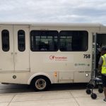
Airport to downtown flyer
The schedules thing is going to be a much harder sell than you’d think. The Transit Riders Union has brought this up with MCTS leadership a bunch of times and basically been told that it’s “too much work” when the schedules change 3-4 times a year. Kind of silly if you think about how much more user-friendly it’d make MCTS.
Night service on the weekends seems also like something worth investigating. A lot of routes through the East Side/Downtown/Walkers Point end service a hour or so before bar closing time because of budget cuts over the years. One extra run per route can’t possibly cost that much more, and it seems like it would be a cheap political win for Abele and the county board to be able to say they got drunk drivers off the roads. Miller already pays for it a couple of nights a year- wouldn’t it be possible to get a little more corporate funding to expand it year-round?
Speeding up service seems like it’d be another way to improve service for everyone and attract choice riders, and the fastest, cheapest way to do that is to consolidate bus stops so that they actually follow MCTS’s service guidelines. They studied it in San Fran, and it was expected to save a couple million dollars a year in operating costs: http://sf.streetsblog.org/2009/07/02/bus-stop-consolidation-the-times-have-changed/. Since MCTS is facing what, $11 million? in cuts for next year thanks to Walker, this seems like the ideal time to present this as an option- either people can weather the cuts in a way that actually improves the system for the majority of riders, or we can just cut routes like usual.
To get anything done, though, Abele’s going to have to take a lot more proactive stance on transit than any politician’s done in Milwaukee in a long time. And he’s gonna have to get changes in the general culture in MCTS management, which a lot of the time seems to view riders as more of an annoyance than the reason they exist.
Having the bus tracker like Chicago has would instantly change my bus commutes from a grade C to a B+. It is the single easiest way to improve the system. I don’t need heated shelters if I can plan to not be outside waiting long. Likewise, I don’t really need more frequent service if I can stay in my house or office waiting for the next one to get close. I also think I could actually convince more of my friends to take the bus with me if I could promise a minimal wait.
I would rather have MCTS spend the money to do this before buying any more new buses (as nice as the new ones are)
I would love to be able to see the bus location on a smart phone. If I’m running errands somewhere, or just about to leave my house, or am making my way to a stop from a few blocks away, I want to see exactly where the bus is. Think about how great that would be in the winter! No more long waits outside.
I understand that some people who ride the bus won’t have smart phones due to affordability. However, I think it would encourage people who do have them, who maybe don’t currently take MCTS, to give it a try if it will be that easy and efficient.