
Blue County vs Red County Urban Sprawl
Americans are dividing into two different ways of life. How do Milwaukee and Wisconsin rank?
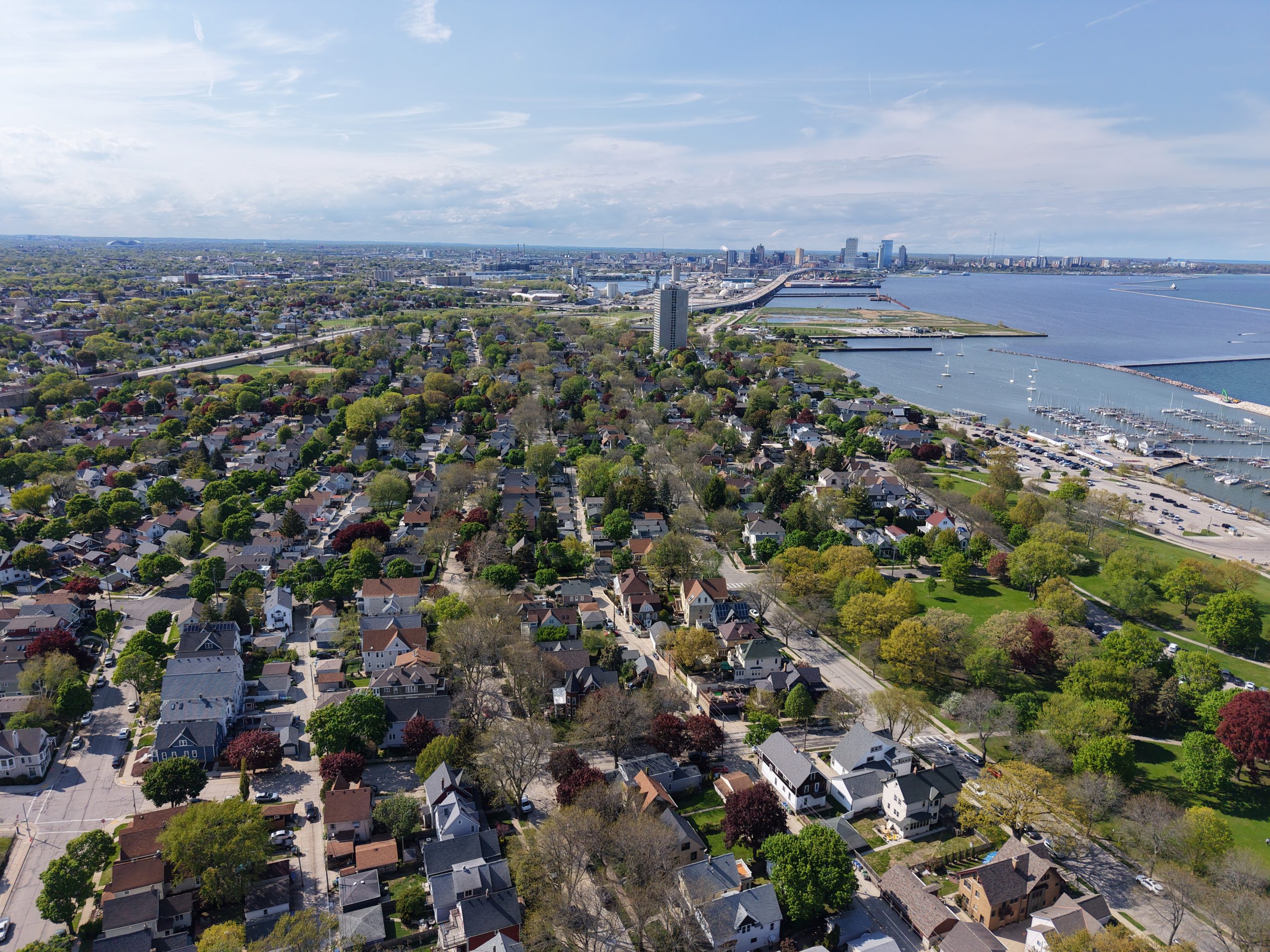
Bay View and the Milwaukee skyline. Photo by Urban Milwaukee staff.
Is America separating into two different ways of life? A new report on urban sprawl finds large differences among nearly 1,000 of the nation’s most metropolitan cities and counties. It found that cities like San Francisco and New York are the most compact, with the most urban density, while metro areas like Atlanta and Riverside, California are the least compact.
The study, by the John Hopkins Bloomberg School of Public Health, is entitled “Who Sprawls The Most?” It does not discuss politics, but is focused on the health consequences of living in more compact areas.
“We found that compact and connected neighborhoods, counties, and metro areas have lower energy costs, better health outcomes, lower exposure to vector-borne diseases such as Lyme disease, well-connected social lives and greater opportunities for children to thrive. Even housing, which has been the subject of many debates recently, is more affordable in compact areas after combining it with transportation and energy costs…. Compact and connected areas also provide residents with healthier, safer, and most cost-effective transportation options.”
With this in mind the study ranked the 233 largest metro areas and 995 metropolitan counties in the U.S. using four key measures: 1) residential and employment density; 2) neighborhood mix of homes, jobs and services; 3) strength of urban subcenters and downtowns; and 4) connectivity of the street network.
The rankings are interesting in themselves, but all the more so when you consider how these areas vote, something the report does not discuss. The highest-ranked or most compact areas tend to be blue areas like New York, San Francisco, Philadelphia and Boston. The lowest-ranked and most sprawling large metropolitan areas tend to be in red states, like Jacksonville, Florida, San Antonio and Houston in Texas, and Nashville, Tennessee.
In the ranking of the 995 most metropolitan counties in the U.S., 22 of the top 25 ranked counties are in blue states, and 22 of the 25 lowest-ranked and most sprawling counties are in red states.
You can see how this works when you look at Wisconsin. Deep-blue Madison ranks first, as the most compact of the medium-sized (500,000 to 1 million) metro areas in the nation.
At first glance, Milwaukee seems to rank not so high, 62nd among the 233 largest metro areas. But that’s for the four-county area, which includes the WOW counties of Waukesha, Ozaukee and Washington. When separated out, in the ranking of 995 most metropolitan counties, Milwaukee ranks 54th, as more compact than 941 other U.S. counties and far higher than Ozaukee (ranked at 482), Washington (733) and Waukesha (844).
Of the three WOW counties, the higher density for Ozaukee might explain why it is becoming more of swing area, that supported liberal Chris Taylor in the recent Wisconsin Supreme Court election. Urban Milwaukee’s Data Wonk has done research showing that the further WOW county residents live from Milwaukee, the more likely they are to vote Republican.
The report briefly notes the views of New York Times writer Ezra Klein, who co-wrote the book Abundance, arguing that housing unaffordability is due to overregulation by often-Democratic cities. Klein has celebrated cities like Dallas and Austin for building more housing while criticizing slower-growing cities like San Francisco and Los Angeles.
In doing so, Klein is celebrating a 60,000-square-mile triangle in Texas, encompassing Houston, Dallas and Austin, that is becoming “One Giant Sprawling City,” as one analysis noted.
The sprawl is driven by a “lack of zoning, private deed restrictions, and highway expansion, making cities costly and car-dependent,” notes another analysis entitled “Why The Worst Designed Cities Are Always in Texas.”
These are areas where the houses may be cheaper, but not when you figure in the transportation and energy costs, the Johns Hopkins researchers argue.
The Texas style is really part of the southern style, as David Gross, a writer and researcher on urban density, noted in his article, “Why Southern Cities Have Low Density.” He notes that Southern cities often have lower densities—around 3,000 to 4,000 people per square mile—because they developed later and mirror suburban sprawling patterns.
“5,000 people per square mile is not exceptionally dense,” he writes. “It’s about 1/3rd the density of Boston, and less than ½ the density of Chicago and Philadelphia. But throughout the entire former Confederacy, the only cities with more than 5,000 people per square mile are Arlington, Alexandria, and Falls Church directly across the Potomac from Washington, DC, as well as Miami and some of its nearby suburbs. And few people consider modern Miami or suburban Washington particularly Southern.
“But it’s not just Seattle, or Boston, or New York. Detroit, St. Louis, and Cleveland, in spite of losing over half of their populations, and countless jobs, are still denser than Atlanta, Dallas, and Houston. Milwaukee remains 50% more dense than Dallas or Houston.”
Which, if this new report is correct, should make Milwaukee a far more healthy place to live.
If you think stories like this are important, become a member of Urban Milwaukee and help support real, independent journalism. Plus you get some cool added benefits.
Murphy's Law
-
Tiffany, Republicans Look Terrible on Gas Prices
 May 11th, 2026 by Bruce Murphy
-
Milwaukee Pridefest’s Leadership Questioned
 May 6th, 2026 by Bruce Murphy
-
The Inside Story of Democratic Race for Governor
 Apr 30th, 2026 by Bruce Murphy