New Plaza, Protected Bike Lanes, Street Reconstructions Proposed
$33 million effort aims to improve Downtown, Historic Third Ward and Walker's Point.
Major street changes could be coming to the downtown area under a $33 million proposal from the City of Milwaukee.
Proposed projects include a new plaza atop a portion of W. Highland Avenue, adding protected bike lanes to N. Jefferson and E. Erie streets, rebuilding portions of multiple Historic Third Ward streets, narrowing W. Vliet Street in the Haymarket neighborhood, improving connections to the KK River Trail and making improvements to Erie Street Plaza and Catalano Square.
The Department of City Development proposes to fund the effort by tapping two overperforming tax incremental financing (TIF) districts: a 2015 district created to support the development of Fiserv Forum and a 2004 district created to build the southern Milwaukee RiverWalk segment in the Third Ward.
“There is no priority higher than making Milwaukee as safe as possible,” said Mayor Cavalier Johnson in a statement. “These improvements reinforce our commitment to combating reckless driving, increasing pedestrian accessibility, and improving our City’s vibrancy. Residents and visitors alike will feel and experience the positive impact of these enhancements.”
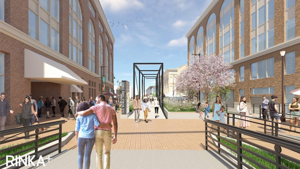
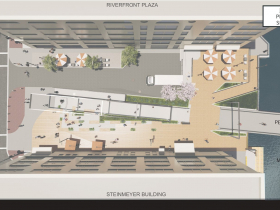
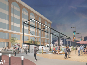
The new plaza would be built on the stubend portion of W. Highland Avenue between N. Martin Luther King Jr. Drive and the Milwaukee River. The half-block street currently feeds into the Highland Avenue Pedestrian Bridge, but a notable elevation change redirects pedestrians onto a nearby sidewalk and leaves the street as effectively an oversized public loading dock. Conceptual designs from RINKA would eliminate the pedestrian detour in favor of a more direct walking route between the Deer District and East Town.
“I am very pleased to see these public improvements moving forward throughout my district,” said Alderman Robert Bauman. “These investments will improve public safety and enhance the built environment.”
The Redevelopment Authority of the City of Milwaukee Board is first to consider the changes at its Dec. 19 meeting. Common Council review would follow.
Specific details on project boundaries and individual project costs were not immediately available. State law allows tax incremental financing districts to fund public improvements within a half mile of their boundaries.
W. Vliet Street, which runs past the new natural history museum in the Haymarket neighborhood, would be reconstructed and narrowed, with traffic calming measures added.
The Third Ward TIF district would be tapped for several improvements.
Portions of N. Water Street, E. Menomonee Street and N. Lincoln Memorial Drive would be reconstructed.
Protected bike lanes would be added to N. Jefferson and E. Erie streets and E. Corcoran Avenue. N. Jefferson Street has long been eyed for a north-south link through Downtown, after an earlier plan for N. Milwaukee Street and N. Broadway was abandoned.
“Enhancements” would be added to better connect to the KK River Trail at S. Water Street, E. Pittsburgh Avenue, N. Young Street and E. Menomonee Street. The trail, which is scheduled to be rebuilt through the Harbor District with a bidirectional bike lane and new lanes in Bay View, would be then connected to the north-south Jefferson Street lanes.
Raised crosswalks would be added to E. Erie Street. Speed humps were added in recent years to prevent speeding, but raised crosswalks (also called speed tables) allow motorists to proceed closer to the speed limit instead of 15 mph.
Erie Street Plaza and Catalano Square, two city-owned small parks used primarily by the Historic Third Ward Association for events, would receive improvements.
TIF districts have a maximum legal life of 27 years and rely on capturing increased property tax revenue within their boundaries to pay down associated debt. City officials have increasingly used the districts to support development and then harvest increased revenue to fund public improvements without needing to compete for money in the city’s general fund. The strategy, as described by DCD officials, is intended to allow for general fund revenue to be used in areas where TIF districts are not suitable because of a lack of new development.
Plaza Renderings
Existing members must be signed in to see the interactive map. Sign in.
If you think stories like this are important, become a member of Urban Milwaukee and help support real, independent journalism. Plus you get some cool added benefits.
Political Contributions Tracker
Displaying political contributions between people mentioned in this story. Learn more.
- February 20, 2016 - Cavalier Johnson received $250 from Robert Bauman


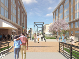






That one-block stretch of Highland is naturally a great candidate to become a plaza, and I like the renderings!
There seems to be a little glitch with the third rendering. Although you’d expect it to be east facing toward the river (given the ramp to the bridge), the fact that Fiserv Forum is in the background makes it appear west facing. For that to be true, the five-story buildings on either side of the plaza would need to be replaced by the “landing” located on the east side of the river, perhaps with the proposed “Edison” apartments on the left and the River Houses on the right.
Gives me a bit of understanding of how the architectural rendering program works. Or, maybe there is an alternate reality in which this view actually exists…? 🙂
@Franklin – The third rendering is directionally accurate, the view is coming west off the pedestrian bridge.
Here it is in 2016 – https://maps.app.goo.gl/eprDrD9x5daQnx9N6
Oh, I see! For good grief… 🙂
The Highland plaza between Third and the river is not a bad idea, but I doubt we’ll ever see that many people using it at any one time. Bring back Riversplash!
One thing I want to add is that spaces like these are very important. Places where people walking by or walking through can have an experience. Not necessarily big, just personal. (These spaces clearly aren’t meant to appeal to someone driving or riding by.)
This said, I agree with @DStreeter that there needs to be reasons to use the plaza. Walking across the river is clearly one. Hanging out before or after a Fiserv Forum event or after visiting an Old World Third Street establishment are other reasons. Some kind of programming in the plaza would be another. Point is that the area–and downtown in general–frankly does not have consistent amounts of foot traffic to make the plaza consistently used. More residential in the area will be a huge bonus.
Nice with the LED light thing.
Nice to hear that the plaza is proposed to be named for developer Gary Grunau.
This is NOT a good way to spend our money. SERIOUSLY.
How about reliable snow plowing? Do the drivers need higher pay?
How about screening for guns at all of our schools?
How about Universal changing tables (recently discussed in an article here)?
A plaza in the 3rd ward does NOT help the majority of MKE county voters. We need to stop with advocating for foolish ways to spend money while other needs go unmet. Really.