Did You Like the “Active Streets” Program?
Take a survey from the City of Milwaukee and help guide future efforts.
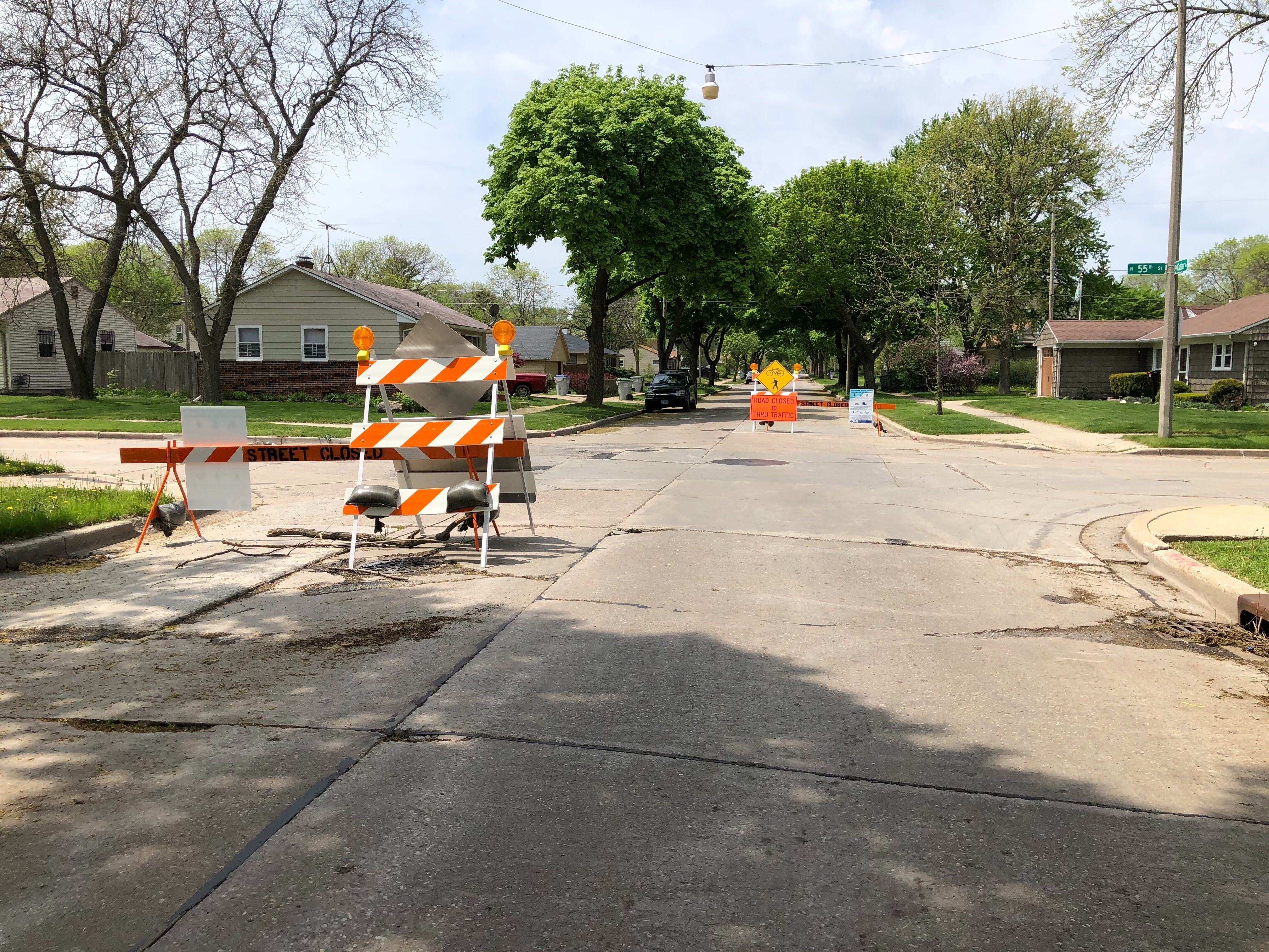
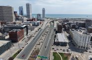
W. Custer Ave. at N. 55th St., reconfigured to be an “Active Street.” Photo by Jeramey Jannene.
In May, the City of Milwaukee, Milwaukee County Parks and several local municipalities launched a program called “Active Streets” in a bid to create more public space at a time when the COVID-19 pandemic had shut down bars and restaurants and many other gathering places were closed to the community.
Active Streets was intended to provide more space for socially-distanced activities like biking and running. In the early days of the pandemic, the parks and trails were loaded with people escaping the isolation of their homes. At the time, the parks department estimated that usage on some of the trails was up 45 percent.
The county completely closed off a handful of county parkways, while other parkways, and some city streets, had barriers and signage put in to discourage anything but local traffic.
This first run of the program officially ended this week. Now the city is looking for feedback on Active Streets. Did you like it? What did you like about it? Do you want it in your neighborhood next year?
The program was technically a pilot. The first closures were parkways in Humboldt, Grant and Jackson parks, and the Little Menomonee Parkway. Next, the city partially closed a number of streets in various parts of the city. You may have seen traffic cones and road closure signs partially blocking a street in your neighborhood, with no construction on site. That was probably an active street.
They included:
- W. Washington St. from S. Water St. to S. 20th St. in Walker’s Point
- W. Custer Ave. from N. Sherman Blvd. to N. 64th St. near McGovern Park
- N. Fratney St. from W. Meinecke Ave. to W. Keefe. and Wright St. from the Beerline Trail to N. Palmer St. in Riverwest
- W. Galena St. from N. 14th St. to N. 40th St. and N. 14th St. from W. Juneau Ave. to W. Galena St. connecting King Park, Tiefenthaler Park and Washington Park on the city’s west side
One of the active streets routes essentially became a trial run for the Riverwest Bike Boulevards, which were recently completed. These bike boulevards along N. Fratney St. and E. Meinecke Ave. are intended to discourage and greatly slow down vehicle traffic to encourage pedestrian and bicycle traffic.
In July, the Active Street in Humboldt Park was scaled back to allow vehicle access to the beer garden. The parks department said it was supposed to increase accessibility for all the amenities in the park. But as Urban Milwaukee reported in July it did not.
To share your views on active streets, explaining whether you liked them, what you liked about them, why you used them, take the Active Streets survey:
English: https://www.surveymonkey.com/r/MAS_English3
Español: https://www.surveymonkey.com/r/MAS_Spanish3
Hmong: https://www.surveymonkey.com/r/MAS_Hmong3
If you think stories like this are important, become a member of Urban Milwaukee and help support real, independent journalism. Plus you get some cool added benefits.
Transportation
-
Milwaukee Plans 60 Traffic Safety Projects for 2026
 Apr 8th, 2026 by Jeramey Jannene
-
State To Reveal New I-794 Cost Estimates
 Apr 7th, 2026 by Jeramey Jannene
-
Bus Riders Can Finally Pay With Credit Card
 Apr 6th, 2026 by Graham Kilmer