
MCTS Announces MetroEXpress – GreenLine, BlueLine, RedLine

MCTS will use existing buses to service the new routes
The Milwaukee County Transit System has unveiled a name for the new express service, and for the three new express routes. The express service will be known as MetroEXpress, and will begin service January 29th, 2012.
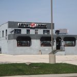
The Bayshore to Airport express service will be known as GreenEXpress GreenLine. The Fond du Lac – National express service will be branded BlueEXpress BlueLine. The Capitol Drive express service will be known as RedEXpress RedLine.
The final routes will follow closely what was initially proposed in the face of the substantial state funding reduction (and the CMAQ funded two-year bailout).
The new service will operate with existing MCTS buses, and does not include any vehicle branding at this point beyond the name being digitally displayed on the signage. Service will stop approximately every 1/4 of a mile, compared to the current 1/8 mile standard MCTS service follows.
In addition to the new service, MCTS is restructuring a number of other routes, and adding a handful of new routes. All of the details can be found in the links above, which point to PDF maps of each of the new routes.
Of note compared to prior maps of the routes, MCTS has changed the new route 56 (replacing much of Routes 11 and 18). Instead of continuing straight west on W. Greenfield Avenue from 1st to 124th, the route will turn south on the Miller Park Way, where service was previously proposed to be discontinued. It will follow Miller Park Way to Burnham Street, and Burnham to 60th Street, where it will head north to rejoin Greenfield Avenue.In addition, the northern end of the new Route 52 (servicing a branch of Route 15) has been extended with the route continuing north to Mitchell Street instead of terminating at Lincoln Avenue and Kinnickinnic Avenue.
As noted in a previous article, this new service will not cost any more than existing service to ride.
For a much greater background on the new express service, MetroEXpress, please see our previous article “Introducing the Bayshore – Airport Express Bus Service“. MCTS has also published a page containing information on the upcoming service changes.
UPDATE: I left out information on headways and service hours when I originally published this article, they will begin as follows.
RedEXpress (Capitol Drive)
- Service will operate roughly 4:30 am to 12:30 am, seven days a week
- Frequency – Weekday: 15-20 minutes, Saturday: 25-30 minutes & Sunday: 25-30 minutes
BlueEXpress (Fond du Lac-National)
- Service will operate roughly 4:30 am to 2:00 am, seven days a week
- Frequency – Weekday: 15-30 minutes, Saturday: 30-45 minutes & Sunday: 30-45 minutes
GreenEXpress (Bayshore-Airport)
- Service will operate roughly 4:30 am to 2:00 am, seven days a week
- Frequency – Weekday: 10-15 minutes, Saturday: 20-25 minutes & Sunday: 25-30 minutes
RedEXpress & Route 62 combined frequency
- Weekday: 15-20 minutes; Saturday: 10-15 minutes & Sunday: 10-20 minutes
BlueEXpress & Route 23 combined frequency
- Weekday: 10-15 minutes; Saturday 15-20 minute & Sunday 15-20
UPDATE 2: I have been notified by MCTS that the individual lines will be updated to be known as the GreenLine, BlueLine, and RedLine.


I’m still holding my judgement to see the service frequency. It looks like there won’t be much change from existing service or a downgrade… I’m waiting to see the schedules in January. It looks like more standing room buses running around town during rush hour, anyone hear anything specific about headways?
Oversight on my part. I’ve now included them in the article. Speaking particularly about the GreenEXpress line, that will actually be an increase in service, given that the service hours are extended later.
The branding looks positive and the frequencies are alright given resource constraints. So let’s see how this latest attempt goes… My only concern is that stops every 1/4 mile are industry standard for local buses, not express. If you want a bus to move really quickly, then the stop spacing needs to get up to about 1 mile average. Of course they may be closer if there is a reason, or farther if not. Wider spacing saves on fuel, maintenance and facilities costs in the long run and the additional speed gained may allow increased frequency without adding new equipment or labor. MCTS obviously knows this because they are increasing the space, just not enough IMO. Perhaps they are taking an incremental approach to avoid drastic change that could produce backlash, or perhaps management just has a perception that attracting new choice riders is not worth a slight inconvenience for existing riders accustomed to having stops very near by. I can certainly appreciate not wanting to walk far in bad weather but, most people can walk a 1/2 mile. It takes about 10mins, comparable to walking from one end of a suburban shopping mall to the other. If they can’t walk that far or use a mobility device, then they are probably eligible for paratransit service. Thanks for the info.
Industry standard in the US is not 1/4 mile between bus stops, it’s 1/8 of a mile. Seattle has been busy making 1/4 mile the standard for local bus stops, but it has been not matched by any other American or Canadian city. In any case,a large percentage of the transit dependent are elderly and disabled than many people think. These people cannot walk 1/2 mile or more to a bus stop, and siphoning them off to paratransit will increase agency costs and increase their isolation. Certainly if a service with 1 mile stop spacing is productive it should be operated, but if there’s going to be empty seats then it is not worth it. Are we in transit to move buses around or to move people around?
The change from 1/8 to 1/4 mile is great and will have significant benefits I’m sure, but if you are going to stop every 1/4 mile, then calling it express is laughable. We are in the business of moving people, however it is OK to design specific services to have specific purposes that are not all-emcompassing. Do you have a source for 1/8 mile standard? I don’t see it at APTA, the only thing there is standards for BRT – which generally refers to an express type service of some degree. See this document: http://www.aptastandards.com/Portals/0/Bus_Published/004_RP_BRT_Service_Design.pdf
On p. 11 (13 of the .pdf) it states that most people are willing to walk .25 to .33 miles. It also says patrons expect shorter walks in high activity centers but will accept longer walks for better service. I don’t see anything about how far the elderly will walk. I know my grandma can’t even go 1 block (bum knee, she takes paratransit) while my great uncle used to walk 5 miles a day until he died at 93.
My agency runs a BRT with ~ 1 mile spacing and overlapping local service that has stops spaced between 1/4 to 1/2 mile. In 2 years of BRT operation, the only comments I ever had about stop spacing were related to a 2 mile gap that was already in the process of being filled in. My dependent riders love the service because its’ FAST and FREQUENT. Why do you think dependent populations should get stuck with slow, infrequent service? What is the basis to assume that someone not capable of walking 1/4 or 1/2 mile IS able to walk 1/16 or 1/8 mile? My experience has been that if you can walk, you can walk 1/2 mile, and if you can’t walk, you need a mobility device or paratransit, no matter how close the bus is. Thus, I think the increase in paratransit usage would be small and the cost offset by savings.
The problem with such a tight stop spacing is the walking assumption that it’s built on and the network effect of scaling that assumption. A stop spacing of 1/8 mile indicates an assumption that no one can walk more than 1/16 of a mile (330 ft.) to get to a stop. In that case, routes will ideally be spaced 1/8 mile apart to cover your geography. Most metropolitan areas don’t have arterials spaced that closely, so you are creating a situation where buses have to travel on slower local streets. It also means on a traditional grid you would have to provide double the amount of service that you would if you assumed a 1/8 mile walk or 4X as much service as if you assumed a 1/4 mile walk, which is the APTA standard referenced above. That means the difference between 1/8 mile spacing and 1/2 mile spacing is that routes on the 1/2 mile spaced network could operate 4X more frequently for the same cost in revenue hours and with that spacing they are more likely to be on a faster arterial road with better signal timing or other ITS treatments. The choice then becomes: fast 15 minute service with an aditional 3/16 mile walk (990 ft.), or hourly service right out your door with a much slower overall trip to your destination? This becomes really important when you think about transfers and the fact that they are very difficult to make with hourly service, but relatively easy with 15 minute service. 15 minute transfers can occur at intersections, but hourly transfers only work with coordination at a specific point. That usually involves substantial infrastructure and operations costs and it produces a steep time penalty for anyone traveling through but not transferring. It can create terrible routing as everything is forced to deviate into a single point.
I do believe that transit has a special responsibility to dependent populations, but pedestrianism is an integral part of fixed-route transit (excepting long-distance commuter park-and-ride types). We can design a system that works well for the overwhelming majority of people and then add in special provisions to help people with specifc and widely varying challenges, or we can design a system that doesn’t work well for anyone, including the dependent. I prefer the former. Seattle has a high transit mode share and they provide excellent service to dependent AND choice riders. Milwaukee could learn a lot from them.
I wanted to test these new express routes, so I ran a trip search through RideMCTS.com from downtown (I used 100 S Water St) to Bayshore. Assuming that the google maps system MCTS uses is up to date, and it seems to reflect the new routes, the fastest would be the 49 Freeway Flyer. The Green Line takes almost a third longer.
Here are the three options I was given for the trip:
– 49 Freeway Flyer at 35 minutes;
– The new Route 15 at 36 minutes; and
– Green line at 46 minutes.
Can MCTS really the Green line “express” if it takes 10 more minutes to make this trip than the 15 up Holton? Personally, I agree with G-Man that they really need to consider better spacing on the stops to actually deliver a useful level of service.
(link: http://www.google.com/maps?ie=UTF8&f=d&dirflg=r&sll=43.049322%2C-87.868652&sspn=0.202969%2C0.391045&saddr=100%20S%20water%20st&daddr=bayshore%20towne%20center&ttype=arr&date=2/1/12&time=8:00%20am)
p.s. I may have come across a bit more negative than I intended. I will at least give these new routes a chance, but I was a bit shocked to see those numbers. Hopefully, they will not be reflected in reality.