

Strong El Niño Raises Odds Of Mild Winter, Tough Drought For Wisconsin
A likely record El Niño could mean warmer months ahead, but little relief for parched fields and forests.
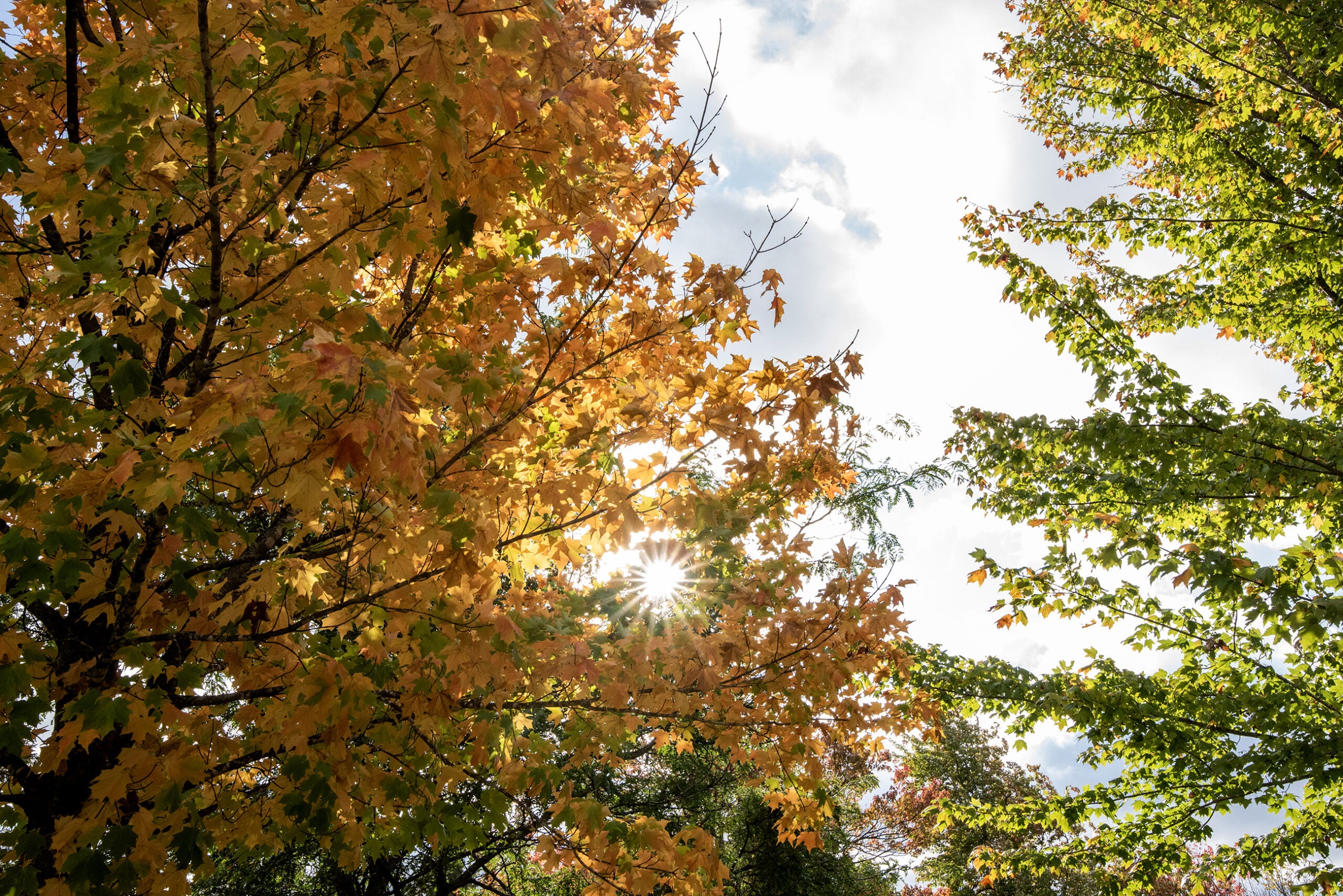
The sun shines through leaves in the Medford City Park on Friday Oct. 6, 2023, in Medford, Wis. Angela Major/WPR
Scientists say the strengthening El Niño is likely to be the largest ever recorded, increasing the chances of a warmer fall and winter in Wisconsin.
This week, scientists announced they measured the highest ocean temperatures on record, those temperatures driven by a strong El Niño developing in the tropical Pacific along with decades of global warming.
El Niño is a warming that occurs in the equatorial Pacific Ocean, and a very strong or super El Niño occurs when the ocean is 2 degrees Celsius — 3.6 degrees Fahrenheit — warmer than usual.
The National Oceanic and Atmospheric Administration is predicting a greater than 90 percent chance of a “very strong” El Niño during the fall and winter.
While it may not seem significant, the effects of warming can ripple far beyond the tropical Pacific, said Dan Vimont, a professor of atmospheric and oceanic sciences at the University of Wisconsin-Madison who studies the climate pattern.
“This is likely to be the largest El Niño event in recorded history,” Vimont said. “In the tropical Pacific, this is an enormous event, and that definitely weights the dice here in Wisconsin.”
Vimont said strong El Niño events tend to mean warmer winters in Wisconsin, but it’s not yet clear how it will play out this year. Typically, the effects are strongest in the winter while it’s been more of a mixed bag during fall, said Bridgette Mason, assistant state climatologist with the Wisconsin State Climatology Office.
“It’s been a mix of slightly warmer and slightly cooler than average during these events, and so there’s not a very strong signal for fall temperatures looking back at past El Niño events,” Mason said.
Wisconsin previously saw strong El Niño events in the falls of 1982, 1997 and 2015. The state had cooler-than-normal weather in 1982 and 1987, but temperatures were up to 4.5 degrees warmer than normal in 2015. Meanwhile, it was over 2 inches wetter than normal in 1982 and 2015, but drier than normal in 1997.
Even so, NOAA’s Climate Prediction Center slightly favors above normal temperatures with equal chances for above or below normal rainfall in Wisconsin over the next three months. Mason said it’s not the only factor that can influence seasonal outlooks or day-to-day weather, and El Nino’s effects typically aren’t felt until later in the fall.
“It’s a little bit unprecedented how strong and early this El Niño event is happening, so it could be a little bit of a surprise for for what actually comes,” she said.
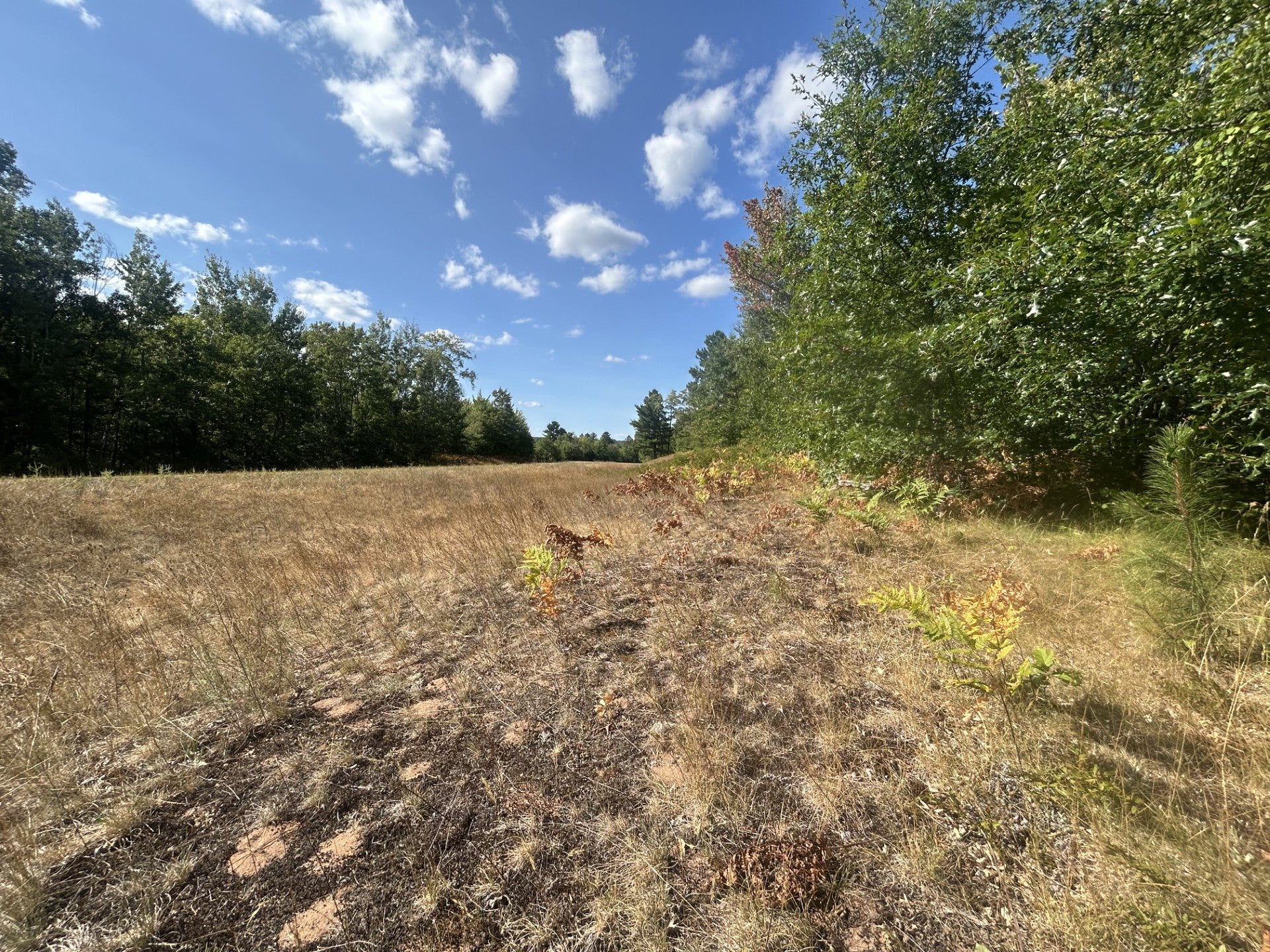
Plants and grass are dead or drying out in northwestern Wisconsin, and some leaves are beginning to turn near Lake Nebagamon in Douglas County. The area is experiencing extreme drought. Danielle Kaeding/WPR
Warmer than normal fall wouldn’t help ease drought conditions
If it remains warmer than normal through fall, Mason said that doesn’t bode well for improving drought conditions in Wisconsin. The latest report from the U.S Drought Monitor shows most of the state is abnormally dry and more than 42 percent is experiencing severe drought. This month, extreme drought returned to Wisconsin for the first time in two years and now affects eight northwestern Wisconsin counties.
The Hayward area typically sees an average of about 11 inches of rain from June to date, but it’s about four inches below normal. The same is true for the Ashland area, said Josh Sandstrom, meteorologist with the National Weather Service Office in Duluth.
“Northwest Wisconsin, at least at the beginning of the summer, we had some places getting around average rainfall, but it’s been really in the past month or so that it’s kind of flatlined for a lot of places,” Sandstrom said. “We just have not seen a lot of rain.”
Much of northern and central Wisconsin has seen roughly half to 75 percent of their normal rainfall since May 1, said Mason. Northwestern and north central Wisconsin would need 15 to 16 inches of rain to end drought conditions this fall, which is almost double their normal rainfall for the season.
West central and northeastern Wisconsin would also need about three inches more rain than normal. Jerry Clark is a regional crops and soils educator for Chippewa, Dunn and Eau Claire counties with the Division of Extension at the University of Wisconsin-Madison. He said corn for silage was harvested about two to three weeks earlier than normal in some areas because plants were dead or drying up.
“I think for corn and soybeans especially, we’re probably going to be down, maybe looking at a drought-stressed crop versus maybe a normal crop,” Clark said. “It looks like that is down about a third from what might be normal.”
He said the size of soybeans are going to be small compared to normal and ears of corn aren’t quite filled out, noting areas with sandier soils have been more affected. Lower yields on drought-stressed fields means there won’t be as much grain to sell for feed for cows and cattle, and farmers may have to dip into their stored inventory.
However, warmer temperatures may extend the boating season for some. Drought conditions could disrupt that with lower water levels on lakes and reservoirs, which has prompted some utilities to adjust operations at their hydroelectric facilities.
Mason added that the combination of drought conditions and a strong El Niño may also play a role in leaves changing their colors earlier and falling faster than normal this fall.
Strong El Niño may bring greater chances of warmer fall and winter in Wisconsin was originally published by Wisconsin Public Radio.
If you think stories like this are important, become a member of Urban Milwaukee and help support real, independent journalism. Plus you get some cool added benefits.

















And the response from the richest, and therefore brightest, people in the land is to build data centers that run on copious amounts of fossil fuel. And the politicians are like, hey, these are good paying jobs, albeit mostly temporary. And they generate precious tax revenue so lets have a go at it. Furthermore data centers and AI related propaganda deepfakes, flock cameras etc. represent, I don’t know, let’s just say (pretend) our brightest future? and I’m a big dummy if I can’t see that very obvious truth?
Meanwhile there is not enough maple syrup for my freaking delicious waffles anymore because of warm winters and the whiny poopy diaper baby President effing with our good neighbors to the north.
But I’m an affluent, intelligent and very sophisticated suburbanite with a damn nice looking portfolio of tech stocks and I’ll be damned if I’m going to stop voting Republican!
Let’s keep voting for climate science deniers and greed monsters, as Diane suggests, and speed the destruction. Vote red, and the planet’s dead.
If this continues the friends I winter with in Florida will be coming up here for the winter.