
New Trail Planned For Bender Park
County puts trail construction project out to bid.
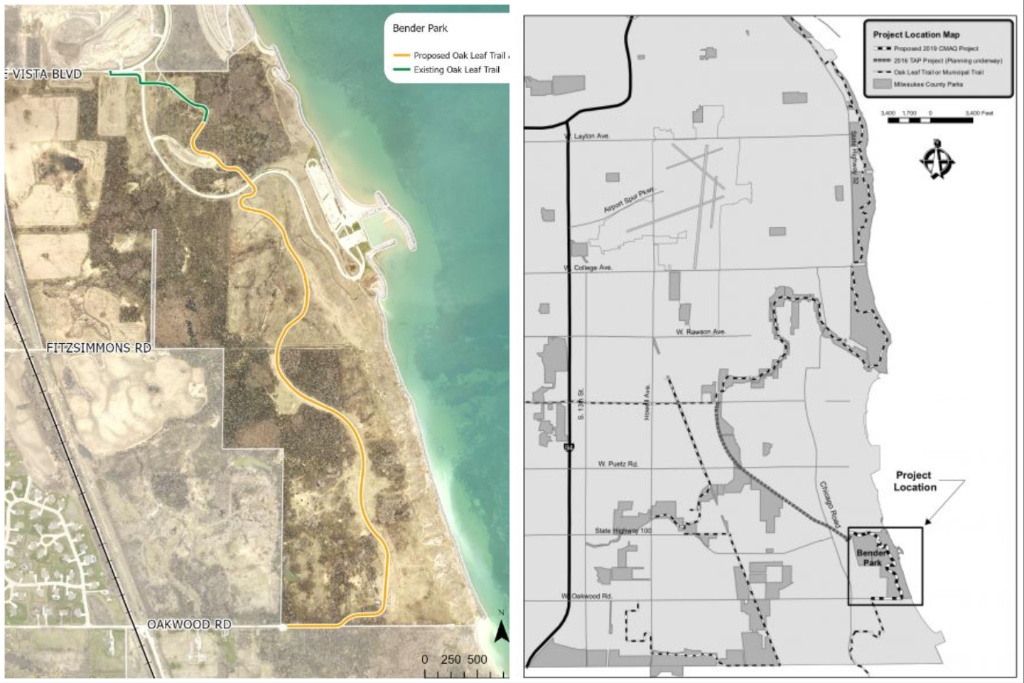
Bender Park trail project maps. Milwaukee County Parks.
Milwaukee County Parks is planning to extend the Oak Leaf Trail more than a mile through Bender Park next year.
The plan is for 1.3 miles of trail connecting E. Oakwood Road in the south to Lake Vista Boulevard in the north. Once complete, it will be the southernmost spur of the Oak Leaf Trail network in the county. Bidding on construction for the trail recently started, and the project should be completed by early September next year.
The new one-mile trail will extend the county’s Oak Leaf Trail network further south, bringing bicyclists closer to the Milwaukee-Racine-Kenosha Trail in northern Racine County. In the opposite direction, the trail will connect Bender Park to the South Shore line of the Oak Leaf Trail, which extends north for approximately 16 miles to Cupertino Park in Bay View.
The project is being funded with $1.3 million in federal Congestion Mitigation and Air Quality Grant (CMAQ) grant funding. Parks is also using CMAQ funding to construct a 2.4-mile trail through Kohl Park on the northern end of the county.
The Bender Park trail is one among a handful of trail projects Parks has taken on in recent years, including four road-to-trail conversions. Construction has wrapped on the conversion of a short section of the Lincoln Creek Parkway to a trail. The same goes for the conversion of approximately one mile of the Menomonee River Parkway to a trail.
A portion of Underwood Creek Parkway is currently being rebuilt a section converted to a trail.
A Kinnickinnic River Parkway project was recently delayed after rapid stream bank erosion upset plans for rebuilding the roadway. That project also included a partial conversion to a trail of one section of the roadway.
Parks began pursuing these road-to-trail conversions as a way to add more recreational infrastructure, provide a safer right-of-way for pedestrians and cyclists and save the county money in the long term, as trails are cheaper to maintain than roads.
The department is also updating a trail network plan created in 2007. Parks is collecting public input on gaps in the trail system and has created the MKE Trail Comment App, which allows users to provide comments and draw potential trail routes.

Existing members must be signed in to see the interactive map. Sign in.
If you think stories like this are important, become a member of Urban Milwaukee and help support real, independent journalism. Plus you get some cool added benefits.
MKE County
-
Committee Approves Towing Reckless Drivers, With Objections
 Mar 12th, 2026 by Graham Kilmer
-
Domes Project on Track for 2027 Groundbreaking
 Mar 12th, 2026 by Graham Kilmer
-
Judges Won’t Extend Schimel’s U.S. Attorney Appointment
 Mar 10th, 2026 by Graham Kilmer