Questions and Answers on Estabrook Dam
Part 2 of analysis disagreeing with our series and arguing dam should not be repaired.
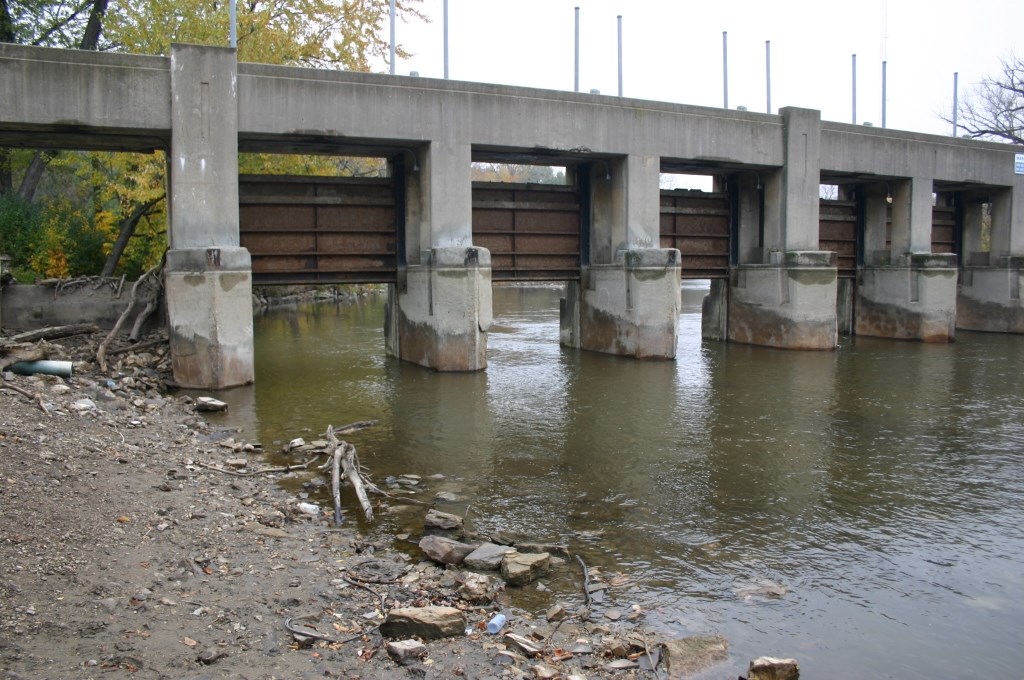
Estabrook Dam
Last week, I wrote an article disputing David Holmes‘ claims that repairing the Estabrook Dam is a more environmentally sound dam management alternative than removal. This week, I’d like to continue my case as to why repair of the Estabrook Dam and the addition of a fishway on the Milwaukee River is not the most socio-economic and environmentally sound and cost-effective alternative. As with the previous article, the following is a very brief summary of a longer and more in-depth analysis with exhibits and links regarding the future state of the Estabrook Dam and impoundment, which can be found here. I would appreciate your review of the larger document and offer your comments by way of this article.
Flood Control: Does the dam lessen or worsen flooding and potential property damage?
The environmental impacts following modification of the Milwaukee River in Lincoln and Estabrook Parks by lowering the original rock outcrop, deepening and widening the channel over a distance of 1.5-miles, and construction of the Estabrook Dam have been severe. These modifications may have reduced some of the flooding caused by the historic meander or “S-curve” of the river, and its limited ability to convey flood flows and propensity to accumulate ice dams, but they did not eliminate them.
Proponents for repairing the dam suggest that the SEWRPC flood model data, which predicts flood water elevations and flood damage estimates for the Milwaukee River, are not accurate. They cite the June 1997 flood that approximated a 200-year flood event with limited flood damages in the flood prone Sunny Point neighborhood (located between Silver Spring Drive and Bender Road) as evidence. While the observed record flows (16,650 cubic feet per second) at the Estabrook Park USGS flow gage located downstream of the dam and Lincoln Creek did occur, Lincoln Creek contributed more than 50% of the peak flow at the USGS gage. Lincoln Creek is located 1-mile downstream of the Sunny Point neighborhood. By way of a flow mass balance, the Milwaukee River at Bender Road did not exceed the 10-year flood event. This is to say that the extreme precipitation, runoff, and river flooding experienced during the June 1997 was not a watershed-wide event; but instead was relatively localized.
Removal of the Estabrook Dam is the only dam management alternative that reduces potential flood damages from the Milwaukee River or from submerged storm sewers. Compared to the dam removal alternative, the dam repair alternative poses the following risks:
- With all 10 flood gates open, the 100-year flood event elevations increase between 0.5 and 1.5-feet between the Dam and Bender Road;
- If the County is unable to raise all 10 gates of the dam during the 100-year flood event because of obstacles such as unsafe access to the dam, staff availability, the loss of power during the storm, mechanical gate failure, or the accumulation of ice and debris at the gates, the flood water elevations would be as much as 1.5 feet higher than the 100-year flood elevation near the dam with the gates open, and continue to exceed the 100-year flood elevation at Bender Road. This would result in flood damages to more than the current 292 residences in the current 100-year floodplain.
- If the County is unable to raise all 10 gates during more frequent and less extreme flood events beginning at the 15-year flood event, the flood levels and resulting damages would be similar to those experienced during the 100-year flood with all 10 gates raised.
These findings were made available in public documents and at public meetings over a year ago, well in advance of the County’s recent policy change to repair the Estabrook Dam in early 2015, or their decision last December to add an additional million to the repair authorization (bringing the total bill to nearly $6 million with operation and maintenance). The County Board chose not to heed the advice of their own Director of the Office of Emergency Management, the Village of Glendale’s Certified Floodplain Manager, or an independent risk management and flood insurance provider that recommended that given the flood risks and damages and potential liability to the County, the dam should be removed.
There are approximately 292 residential properties in the 100-year floodplain (all but four are located between Silver Spring Drive and Bender Road in the City of Glendale’s Sunny Point neighborhood), 163 properties have water frontage and 129 are located inland from the river and do not have waterfront property and access to the river. In the event that the County is unable to raise all of the dam gates in a timely manner, even for floods much less extreme than the 100-year event, the number of waterfront properties experiencing flood damage will remain the same. However the number of overall properties without waterfront property experiencing flood damage would increase. If all the dam gates cannot be opened in a timely manner and flood damages occur, it would increase the County’s exposure to flood damage liability.
Residents with mortgages located in the 100-year floodplain already carry flood insurance and future flood insurance premiums will be increasing. The 129 residences located in the 100-year floodplain and without waterfront access do not have the added property value that waterfront property owners have. As such, they may have the most to gain from being removed from the floodplain boundary by eliminating payment for flood insurance, and absent that stigma, could receive a higher selling price.
What are the costs of the various dam management alternatives to taxpayers?
Milwaukee County’s own consultant estimated the 20-year cost for repairing, operating, and maintaining the Estabrook Dam with an engineered fish passage at $6 million. Consider other tangible and intangible costs:
- The price tag for dam repair does not include the potential exposure and liability to the County associated with increased over bank flooding and localized nuisance flooding of streets and yards due to storm sewer surcharging, as discussed earlier.
- The County has been delinquent in removing debris from the Dam spillway in the past. As part of DNR’s pending Operational Order and Environmental Impact Statement process establishing water levels for the Dam and fishway, operation and maintenance requirements including debris removal will have to be addressed by the County and this could get expensive.
- Mr. Holmes stated that the balance for the dam’s operation and maintenance will be $300,000 by 2017. That balance may not add up. The annual $51,000 allocation from the television tower rental fund for dam operation and maintenance started in 2014 or 2015 and the account has been used for no less than three debris removals in 2015, and debris removal must still be completed for 2016. Past debris removals have cost as much as $40,000 per year and 300 cubic yards of debris are still awaiting removal from the Estabrook Park floodplain next to the dam’s gated section (that debris pile has been onsite for years). In addition, the County has not confirmed whether there is a designated dam maintenance account with these rental fees that is set aside for purposes solely relating to Estabrook Dam, or whether the fees are just put into the overall Parks budget and thus prey to other County Park funding needs on an annual basis. Any additional shortfalls in funding for the dam and fishway operations and maintenance (O&M) will have to be funded through the annual budget process. Since there is no designated fund for plan for how to pay the balance of dam and fishway O&M (estimated at an additional $110,000 per year), the County must allocate the balance by way of the same annual budgeting process that competes for all County projects. The price tag for dam repair does not include potential expenses associated with future demands to re-dredge accumulated sediment responsible for nuisance conditions or in order to accommodate navigation by motorized boats.
As of 2008, the deferred maintenance on Milwaukee County Park facilities was estimated at over $275 million based on an independent study by the Public Policy Forum. This means the County cannot pay to repair, maintain, and operate its current park facilities in good working order, and throwing millions at this Dam means that other important projects will not be funded–projects like repairing the Mitchell Park Domes at a cost of $75 million, a new County Safety Building at $184 million, and saving the iconic bridges in Lake Park.
Supporters of repairing the Dam argue that removing the “natural lake” would impact their property values and add to the County’s total cost of dam removal. They have also threatened to sue the County over projected property value losses estimated at $74,000 per residence. However, there is no evidence to suggest that this would be the case. To the contrary, there are Wisconsin-based peer-reviewed studies and an appraisal that looked at the effects of small dam removal on water front property values that concluded property values generally stay the same or slightly increase following dam removal. In addition, I am not aware of any property devaluations that have occurred as a result of the 14 dams removed in the Milwaukee River Basin during my career (e.g., North Avenue Dam in Milwaukee, Lime Kiln Dam and Chair Factory Dam removals in Grafton, Woolen Mills Dam removal in West Bend, Newburg Dam, Campbellsport Dam, etc.). There are many factors that influence property values, and proximity to water is only one factor. Removal of a dam will not result in the elimination of waterfront property, but rather results in a change in the water type, from reservoir to free-flowing river, and the quality and quantity of uses they support. Power boating by deep drafting and higher horse power motors will no longer be feasible should the dam be removed; however, other recreational opportunities such as fishing and “river” paddling may be improved.
As far as the County’s potential liability for “lost” property value, my understanding of existing case law is such that landowners that live on impoundments do not have any rights to water levels that would require the owner of a dam (in this case, the County) to maintain the dam or the resulting impoundment, in perpetuity or for the benefit of upstream landowners. To lessen or eliminate the costs to County taxpayers, riparian landowners in favor of keeping the dam should consider forming an association and levying fees for the repair and operation and maintenance of the dam, a special assessment, or other funding mechanism.
The 20-year present worth cost for removing the dam and restoring fish passage and quality habitat for fish and wildlife, creating a recreational fishery, and eliminating the county’s potential liability for flooding properties and causing nuisance flooding is $1.7 million, or three times less than repairing the dam. A large percentage of costs for removing the Dam could be paid for by federal, state and private grants. Remember also that if the dam is repaired, it will extend the lifetime of the structure for 20-years. After spending $6 million to repair the dam and put in fish passage, the gated section of the dam will have to be demolished and replaced.
Article Continues - Pages: 1 2
Op-Ed
-
Why Vote for MPS Funding Referendum
 Mar 30th, 2024 by Nehemiah Edwards
-
Wisconsin’s Very Own Rudy Giuliani Should Not Oversee Judicial Ethics
 Mar 25th, 2024 by Richard Niess
-
Voting at Wisconsin’s Universities Isn’t Easy
 Mar 17th, 2024 by Nicole Laudolff


With the dam removed, and the river-bed exposed most of the year, who is going to clean up all of the brush and trees that take root in the river bed and all of the debris that collects in them?
This will create ice dams, which will cause flooding each spring!
Will the county dredge the riverbed prior to each spring flood season? How much will that cost?
The recent brush cleanup in Lincoln park was a one time activity that was part of the EPA PCB removal project. Prior to that, the river flow was significantly impacted. This was never an issue when the dam was in operation.
@Dan, no one does that north of the former North Ave dam site and there are no problems, why expect any different?
@Rich – have you visited the areas north of North Ave Dam and North of Estabrook Dam? The topography is very different. The banks upriver of the north Ave dam are much taller and buildings are farther back. The better question would be, why would we expect one solution to work the same everywhere without assessing each individual environment?