New Public Access Lands Web Map Now Available

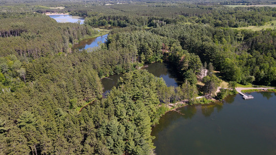
The Public Access Lands web mapping application is user-friendly and available on mobile devices. / Photo Credit: Wisconsin DNR
MADISON, Wis. – The Wisconsin Department of Natural Resources (DNR) today announced that a new web mapping application is available for people to learn about public lands in Wisconsin and plan their next outdoor adventure. The Public Access Lands application is designed for desktop and mobile devices and offers user-friendly tools.
“The updated Public Access Lands map app has been simplified with an uncluttered screen and easy-to-use tools,” said Ann Scott, DNR real estate land records officer. “Click on the screen to open links to find information on DNR properties, public access, open private lands for hunting and other helpful features to find the perfect getaway.”
This web-based mapping application provides up-to-date property information, including maps, restricted areas and links to webpages, if available. To find specific opportunities, such as fishing waters or hunting zones, select which “theme” interests you, and the application will display layers relevant to the activity. The application also shows DNR parking areas and boat access sites and complements the printed Public Access Lands Atlas, which contains 441 maps covering statewide public lands, roads and waterways.
Launch the Public Access Lands application or visit the DNR’s Public Access Lands webpage to learn more.
NOTE: This press release was submitted to Urban Milwaukee and was not written by an Urban Milwaukee writer. While it is believed to be reliable, Urban Milwaukee does not guarantee its accuracy or completeness.
Mentioned in This Press Release
Recent Press Releases by Wisconsin Department of Natural Resources
DNR Seeking Public Comment For Environmental Review Of Marshfield Safe Drinking Water Loan Program Project
Dec 11th, 2024 by Wisconsin Department of Natural ResourcesGroundbreaking Production Coming to Historic Third Ward January 2025
DNR Releases 2024 Air Quality Trends Report
Dec 10th, 2024 by Wisconsin Department of Natural ResourcesIncludes Air Monitoring Data Through 2023


