A Short History of Milwaukee’s Old Streetcar System
The city once had a dense system with 20 routes that helped change the city. Why did it die and what is its legacy?
What are the lessons from the streetcar’s death?
The Coverdale & Colpitts study had argued the streetcar had limitations making it inferior to trolleybuses and diesel buses. The only cities that built or were ordering new trains were for routes not sharing road space with autos. Examples include Chicago’s “Els” or New York’s subways.
Conventional thinking at the time was to make the streets convenient for automobile drivers, and streetcars were viewed as traffic hindrances. There was also a strong case showing trolleys were less safe because they lacked maneuverability in traffic. The rails could also be a slipping hazard for autos in poor weather, and passengers were at risk because they loaded in the middle of the street rather than at the sidewalk curb.
The study also made a safety comparison between streetcars and trackless trolleys along one route – Route 22 which went along Center Street. In 1940 the route still had a streetcar, but it had become trackless by 1947. The trackless trolley, while carrying over twice the number of passengers and going double the amount of vehicle miles, had virtually the same number of accidents as the streetcar did in 1940. Looking at it another way, in 1940 the streetcar along Route 22 had .7039 accidents per 1,000 vehicle miles while the trackless trolley in 1947 had .2880 accidents per 1,000 vehicle miles. This was, of course, only one route in a big city yet the authors felt safe using it as a model. citing the city Safety Commission’s position that the Center Street Route was typical a typical one in Milwaukee.
But a huge element of the proponents’ argument for the new system cites evidence that it will aid in boosting Milwaukee’s image, encourage economic advancement, and appeal to younger, college educated residents that cities try to attract. And analysis of these arguments are beyond the scope and expertise of this article.
It is clear that Milwaukee’s historic trolleys were at one time vital to the city’s economy and how people lived their daily lives. Former city leaders and the old transit company removed the old lines due to the changing times and economic realities. To them trackless trolleys and buses were safer and more efficient. Proponents of the new streetcar say the new technology will work better, that fixed rail attracts business and the trend today is moving away from auto traffic. Are they right? We’ll find out in the years to come.
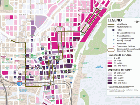
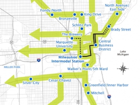
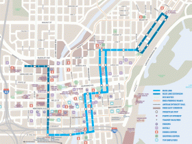
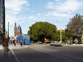
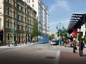
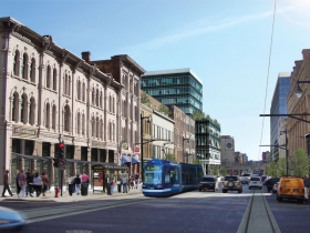
Streetcar Maps and Renderings
Urban Milwaukee Streetcar Coverage
- Anti-Streetcar Petition Drive Fails – Bruce Murphy – March 5th, 2015
- Streetcar Signing Is Quite a Celebration – Michael Horne – February 13th, 2015
- Milwaukee Streetcar Approved – Jeramey Jannene – February 10th, 2015
- Who’s Lobbying for the Streetcar – Bruce Murphy – February 5th, 2015
- Will Streetcar Help the Inner City? – Bruce Thompson – February 4th, 2015
- City Attorney Says Streetcar Petitions Might be Moot – Bruce Murphy – January 30th, 2015
- Millennials And The Streetcar – Bruce Thompson – January 27th, 2015
- Streetcar Responses Show Wide Support – Jeramey Jannene – January 22nd, 2015
- Streetcar Approved, but Held – Jeramey Jannene – January 21st, 2015
- Koch-Funded Group Backs Anti-Streetcar Drive – Bruce Murphy – January 20th, 2015
- Streetcar Backers Say They Have the Votes – Jeramey Jannene – January 20th, 2015
- Who is Funding the Anti-Streetcar Effort? – Bruce Murphy – January 20th, 2015
- Will Anti-Streetcar Referendum Succeed? – Bruce Murphy – January 9th, 2015
- The Story Behind the Streetcar Referendum – Michael Horne and Bruce Murphy – January 8th, 2015
- Council Delays Streetcar Until January – Jeramey Jannene – December 16th, 2014
- Committee Takes No Action on Streetcar – Jeramey Jannene – December 10th, 2014
- Committee Approves Milwaukee Streetcar – Jeramey Jannene – December 9th, 2014
- RACM Approves Tax Funding for Streetcar – Michael Horne – December 8th, 2014
- How to Sell the Streetcar – Michael Horne – November 28th, 2014
- Next Stops for the Streetcar – Michael Horne – November 24th, 2014
- Barrett Moving Forward with Streetcar – Jeramey Jannene – November 18th, 2014
- Who Will Be Streetcar Operator – Michael Horne – May 8th, 2014
- A Streetcar Named Cooperation? – Dave Reid – April 27th, 2014
- How a Streetcar Spurs Development – Angie Schmitt – November 3rd, 2013
- Streetcar Social – Michael Horne – September 12th, 2013
- Mayor Says Streetcar is a “Trojan Horse” – Michael Horne – April 17th, 2013
- Whoops, We Changed Our Mind – Dave Reid – September 27th, 2012
- Battle of the Bobs: Donovan vs Bauman Streetcar Press Conference – Jeramey Jannene – May 18th, 2012
- Important Hoan Bridge and Milwaukee Streetcar Meetings This Week – Dave Reid – November 14th, 2011
- Milwaukee Streetcar Passes Common Council – Jeramey Jannene – July 26th, 2011
- Keep the Milwaukee Streetcar Moving Forward – Jeramey Jannene – July 8th, 2011
- Milwaukee Streetcar at Apex – Jeramey Jannene – June 16th, 2011
- Milwaukee Streetcar Takes Key Step Forward – Jeramey Jannene – May 6th, 2010
- Milwaukee Streetcar Meeting This Thursday – Jeramey Jannene – October 5th, 2009
- Milwaukee Streetcar Routes Unveiled by Mayor Barrett – Jeramey Jannene – September 21st, 2009
- Milwaukee Streetcar Round-Up – Jeramey Jannene – April 19th, 2009
- Vote for your Favorite Milwaukee Streetcar Route – Jeramey Jannene – March 25th, 2009
- Design Your Own Streetcar Route – Jeramey Jannene – March 23rd, 2009
- Streetcars Coming to Milwaukee – Dave Reid – March 14th, 2009
Article Continues - Pages: 1 2
More about the Milwaukee Streetcar
For more project details, including the project timeline, financing, route and possible extensions, see our extensive past coverage.
- Streetcar Begins Daily Service To The Couture, BRT Will Soon Follow - Jeramey Jannene - Apr 11th, 2024
- Milwaukee’s Three Streetcar Extensions Need Mayoral Direction - Jeramey Jannene - Nov 8th, 2023
- Transportation: Streetcar Extension Opens Sunday - Jeramey Jannene - Oct 28th, 2023
- Ride Along On Streetcar Extension Before It Opens - Jeramey Jannene - Oct 11th, 2023
- Lakefront Streetcar Extension Opens October 29 - Jeramey Jannene - Aug 22nd, 2023
- Streetcar Ridership Has Climbed For 27 Straight Months Year-Over-Year - Jeramey Jannene - Jul 28th, 2023
- Transportation: Harley-Davidson Is New Streetcar Sponsor - Jeramey Jannene - Jul 7th, 2023
- Committee Backs 4 Streetcar Extensions - Jeramey Jannene - Jun 28th, 2023
- Garbage Truck Crashes Into Streetcar - Jeramey Jannene - Mar 27th, 2023
- Eyes on Milwaukee: City Has $16 Million Plan For Downtown Plaza - Jeramey Jannene - Mar 10th, 2023
Read more about Milwaukee Streetcar here





Not mentioned here is the passage by congress in 1935 of the ‘Utilities Holding Company Act’ which forced generating companies to dispose of their transit lines. As of 1938, streetcars and interurbans were supposed to pay their own way; the result, barring the artificial stimulus caused by World War II, was disastrous. TMER&T (the free-standing transit company), did nothing to upgrade stock or service, and the result was andonment. Milwaukee mayor Frank Zeidler and others tried to establish a regional transit authority, but the state legislature of the time wouldn’t go along (which ought to sound familiar to Milwaukeeans of today.)
Where can one find a map showing all the former streetcar routes?
It was that last glass of Braumeister that fuddled my comment above; the word should be ‘abandonment.’
@Big Al: TMER&T used to issue system maps in the late 40’s and early 50’s. I’d start at the library’s map collection; also look for Bulletin 112 of the Central Electric Railfan’s Association, published in 1972. This is a dictionary-sized history of Milwaukee’s streetcar and interurban systems, full of maps and illustrations. Also, a couple of websites can provide various maps and links: http://www.tmer.org, and http://www.northshoreline.org. Ken Smith doesn’t mention it, but the North Shore system operated streetcar service on Wisconsin Avenue and along south Fifth and Sixth streets until 1951. On the North Shore site there’s an entertaining 1945-vintage film of a trip from Roosevelt Road in Chicago to the Milwaukee terminal at Sixth and Michigan.
The Milwaukee Transit Archives & Museum, the area’s archival museum for Milwaukee’s transit history, has a transit map collection, as well as a large framed map of city transit lines in 1915. There are also several smaller pamphlets containing streetcar routes as early as 1909. A copy of the CERA Bulletin 112 on the “TM” is also available for viewing and research. The museum, located at 2270 S. 102nd St. in West Allis, is open to the public most Mondays and Thursdays from 11 to 4, or by arranging a visit by phoning 414-345-7210. More information and photos are on the website at http://www.milwtransit.org.
The North Shore Line did operate local streetcar service in Milwaukee until 1951, with interurban service to Chicago lasting until 1963. City cars traveled from Oklahoma Av. along private right-of-way to Harrison St., then via 5th and 6th Sts. and the 6th St. viaduct to the Milwaukee depot at 6th & Michigan. Prior to 1920, city cars traveled along N. 5th St., then east on W. Wells St. and south on N. 2nd St.to a storefront depot near Wisconsin Av. An operating HO model layout of the NSL Milwaukee Depot and the entire city block that it sat upon is on permanent display at the Milwaukee Transit Archives & Museum.
The impact upon Milwaukee from the simultaneous National City Lines conspiracy, though never fully examined regarding TMER&L itself, cannot be diminished if only because of the national attitudes and prejudices fostered by the NCL executives and corporations against rail transit despite their later federal convictions on charges of conspiracy.
http://www.chicagorailfan.com/mkehist.html
I was interested in hard historical info-old maps of the lines and the like-instead of preachy, politic-based tripe. Waste of time.