
MCTS Should Take the Next Step to Government 2.0

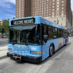
New MCTS Bus.
Government 2.0 is the idea of exposing government controlled data to the public, in an open standardized format. This allows the public to build applications utilizing the data, and allows the government to become more efficient and transparent. There are numerous data feeds that local governments could and should make available in open formats to the public. Crime stats, building violations, service requests, and transit data are just a tiny fraction of what can be done to make our government more open and useful. And all of these would be worthwhile projects in their own right, but transit data offers an early, affordable, quick win for Milwaukee.
Recently, MCTS took the first step forward in this area, by publishing transit scheduling in the Google Transit Feed Specification (GTFS) format. This has allowed MCTS transit routes to be integrated with Google Transit, and a variety of other applications for trip planning. But this is just the first step of opening up transit data.
The next step for MCTS, is to open up real-time GPS location data of their buses. Other cities, such as Portland, New York, Boston, Washington D.C., San Francisco, Chicago, and Seattle have done this, and have seen the rise of applications as a result. In Portland, you can check when the next MAX light-rail train arrives via an iPhone or from count down timers in local coffee shops. In Boston when this data was opened up, within an hour the first application was freely available to the public. In these cities, instead of waiting in the cold for a bus that is running late or one that you just missed, a quick check of your iPhone, will tell you accurately when the next bus arrives at the bus stop.At one time the Milwaukee County Transit System was a leader in delivering services to the public, today it is lagging behind. MCTS could spend the funds to develop these services internally, but that route is limiting and costly. Taking the next step, toward Government 2.0, will allow Milwaukee’s open-source community to help make Milwaukee County more transparent, while providing enhanced services to residents.


It would be great to have, and gov should provide a lot more data to the public in a digitally accessible way.
Two problems, it costs money and there is very little demand. How many MCTS riders have an iPhone? And really, how useful is it to know where the bus is, the next one is only 15mins away. MCTS is too small a system for this to be worthwhile.
I think it would be great if a local software firm (or maybe even Google) would get the data stream created for free. Heck, even create the app for free as well for some free advertising and to build their portfolio.
While they’re at it, how about get WisDOT traffic data too. That would benefit a lot more people. Yes, I’ve seen the 511wi.gov website, which is terribly confusing, convoluted, and full of useless information. Put that data in the hands of people who actually know how to present it clearly, and you can get amazing results.
Also, I’m sure the highest percentage of MCTS riders who have smartphones are UWM and MU students. Creating the GPS data feed and an app or mobile website to use it could be a great class project.
Maybe if you know any CompSci profs or assistants, give them a nudge about this. MCTS might be more willing to work with an education non-profit than a private company.
@SS To be clear by putting data in an open format it isn’t just so iPhones can utilize the data. Applications that run on all sorts of platforms could utilize the data. For example, stores with countdown timers (Portland/Boston now have these). A problem with a bus system is you don’t know it will be there in the next 15 minutes, buses are often very late, breakdowns, snow, changing schedules, unknown to visitors.
“I think it would be great if a local software firm (or maybe even Google) would get the data stream created for free. Heck, even create the app for free as well for some free advertising and to build their portfolio.”
The apps would be created for free, that’s a big advantage of getting government to open up the data (in an standardized open format). The opening up of the data would require MCTS to take action, but the value is in part that then applications would be built for free, and in fact create biz opportunities for dev companies.
I’d add countdown apps are just the start of what GPS location data can be used for.
While I am a MCTS user and would welcome the wiz bang technology capability of knowing when the next bus would arrive, I think the transparency issue is bigger and more important. Wouldn’t I like to know how many building code violations my perspective landlord has and in particular the building I’m contemplating signing a one year lease? It would be great to know the disposition of that robbery report that was called in last night. Who really owns and maintains that vacant house or building that is becoming a eyesore and is the DNS aware of the situation? And part of the allure of this accessibility is that I could do it while I was waiting for the next bus.
@Jeff Oh yes there are numerous Gov2.0 initiatives our city/county needs to get on board with, and we’ll be talking about them here on UrbanMilwaukee.com in the future. To some extent Transit 2.0 is the low hanging fruit.
I for one, think I would use the bus more often if I had this application. I’m on the East Side and when heading downtown its usually a toss-up if I want to wait for the bus for 5-20 minutes or just start walking. If I knew exactly when the bus was going to be at the nearest stop I think I would choose to jump on the bus a lot more often. Especially in the winter when waiting for the bus outside isn’t real appealing. Or when choosing where to go dine/drink, I’d be more likely to hop on the bus and try-out a new Downtown or Bayview place if I knew the timing rather then just staying in my neighborhood.
Any idea of what the costs were for getting the real time GPS info out in other cities? Is this component in the works for MCTS? Would gear actually need to be bought, or is this data they already have and just need to figure-out how to make accessible to the public in the right format? Seems like this should be an easy and cheap win.
As far as the development of Apps goes, I think the model of a contest with minimal prizes (but high attention for the developer) would work– see NYC’s as an example– http://nycbigapps.com/
@Baker
You know there are printed schedules. I think that solves 90% of your problem of not knowing when the bus will arrive.
If someone made an app that just showed the printed schedules in an easy to read format, that would go a long way. Make it location aware and have it just show you the bus routes on the street your’re standing on, that would be useful. But well made apps are neither easy or cheap to make, and there is simply no demand for this in Milwaukee.
Most of those nyc apps are terrible and useless. It’s just someone throwing all the data on the google map. The fact is most of the data is simply not important to people. I think that’s the same problem with bus GPS data, it’s really not important and it’s not going to change people’s plans if they have to wait 5mins or 15mins for a bus, they usually don’t have a choice anyway.
Like I said, it’s a fun little idea if someone is willing to do it for free, but it’s not worth paying for.
Great article. Jeff, you know what else could be done with all those datasets is a realtime neighborhood health indicator or “dashboard” that benchmarks normal and historic stats, identifies potentially significant outliers and trends, etc.
If the City or County want free help developing any smart urban apps, they should apply for Code for America’s 2012 program:
http://codeforamerica.org/2010/11/17/cities-wanted-2012-program-application-now-open/
Send that to your alderperson, supervisor, etc.
Thanks for the advice, @SS
I’ve got the printed schedules, but the issue is that the buses don’t stay right on time, that’s the whole point. There’s a good 20 minute window when the bus could show up, or in bad weather an even larger timeframe.
So if the question is, will this help increase ridership? I think it would. So if it can be cheaply done, why not do it?
> will this help increase ridership? I think it would.
That’s my point, why do you think it would increase ridership? How does the bus rider’s options change if they’re waiting 5min or 15mins? Most riders don’t have another option anyway, they’ll just wait. And if the rider did have other options, how many of those riders even have a smartphone? You’re talking about spending money on a system to cater to a tiny portion of people. The costs are spread on all users, most who are poor, but the benefit is for a few people who are wealthy (at least they’re paying $100/month for a smartphone).
You don’t need GPS to tell you that the bus will be late when there is a blizzard.
I’m just trying to imagine a real-world situation where this would have any significant impact. I can’t think of any. People can say “I’d ride the bus more if X” but I don’t believe it. Explain to me why.
I’d say that implementing bus-priority traffic controls would be more worthwhile. It would keep the buses on schedule and more reliable, which could possibly encourage ridership. I’d rather the bus not be late than to know it will be late.
There are a lot of “poor” people with smartphones. Is it a known fact that most riders are poor? By what measure?
What percentage of riders, poor or not poor, use the bike racks?
What is the sense of limiting improvements to what is relevant to an imagined poor majority of bus riders?
Maybe by your own reasoning it would is good to reach out to the underrepresented non-poor riders and do some things they like.
I doubt these types of apps would increase ridership, but it would be nice if you could tell how close the next bus is so you can decide whether to get a coffee or not, wait inside, walk to the next stop, etc.
Keep in mind too that it would generate a public data store that could easily be queried to show stats on MCTS’ performance. If you had the GPS data and corresponding rider intake counts, you could do a lot to show route efficiency and so on.
@SS “That’s my point, why do you think it would increase ridership”
In my case I would ride the bus more often (see my first post). A ton more? Probably not. But more, yes. Don’t know what more I could explain, if you don’t believe it you don’t believe it.
I don’t need a GPS to tell me the bus is going to be late in a blizzard, but it would be nice to be standing in that blizzard for 5 minutes instead of 1 hour while waiting for the bus.
I agree with you that if the cost would be significant it probably isn’t worth it. But if you can increase ridership even slightly for a very minimal amount then it probably is. It’s hard to judge without at least a rough dollar amount. And following up on @Dan’s point, I think you’re underestimating the number of people that have smartphones / will have smartphones in the near future as the device prices continue to drop and more reasonable plans make there way out there.
Sure I agree that “bus-priority traffic controls would be more worthwhile” but are the prices for the two really going to be comparable?
If you can create a tool to provide better service to your ridership, better position yourself for the future and increase your ridership (even if its only a slight increase) for a minimal amount then why not do it.
> Is it a known fact that most riders are poor? By what measure?
I don’t know, common sense?
http://www.ridemcts.com/About-MCTS/FAQs/
“About 31 percent of adult riders have household incomes of $28,000 or more.”
> What percentage of riders, poor or not poor, use the bike racks?
Not sure why that matters? Barely anyone uses the racks.
> but it would be nice to be standing in that blizzard for 5 minutes instead of 1 hour while waiting for the bus.
Great. So this is useful to you 2 times a year so you aren’t standing in the cold.
> In my case I would ride the bus more often (see my first post). … Don’t know what more I could explain
Explain **why** you would ride more! Why would knowing the precise minute the bus would arrive would result in you riding the bus more often? Was there a situation where you said “I would like to go out to a bar right now, but I might have to wait 10mins at the bus stop so I’m not going, but if I only had to wait 2 minutes I would go.”
Most bus riders are people who HAVE to get somewhere by a certain time and have no other way to do so. They aren’t choosing to ride or not ride based on how long they have to wait for the bus. No one is choosing the bus based on that, because the bus is such a slow way to get around the city in the first place. Example, I live 4.5 miles from downtown and a hundred yards from a bus stop. I can take the #11 straight to Wisconsin Ave with no transfers, and it will take 26 minutes. I could drive there in 10 minutes! There is almost no possible situation that would result in me taking the bus. And this is a best case scenario because there are no transfers barely any walking and I’m assuming the bus is arriving at my stop exactly when I need to leave. Are you telling me that someone who has an hour bus trip with a transfer really cares if the bus is 5mins late?
My point: people who are not taking the bus now are not going to take the bus because their iPhone tells them when the next one is coming. It is a solution without a problem. Yes, it’s a fun little tech project. I do not deny that it is useful to some people. But when MCTS is so cash strapped and fares are rising, does it make sense to waste any resources on this at all?
I agree with what others have said, there are far more interesting and useful gov datasets that should be made public that would help gov services improve and hold gov more accountable. In many cases that data already exists, it’s just not formatted and available.
MCTS appreciates the attention that Urban Milwaukee is giving to Government 2.0 issues. As you indicated, MCTS is publishing transit schedule data in the Google Transit Feed Specifications (GTFS) format. This has allowed MCTS transit routes and schedules to be integrated with Google Transit, and a variety of other applications for trip planning. MCTS also maintains a developer page to enable ad-hoc programming with schedule data: http://www.ridemcts.com/Developer/
The next step that has been taken by other transit systems is to open up real-time GPS location data about buses. This data enables some applications to show the estimated real-time arrival of a bus, not just the scheduled time as is currently available with GTFS data. The vehicle location system currently used by MCTS dispatchers has been in place for nearly 20 years. The objective of this once state-of-the art dispatch system was to improve schedule adherence by bus operators thereby providing a more predictable experience for passengers. The system successfully accomplishes this objective. At the time that this system was installed, no one imagined using the internet or hand-held smart phones and other devices for viewing real-time bus location information.
It is now time to up-date the original automatic vehicle location system. Rather than having location data fed to a proprietary database that is only viewed by the dispatch office, vehicle location information will be stored in a format that is more readily available to the out-side world. This up-date is a big undertaking. The computer aided dispatch with automatic vehicle location information product vendor needs to ensure reliable maintenance of existing operations while upgrading central software and hardware on over 400 buses. This process will begin in January 2011, and is expected to take 18 months (e.g. until Mid-2012). Once the upgrade is completed, MCTS will be positioned to enter the next phase of Government 2.0 as advocated for by Elizabeth Press on the Streetfilms website: http://www.streetfilms.org/a-case-for-open-data-in-transit/#more-47545 and suggested in your story.
Thank you for bringing additional attention to this important issue.
Correct me if I am wrong, but doesn’t the current system already use GPS tracking on their buses, remaining tech from the TransitTV apps on board which announced the next stop and connecting route while displaying current location on the screens? I remember reading the GPS tech was separate from the now defunct TransitTV, but MCTS doesn’t use it anymore because many of the drivers were complaining about not being able to shout out stops.
Am I off a bit here or do we have existing infrastructure in place that could be used?
@Jackie That is excellent news, it is great to see that part of the upgrade is keeping open-data in mind so it will be possible to open up in the future.
@Tracy, Yes an apparently MCTS is about to do a big upgrade to the GPS system, and is keeping open-data in mind.
@SS, I am a student at UWM and there are three choices of buses I could take home. If I could see a real time app that told me which one was the closest to me at that moment, without having to check schedules and assume the buses are on time, I would definitely do this. Instead, I generally just pick a bus and hope it is on time and get frustrated when it is not. Also, when I travel in other cities, I almost always use their transportation and I am thrilled when I see real time GPS count downs (San Francisco has these at quite a few stops). This is especially useful because I don’t know their system or routes all that well, and I never have a route guide with me, plus I don’t know if their buses are typically on time or not. I’m sure people who come to Milwaukee and aren’t familiar with our system would also appreciate apps or LED countdowns at stops. And third, you are totally missing the point here, this is something that could be done for free, if MCTS already had the data (which it sounds like they don’t, but will in the next few years). This doesn’t need to be done by MCTS, all they have to do is open up their data to developers. How would that cost them anything? Oh and also, people do care about a bus being five minutes late on an hour long trip.
@Matt I’m sure there would be some cost, likely to maintain the api servers and rollout new features (though I had assumed and it is true that MCTS already collects GPS data and apparently will be upgrading that system). But it is also true that this will give MCTS the ability to offload much of the application development.
SS, real-time GPS info would increase my customer satisfaction when riding the bus 100%, which would lead me to ride it much more frequently. Not knowing when the next bus is coming, or just missing a bus, is the most frustrating part or taking the bus.
While I often take the bus to work and back, I am only willing to do it because I know during rush hour they come every 10-15 minutes. However, if I am going somewhere at night or on a weekend, I rarely take the bus because at times it only comes every 30 min. If I knew that I could stay at my house, a friend’s house, my office, a bar or a store until just a few minutes before the bus came, that would greatly increase how often I take the bus. I would also be able to convince friends and family to come along with me.
I am also often faced with the option of being equidistant from two different bus routes and this would help me pick the one where the next bus will arrive the quickest, instead of just randomly guessing. And this especially would help in the case of routes that split like the 30 Maryland/Downer, where you could easily be waiting 30-40 minutes at night if you pick the wrong one.
And, it’s not just a blizzard. Have you waited for a bus in the rain, the heat, wind, below zero? Glad to see MCTS is working on this, those 18 months can’t come soon enough!
Dave, thanks for writing this article. Thanks also to the others who responded, creating an interesting dialogue. Jackie, I was especially gratified to hear that MCTS has already started this initiative, though like others, I would love for it to finish early. Thanks also for sharing the link to streetlife.org. I can see that use of transit data may be the most accessible data in the Gov 2.0 movement and will hopefully generate tangible support for the other data.
I firmly believe healthy public transportation supports a healthy community. The recent budget changes put MCTS more at risk than before. I wrote my state and county representatives tonight, asking them to support this open data initiative because I think — and other commenters agree — that this provides positive cash and non-cash ROI.
@Ann I understand that it will take time for MCTS to upgrade the technology to be ready to move to Transit2.0, but hopefully sometime next year we could at least start hearing something on it.
Hidden in the MCTS RFP for its new fare payment system is the detail that the new OrbCAD GPS system will be fully functioning by June 2012. Combining new smart card technologies with apps for real time arrival information will be a huge step forward for the system and its passengers. Can’t wait!