
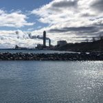
Kinnickinnic River Trail

Julie Lawrence at OnMilwaukee.com drew my attention to this excellent community development taking place along the Kinnickinnic River on the south side of urban Milwaukee, the Kinnickinnic River Trail. The trail is in the early stages of development and will have a southern terminus at the river and 6th Street (near its intersection with Cleveland St) and at Water St and 1st Street on the northern end.
The trail, while still in its infancy, will hopefully include a restoration of the river to a more natural state with the removal of the concrete channeling.
Groundwork Milwaukee has provided a PDF with all you could ever want to know about what was discussed in planning for the trail.
I’ll try to learn more over the next few days as to what the actual status of the trail is (it’s a little bit hard to figure out with the information online).
I took the map out of the PDF and put it online as a JPG image in case you wanted to see the proposed route.


Do you think it’s bike accessible? Like, can it serve as a bike commuting corridor?
Walson P,
Yes, that’s the primary focus from everything I gathered. I clearly didn’t convey that well enough in my article.
-Jeramey-
I’d much rather have a bike path on the Hoan bridge, or maybe even a marsupial bridge for bike and pedestrian traffic underneath the Hoan. That would be a much more direct connection to downtown. You can already bike along the streets in bayview and walker’s point to get to downtown, a bike path there won’t change much IMO.
FYI: Your link to the JPG map isn’t working for me.
I cannot wait for this to be completed.